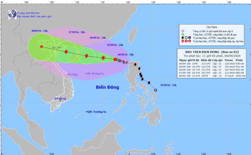
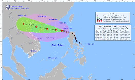
The National Center for Hydro-Meteorological Forecasting has issued an emergency warning about storm No. 3 Yagi. The storm is at level 13 (134-149km/h), gusting to level 15-16 (167-201km/h).
In just over a day, the storm has increased to level 5 and continues to strengthen. Typhoon Yagi is predicted to reach super typhoon level, level 16, with wind gusts above level 17 (level 18-19) - an unprecedented rate of increase in intensity among storms that have appeared in the East Sea in recent years.
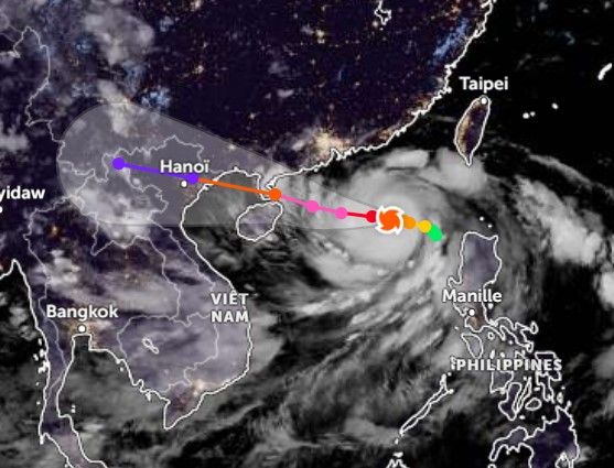
Areas under warning of danger in the next 48-72 hours include Quang Ninh, Hai Phong, Thai Binh, Nam Dinh, and Ninh Binh. Coastal winds near the storm's eye could reach level 9-11, with gusts up to level 13.
From the night of September 6 to the morning of September 7, the storm is expected to move into the Gulf of Tonkin and directly affect all coastal provinces in the North and North Central regions, from Quang Ninh to Ha Tinh.
It is forecasted that this will be the strongest storm in the past 10 years to affect the North, with an intensity equivalent to storm No. 3 ( Kalmaegi) in 2014 and storm No. 1 (Mirinae) in 2016.

The biggest risk now is strong winds and high waves at sea along the 19th latitude North, where the storm may reach level 14-15, gusts of level 17, and waves 8-10m high, capable of sinking all ships, including large tonnage ships. From September 6, wave heights may gradually increase to 10-12m.
Coastal waters from Quang Ninh to Ha Tinh will have strong winds of level 10-13, waves of 4-6m high, and risk of flooding in low-lying areas and river mouths.
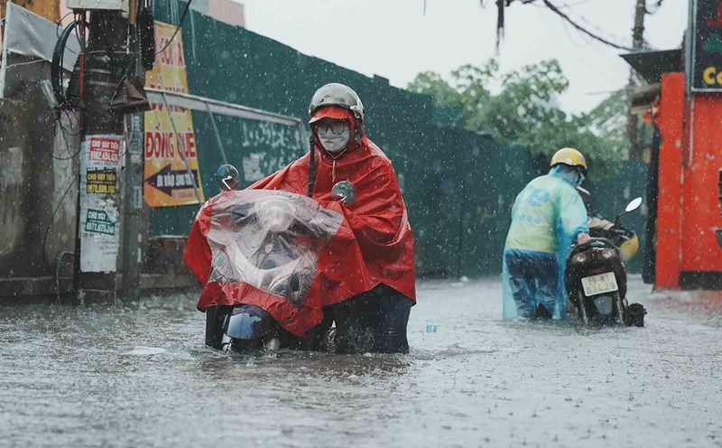
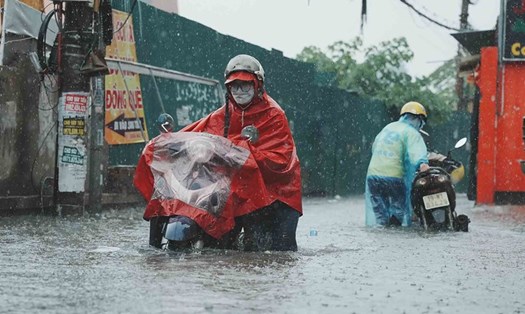
According to the National Center for Hydro-Meteorological Forecasting, the current situation is very alarming, and people need to take immediate storm prevention measures.
It is necessary to reinforce houses, protect property, stock up on necessary items and be ready to evacuate when notified by authorities. Preparations must be completed before September 6 to minimize damage.
Typhoon Yagi is affecting Northern Luzon with maximum sustained winds of 140 km/h, possibly reaching 170 km/h, according to the Philippine Atmospheric, Geophysical and Astronomical Services Administration (PAGASA). The storm is moving slowly west-northwest and is expected to bring rain and thunderstorms to many parts of the country.
Given the complicated developments of typhoon Yagi, residents and tourists need to pay attention to updates on the storm situation, affected areas and prepare preventive measures right now.
Consider postponing future travel, especially limiting travel to the Northern and North Central regions; choose safe, secure accommodation and follow instructions from local authorities.