According to the update of the National Center for Hydro-Meteorological Forecasting at 9:00 p.m. on September 7, the center of storm No. 3 Yagi officially arrived in Hanoi. The center of the storm is located at about 21.0 degrees North latitude; 105.5 degrees East longitude, on the mainland of Hanoi.
The strongest wind is level 9-10 (75-102km/h), gusting to level 12. It is forecasted that in the next 3 hours, the storm will move west at a speed of about 15-20km/h.
Meteorologists warn that when the eye of the storm passes, there will be a period of calm and no rain. However, people need to be extremely vigilant because soon after, the rain and wind will return with greater intensity.
After a period of calm as the eye of the storm passes Hanoi, the wind is expected to change direction to the South and Southeast. The gusts will continue for the next few hours, but the winds will not be strong continuously but will come in short, random gusts.
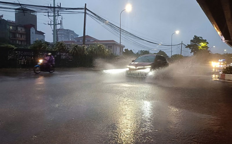
The strongest rain and wind due to storm No. 3 is forecast in Hanoi from night to 1am on September 8. The inner city of Hanoi and surrounding areas will continue to have heavy rain with rainfall ranging from 50-100mm, in some places over 150mm.
Warning: This rain is likely to cause flooding for many inner-city streets with a common depth of 20-40cm. Some streets are likely to be flooded deeper with a depth of 30-50cm including Tay Ho, Ba Dinh, Hoan Kiem, Dong Da, Thanh Xuan, Hai Ba Trung, Cau Giay, Hoang Mai, Bac Tu Liem, Nam Tu Liem, Long Bien, Ha Dong.
At 7:00 a.m. on September 8, the storm continued to move inland in a West-Northwest direction at a speed of 15-20 km/h and gradually weakened. The storm's center is expected to be at 21.4 degrees North latitude and 104.3 degrees East longitude, on the mainland of the Northwestern provinces. Winds at level 6-7, gusting to level 9-10.
Due to the influence of storm No. 3's circulation, Hai Duong has strong winds of level 12, gusts of level 13; Luc Ngan (Bac Giang) has strong winds of level 9, gusts of level 11; Hung Yen has strong winds of level 8, gusts of level 11; Bac Giang has strong winds of level 7, gusts of level 9; Bac Ninh has strong winds of level 7, gusts of level 10...
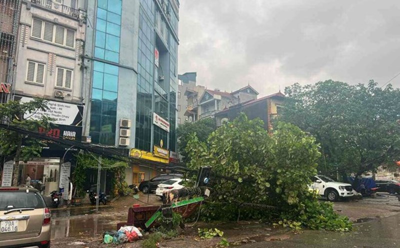
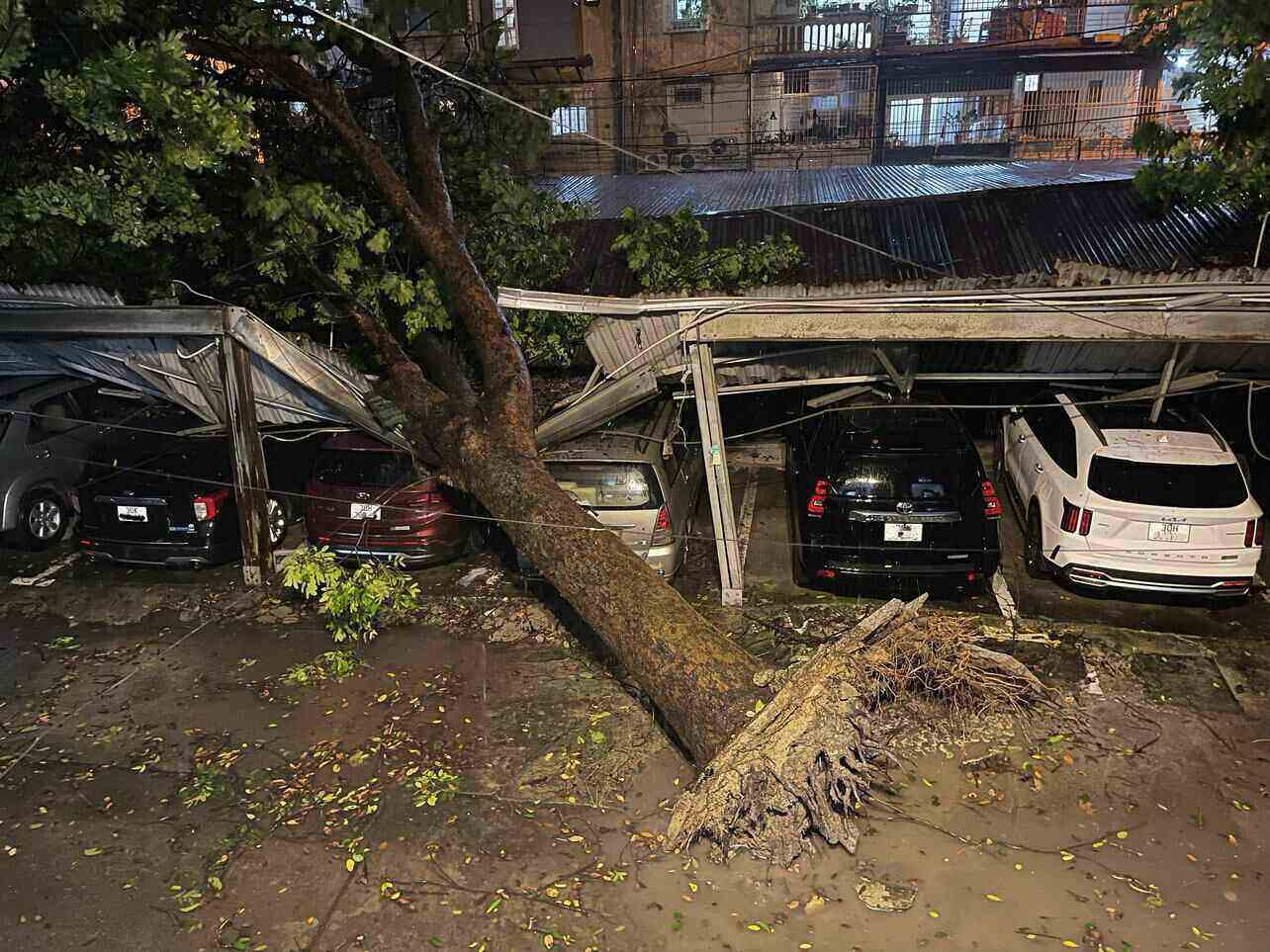
According to a report from the Hanoi People’s Committee, as of the afternoon of September 7, the storm had killed two people and injured seven others due to wind-related accidents. Specifically, Nam Tu Liem, Hoang Mai, Hoan Kiem and Hai Ba Trung districts recorded casualties due to falling trees.
Given this situation, tourists planning to travel to the Northwest and the Northern mountainous provinces from September 8-10 should postpone or cancel their trips. Due to the rain, the roads will be very slippery and muddy, making it difficult to travel on tours, trekking routes, and mountain climbing.
Ta Chi Nhu (Yen Bai), Lao Than (Lao Cai)... are mountains with open terrain, prone to thunder and lightning in the rain. Nam Kang Ho Tao, Pusilung, Po Ma Lung (Lai Chau)... are mountains with many large trees, streams and waterfalls; on the mountains, there is a possibility of sudden flash floods.