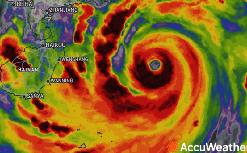
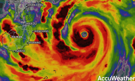
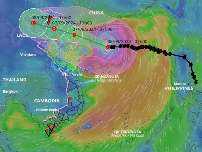
According to the latest update from the National Center for Hydro-Meteorological Forecasting and the General Department of Hydro-Meteorological Forecasting, storm No. 3, internationally named Yagi, is about 570km east-southeast of Quang Ninh. The storm is about 130km east-southeast of Hainan Island (China).
At 10:00 a.m. on September 6, the center of the super typhoon was at approximately 19.3 degrees North latitude; 112.0 degrees East longitude. The strongest wind near the center of the super typhoon was level 16 (184-201 km/h), gusting to level 17, moving west at 15-20 km/h.
The storm is expected to directly affect the Gulf of Tonkin and provinces from Quang Ninh to Thanh Hoa from the evening of September 6.
From around the afternoon of September 6, the eastern sea area of the Gulf of Tonkin (including Bach Long Vi island district) will have winds gradually increasing to level 6-7. From the evening and night of September 6, the Gulf of Tonkin area (including Bach Long Vi island district, Co To) will have winds gradually increasing to level 8-9, then increasing to level 10-11, the area near the storm's center will have winds of level 12-14, gusting to level 17; the sea will be very rough.
In the afternoon and night of September 7-8, the Northern region and Thanh Hoa will experience heavy to very heavy rain. Rainfall can reach from 100-350mm, and in some places can reach over 500mm.
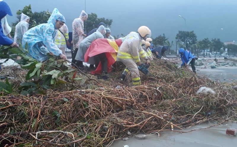
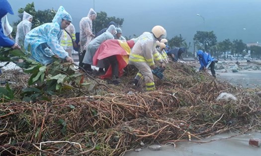
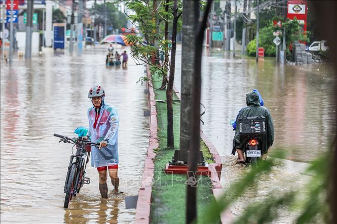
Heavy rains will pose a risk of flooding in low-lying, urban areas, and there is a possibility of landslides and flash floods in mountainous areas.
The strongest winds near the storm's center when making landfall can reach level 13-14, and can gust up to level 17.
From early morning on September 7, the coastal areas from Quang Ninh to Thanh Hoa will witness winds gradually strengthening to level 6-7, then increasing to level 8-9, and the area near the storm's center may reach level 10-12, with gusts of level 14. The inland areas of the Northeast, including Hanoi, will have strong winds of level 6-8 and gusts of level 9-11.
Regarding the warning of sea waves and rising water, from the afternoon of September 6, the Bac Bo Gulf area, including the island districts of Bach Long Vy and Co To, will have sea waves from 2.0-4.0m high, then increasing to 3.0-5.0m, and possibly up to 6.0-8.0m near the storm's eye.
In the North East Sea, waves may be 7.0-9.0m high, and may reach 10.0-12.0m near the storm center.
In the provinces from Quang Ninh to Thanh Hoa, it is necessary to be on guard against storm surges with levels ranging from 0.5-1.8m. Specifically, Quang Ninh can withstand a surge of 1.5-1.8m; Hai Phong and Thai Binh from 1.2-1.5m; Nam Dinh and Ninh Binh from 0.8-1.2m; and Thanh Hoa from 0.5-1.0m.
People need to proactively prepare timely response measures to minimize damage caused by storms. In particular, coastal areas and low-lying areas need to pay attention to preparing for flooding and landslides. Authorities also need to continuously update information and guide people to take safety measures during storms.
The weather situation will continue to be monitored and updated regularly. Authorities and people need to pay attention to information from meteorological forecasting agencies to have timely and effective responses.