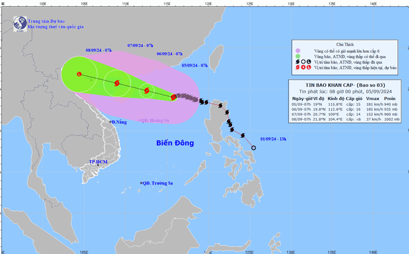
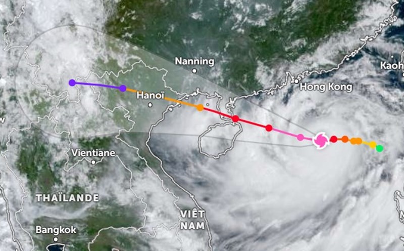
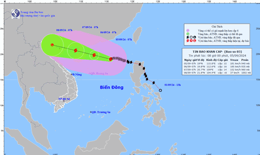
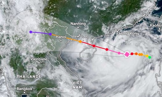
According to information from the National Center for Hydro-Meteorological Forecasting, at 9:00 p.m. today, super typhoon Yagi was located at approximately 19.3 degrees North latitude and 114.0 degrees East longitude, approximately 332 km northeast of Hainan Island. The strongest wind near the storm's center reached level 16 (184-201 km/h), with the possibility of gusts up to level 17 (level 18, level 19).
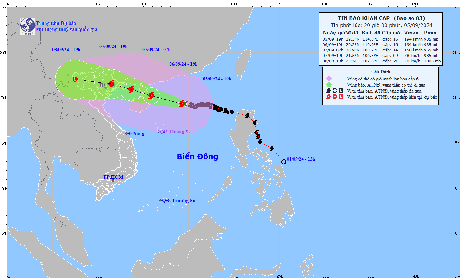
It is forecasted that from the night of September 6 to early morning of September 7, coastal areas from Quang Ninh to Thanh Hoa will have winds gradually increasing to level 6-7, then increasing to level 8-9, and areas near the storm's eye may reach level 10-12, gusting to level 14.
The inland area of the Northeast will have strong winds of level 6-8, gusting to level 9-11, with the strongest winds expected from noon to evening on September 7.
From the night of September 6 to the morning of September 9, the Northern region and Thanh Hoa are likely to be affected by a period of heavy rain, some places with very heavy rain and thunderstorms. Total rainfall is commonly from 100-350mm, some places over 500mm.
The heaviest rain is expected to occur in the Northeast during the day and night of September 7, and in the Northwest from the evening of September 7 to the night of September 8. Heavy rain can cause flooding in low-lying areas, flash floods on small rivers and streams, and landslides on steep slopes.
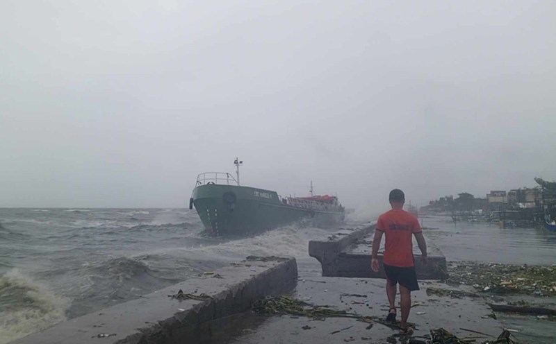
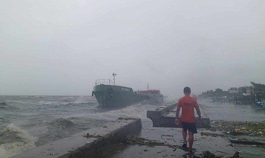
With the storm approaching, many localities have implemented a sea ban. Accordingly, vehicles and boats are not allowed to go out to sea, including tourism activities on the sea and bays; ensuring that no one remains in dangerous areas.
In Quang Ninh, the sea will be closed from 11am on September 6, non-urgent meetings will be postponed, and storm and flood prevention measures will be implemented. Rescue forces will be ready to evacuate people from dangerous areas before 4pm on September 6.
Thai Binh banned the sea from 5am on September 6. Hai Phong banned the sea from 11am on September 6, and started evacuating people from noon on September 6 (after 12pm on the same day).
In Nam Dinh, strictly implement the directives, mobilize all forces for storm prevention work, do not let people stay in dangerous areas and organize evacuation when necessary.
Typhoon Yagi is approaching and is very complicated. People and tourists need to pay attention to the following to ensure safety of life and property:
Regularly update storm forecast and warning information to proactively prevent and avoid.
Prepare enough food, water, medicine and necessary supplies for at least 7 days.
For those who are planning to travel to the Northern provinces, especially the Northern coastal provinces during this time, they should cancel or postpone their trip. The storm may hit during the travel time, causing unsafety and affecting the travel experience.
If you are in an area affected by a storm, find a safe shelter and evacuate as necessary or as requested by local authorities.
For residents and households operating tourism services, it is necessary to improve the structure of houses, trim trees, and remove billboards and posters that pose a safety risk.
With boats, make sure the boat is securely anchored; do not stay on the boat, watchtower or raft when the storm hits.
Prepare for emergencies, save emergency and rescue phone numbers for use when needed.
Being well prepared, calm and not subjective is the best way to protect yourself from the approaching super typhoon.