According to the National Center for Hydro-Meteorological Forecasting, super typhoon Yagi is the strongest storm in 2024 in the Northwest Pacific region to date.
With an unprecedented speed of increase in Vietnam's meteorological history, in just 48 hours, Yagi reached super typhoon level.
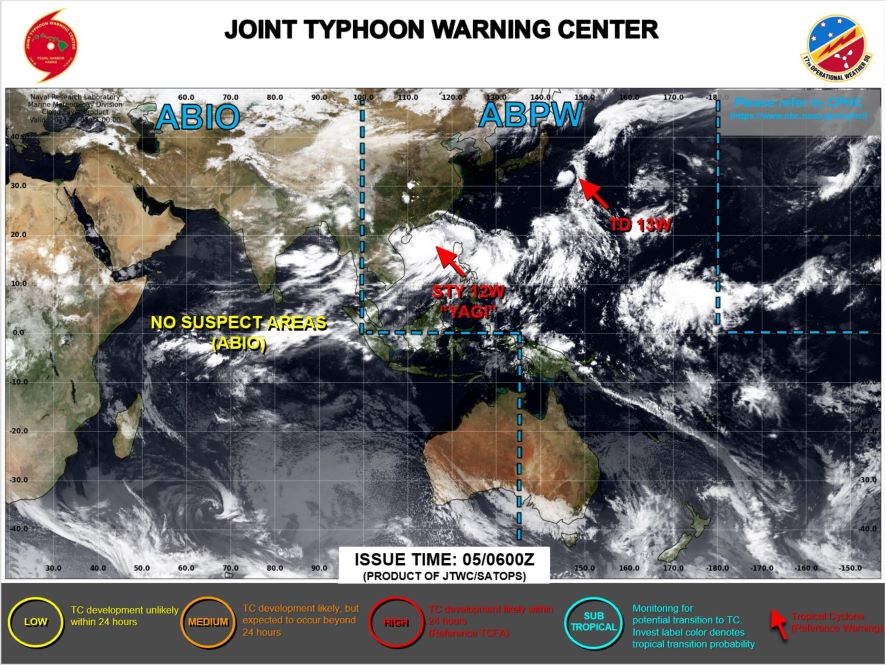
This is also the first time in history that level 4 disaster risk (Red) has been issued for the Gulf of Tonkin region, the third time in history that level 4 has been issued.
In addition, super typhoon Yagi entered the top three super typhoons of level 16 or higher when operating in the East Sea and set a record for the lowest pressure value at the center of the storm in more than half a century in the history of typhoon observation by Vietnam Meteorology.
Current environmental conditions are extremely favorable, allowing the storm to develop into its strongest tropical storm.
Forecasts show that super typhoon Yagi will continue to move towards the Gulf of Tonkin with little change in intensity. However, when the storm passes Hainan Island, its intensity will weaken significantly from level 15-16, gusting to level 18-19, down to level 13-14, gusting to level 16.
As it moves deeper into the Gulf of Tonkin and approaches the mainland provinces from Quang Ninh to Nam Dinh, Yagi may continue to weaken.
At sea, the North East Sea area has strong winds of level 11-14, near the center of the super storm it can reach level 15-16, gusting to level 18-19, and the sea is very rough.
From noon on September 6, the eastern sea area of the Gulf of Tonkin, including Bach Long Vi island district, will witness winds gradually increasing to level 6-7, then increasing to level 8-9 and possibly reaching level 10-12 near the storm's center. The sea will be very rough.
On land, from early morning on September 7, winds will gradually increase to level 6-7 in coastal areas from Quang Ninh to Thanh Hoa, then may reach level 8-9. Areas near the storm's center will have winds of level 10-12, gusting to level 14, while areas deep inland in the Northeast will experience strong winds of level 6-8, gusting to level 9-11.
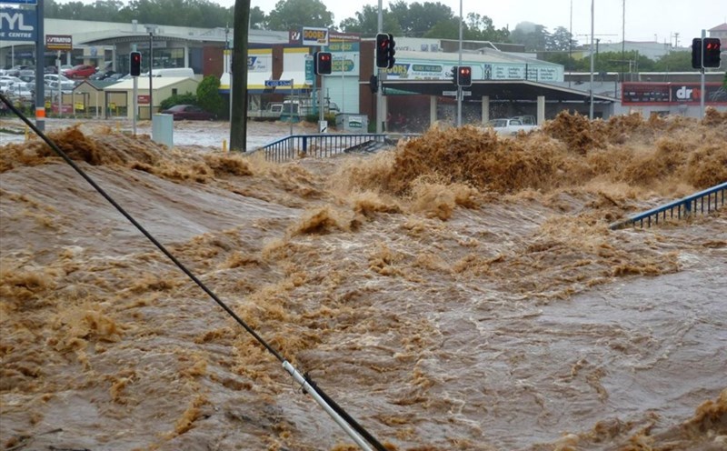
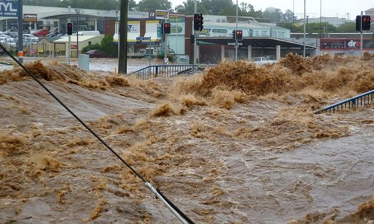
Heavy rain is also a major factor. From the night of September 6 to the morning of September 9, the Northern and North Central regions are likely to experience heavy rain, with total rainfall ranging from 100-350mm, and possibly exceeding 500mm in some places.
Heavy rain will cause flooding in low-lying areas, flash floods in small rivers and streams, and landslides on steep slopes.
In addition, coastal areas from Thanh Hoa to Quang Ninh need to be especially vigilant against storm surges, which could be from 0.5m in Thanh Hoa to 1.8m in Quang Ninh in the afternoon and night of September 7, and storm receding waters from 0.5m in Thanh Hoa to 1.0m in Quang Ninh in the morning of September 7.
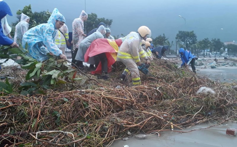
Boat mooring areas, aquaculture areas and sea dykes and embankments in dangerous areas need to be prepared to cope with strong winds, large waves and storm surges.
People in areas affected by Super Typhoon Yagi need to immediately take preventive measures, monitor information from authorities, and proactively prepare to protect themselves and their property.
For tourists planning to travel to the North and North Central regions during this time, they should consider canceling or postponing their trip. In case they are already in an area that is likely to be affected and cannot be evacuated, they should choose a solid, safe place to stay and follow the instructions from local authorities.