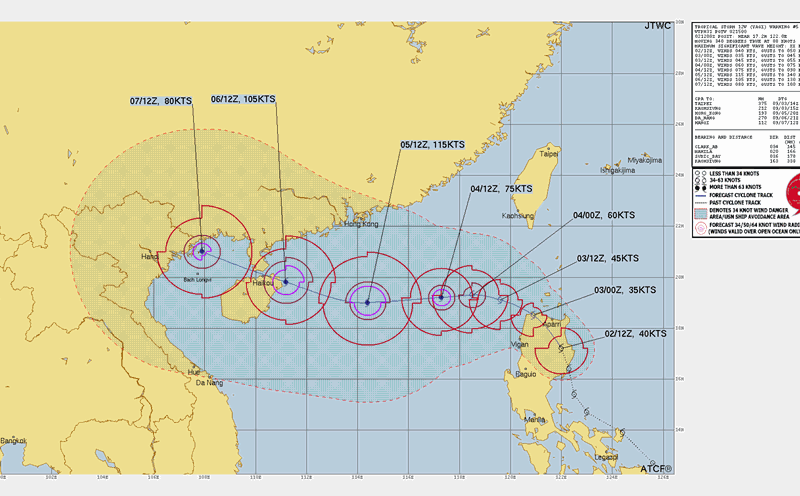
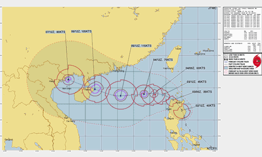
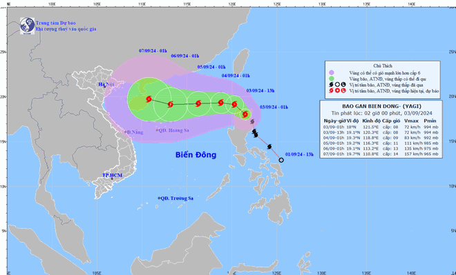
According to the latest warning from the US Joint Typhoon Warning Center (JTWC), at 4:00 a.m. on September 3 (Vietnam time), the center of storm Yagi was located about 198 nautical miles north of the capital Manila (Philippines), with the strongest wind near the center of the storm at about 65 km/h.
The storm is moving west-northwest at a speed of about 17 km/h and is expected to enter the East Sea in the next 24 hours.
Typhoon Yagi is forecast to move westward at a speed of about 10km/h over the next 48 hours. At 7pm on September 4, the centre of the storm was about 640km east of Hainan Island (China). The strongest winds near the centre of the storm reached level 10, gusting to level 13.
By September 5, the storm could strengthen into a typhoon with maximum winds of up to 205 km/h. After that, the storm is forecast to continue moving westward and is likely to directly impact the coastal provinces of Northern and North Central Vietnam around September 7-8.
Experts predict the storm will rapidly intensify as it moves over warm ocean surface temperatures and favorable atmospheric conditions. It may weaken and maintain a steady speed.
However, if favorable conditions such as warm sea water in the Gulf of Tonkin occur before making landfall around September 7 to 9, Typhoon Yagi may re-intensify or maintain its high intensity.
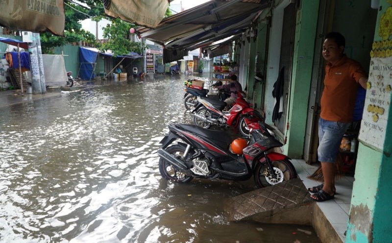
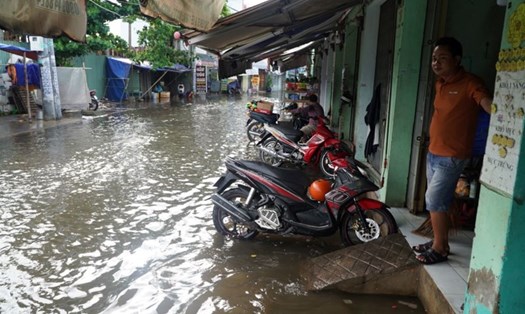
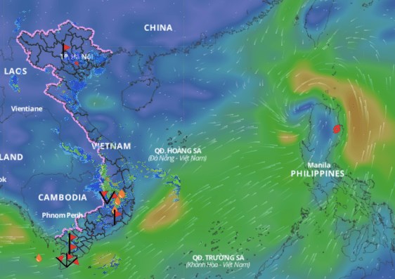
Given the complex developments of the storm, residents and tourists in coastal provinces from Quang Ninh to Nghe An need to closely monitor storm information and strictly implement preventive measures issued by local authorities.
Fishermen and boat owners need to quickly move to shore or away from dangerous areas. Do not be subjective about the storm's developments.
Tourists planning to travel to the Northern and North Central provinces next week should consider changing their schedules to avoid the time when the storm makes landfall.