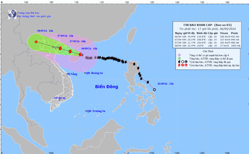
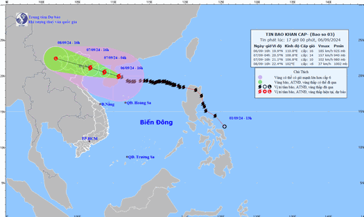
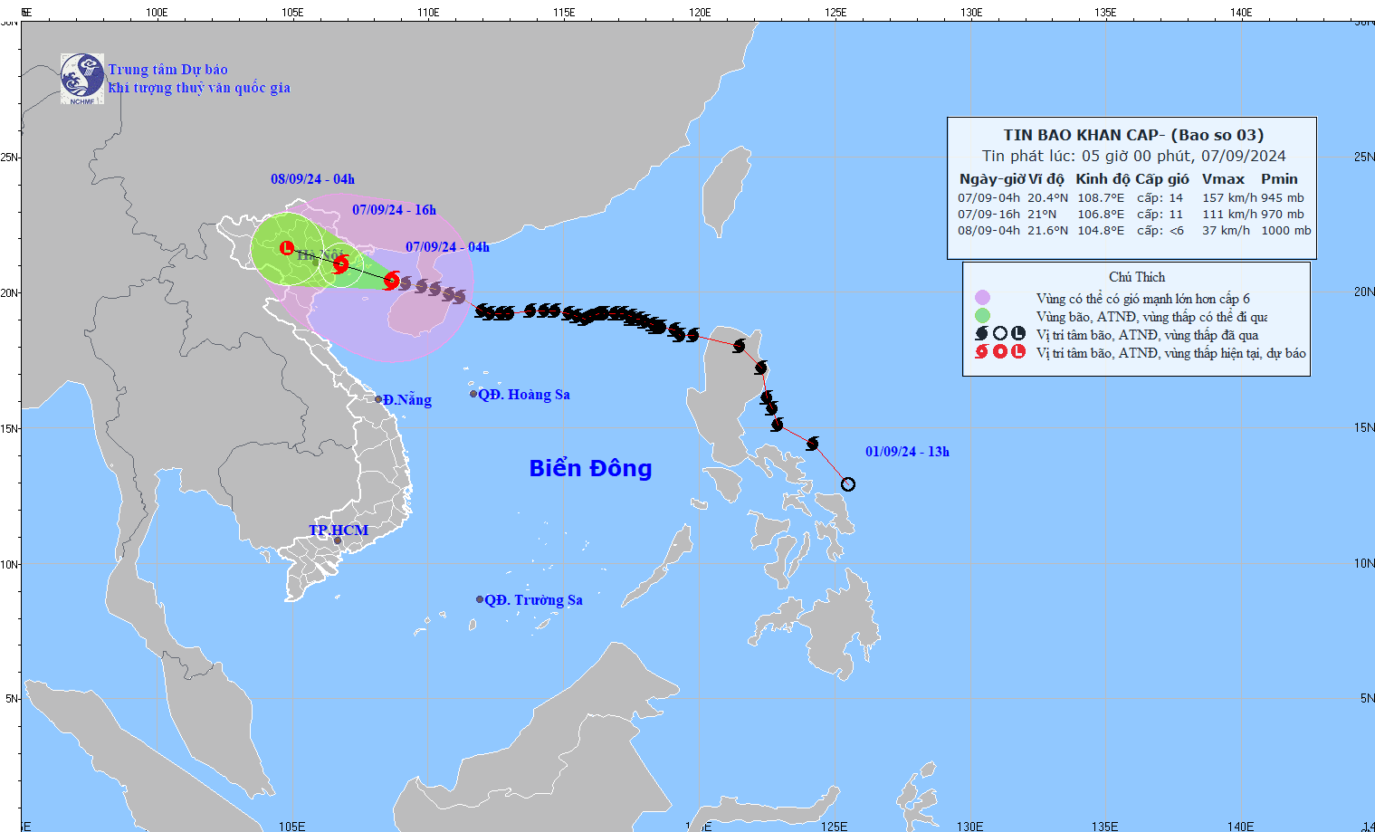
According to the quick news about storm No. 3 released by the National Center for Hydro-Meteorological Forecasting at 7:00 a.m. on September 7, the center of the storm is located at about 20.4 degrees North latitude; 108.2 degrees East longitude, about 153km from the coast of Quang Ninh - Hai Phong.
The strongest wind is level 14 (150-166km/h), gusting to level 17. It is forecasted that in the next 3 hours, the storm will move in the West Northwest direction, at a speed of about 15-20km/h.
The Japan Meteorological Agency assessed Yagi as having the potential to become the strongest storm in history in the East Sea and the strongest in the world in 2024.
This could be the strongest storm in Asia in 2024 and the world's second strongest tropical cyclone after Typhoon Beryl.
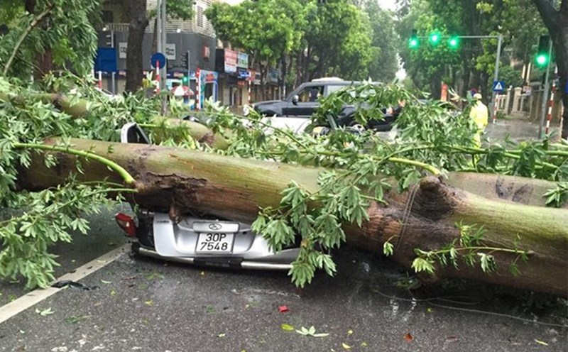
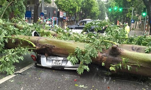
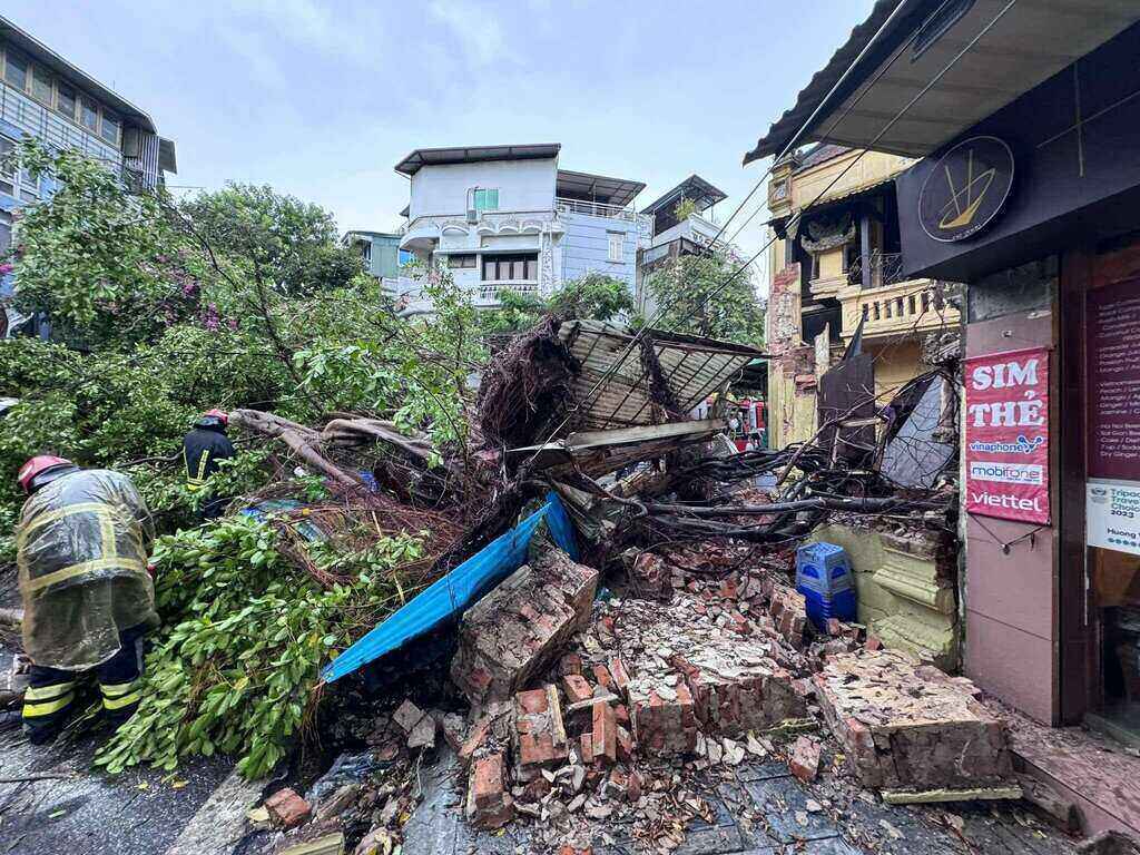
According to experts from the National Center for Hydro-Meteorological Forecasting, super typhoon Yagi is the strongest typhoon in the past 30 years operating in the East Sea and making landfall in Vietnam.
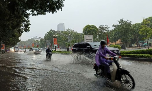
Due to the influence of the storm circulation, in the Northwest region, the area from Nghe An to Thua Thien Hue needs to be on guard against the risk of thunderstorms, tornadoes and strong gusts of wind.
Coastal areas from Quang Ninh to Thanh Hoa are forecast to have strong winds of level 6-7, then increasing to level 8-9, areas near the storm center will have strong winds of level 10-12, gusting to level 14; areas deep inland in the Northeast will have strong winds of level 6-8, gusting to level 9-11 (the strongest winds will be from morning to evening on September 7).
The first area expected to be affected by storm Yagi is Mong Cai (Quang Ninh), followed by other areas from Quang Ninh to Hai Phong.
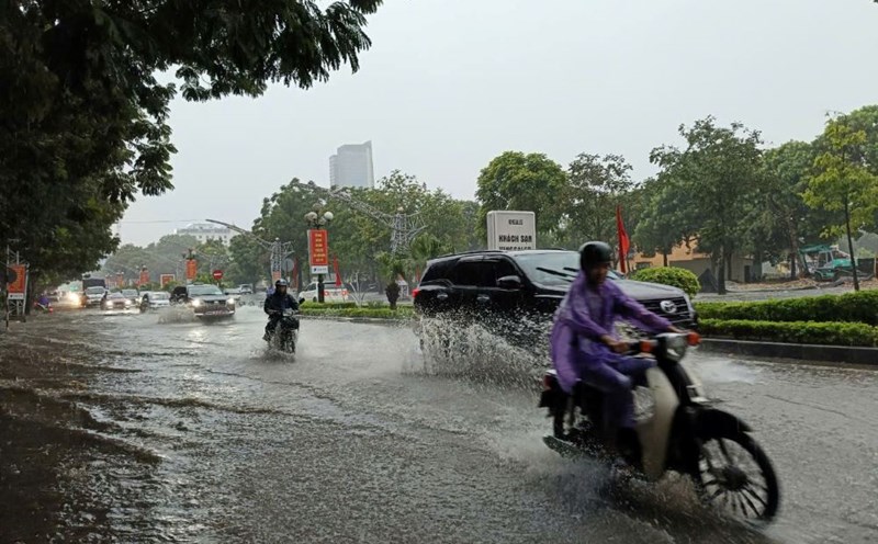
The storm will cause heavy rain in the North and Thanh Hoa from tonight to the morning of September 9. Total rainfall is generally 100 - 350mm, with some places over 500mm. The heaviest rain will be in the Northeast, concentrated during the day and night of tomorrow, September 7.
Faced with the devastation caused by Typhoon Yagi, residents and tourists need to proactively update weather forecast information to respond, promptly deploy safety measures, and limit going out from tomorrow to avoid loss of life and property.