According to the latest warning from the Joint Typhoon Warning Center (JWTC), storm Shanshan (storm number 11W) is moving north - northwest at a speed of about 26 km/h and is currently away from the Japanese island of Iwo Jima. The village is about 263 km south - southwest.
At 12:00 noon on August 24 (UTC time), the location of the storm's center was determined to be about 22.5 degrees North latitude and 140.7 degrees East longitude. The strongest wind near the center of the storm was measured at 120 km/h, with gusts up to 148 km/h.
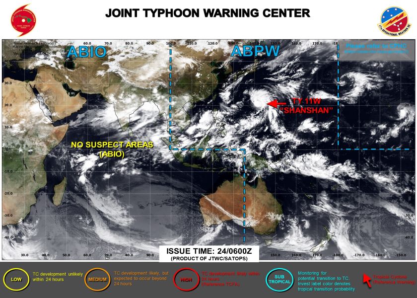
It is forecast that in the next 24 hours, the storm will move northwest at a speed of about 24 km/h and continue to strengthen.
JWTC predicts that by 12:00 noon on August 25, the strongest wind near the center of the storm could reach 148 km/h, with gusts of up to 185 km/h.
Experts predict that Typhoon Shanshan will reach its strongest intensity around 12:00 noon on August 27, with the strongest winds near the center of the storm up to 195 km/h and maximum wind gusts of over 240 km/h.
At that time, the storm will be at about 32.5 degrees North latitude; 134.1 degrees East longitude, moving slowly north at a speed of about 15 km/h.
After that, the storm is forecast to gradually weaken as it moves northeast of Japan. However, experts warn that the storm could still bring strong winds and heavy rain to the area in the coming days.
Japanese authorities are closely monitoring the developments of storm Shanshan and are readying response plans. Residents and tourists in coastal areas are advised to monitor updated information and comply with instructions from local authorities.
Tourists planning to visit Japan in the near future are advised to closely monitor weather information and consider adjusting their schedules to ensure safety. Japanese authorities are also ready to assist tourists in emergencies.
With careful preparation and experience in dealing with natural disasters, Japan is making efforts to minimize possible damage caused by the impact of Typhoon Shanshan.