According to the latest news from the National Center for Hydro-Meteorological Forecasting, a tropical depression is entering the East Sea and is likely to strengthen into a storm in the next 24-48 hours.
At 7:00 a.m. on September 17, the center of the tropical depression was determined to be at 16.9 degrees North latitude and 120.9 degrees East longitude, on the mainland of Luzon Island (Philippines).
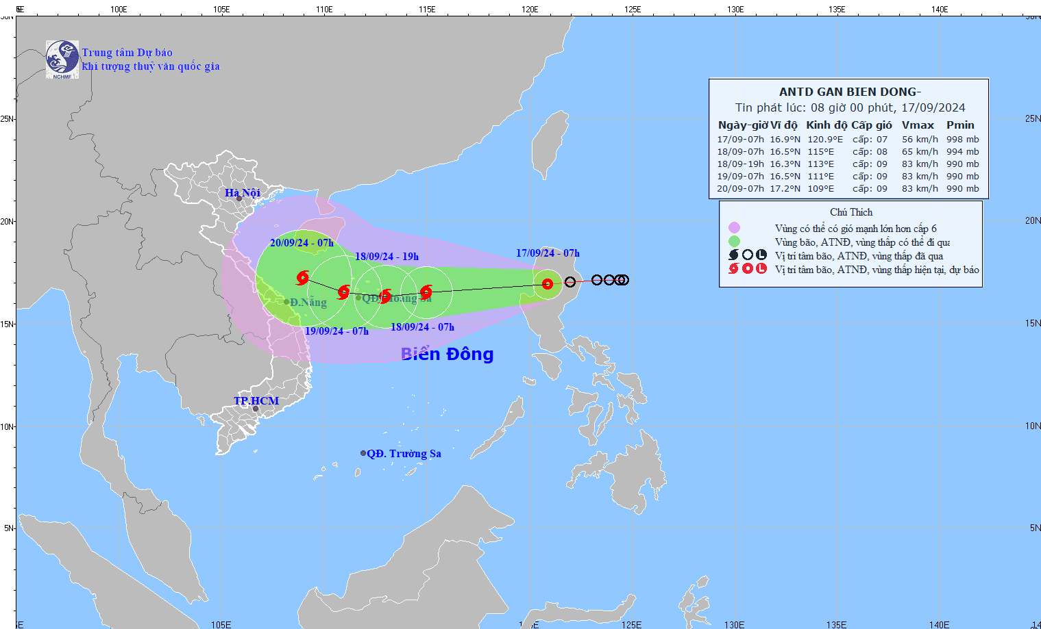
The strongest wind near the center of the tropical depression is level 7 (50-61km/h), gusting to level 9. This system is moving mainly in a westerly direction at a speed of about 15-20km/h.
It is forecasted that in the next 24 to 48 hours, the tropical depression will move into the East Sea and strengthen into a storm.
Specifically, at 7:00 a.m. on September 18, the storm is expected to be at 16.5 degrees North latitude; 115.0 degrees East longitude, in the North East Sea, about 270km east of Hoang Sa archipelago (Vietnam). The strongest wind is forecast to reach level 8, gusting to level 10.
At 7:00 a.m. on September 19, the storm continued to move west at a speed of 15-20 km/h and reached 16.5 degrees North latitude; 111.0 degrees East longitude, in the western area of Hoang Sa archipelago (Vietnam).
The storm intensity can now increase to level 9, gusting to level 10.
In the next 48 to 72 hours, the storm is likely to change direction, moving west-northwest at a speed of about 10km/h.
The eastern sea area of the North East Sea is forecast to have strong winds of level 6-7, the area near the storm's eye may reach level 8 (62-74km/h), gusting to level 10 (89-102km/h), rough seas.
At the same time, this area is also forecast to have waves 2.0-4.0m high, increasing to 3.0-5.0m from the afternoon of September 17.
On the graphic forecasting the storm's progress and path, at 7:00 a.m. on September 20, the storm is forecast to enter Vietnam's sea area with a wide area of influence in the provinces of Quang Binh, Quang Tri, Thua Thien - Hue, Quang Nam, Da Nang and part of Quang Ngai.
The disaster risk level is assessed at level 3 for the North East Sea area, including the Hoang Sa archipelago (Vietnam).
Authorities recommend that vessels operating in dangerous areas pay special attention to the risk of strong winds and large waves.
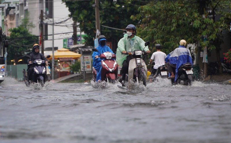
Tourists planning to visit the Central Coast at this time should monitor and update the weather situation and consider postponing their schedule because bad weather will affect their travel experience.
The National Hydro-Meteorological Forecasting Center will continue to update information on the storm's developments in the following bulletins.