On September 18, the Ho Chi Minh City Department of Construction held a conference to discuss the strategy for implementing the BIM-GIS model (project information model combined with geographical information) in traffic construction and technical infrastructure.
The event gathered many management agencies, experts and businesses, aiming to find synchronous digital solutions for the construction industry.
Ho Chi Minh City aims to complete comprehensive digital transformation in the management, operation and maintenance of the transport infrastructure system by 2030. The transportation database will be completed, integrated and connected to the industry's big data system, creating a foundation for the application of modern technology in all stages - from design, construction to management.
In addition, the city will promote the application of BIM in transportation projects. At the same time, the city focuses on building a data sharing mechanism between departments, branches and between Ho Chi Minh City and the Central Government, ensuring smooth and transparent management.
A shared database system will be formed, including information about construction works, fences, bridges, roads, signs, safety corridors, etc. Traffic data will also be collected in real time through specialized equipment, supporting traffic organization and operation and comprehensive digitalization of infrastructure.
Ho Chi Minh City has begun to apply the BIM-GIS model to large-scale infrastructure projects. A typical example is Metro Line 1 (Ben Thanh - Suoi Tien) which has been coordinated by Urban Railway Company No. 1 with Port - marine Engineering Design Consulting Joint Stock Company ( Portcoast) to apply BIM-GIS in infrastructure asset management.
Each equipment and construction item in Metro No. 1 is equipped with a separate identification code, allowing for full storage and updating of operating information, maintenance history and operating status.
According to experts, applying BIM-GIS to metro No. 1 not only helps with synchronous and accurate management, but also opens up the possibility of replication for other infrastructure projects. At that time, an integrated management system from planning, construction to operation will become a reality, helping to save costs, increase transparency and increase the life of the project.
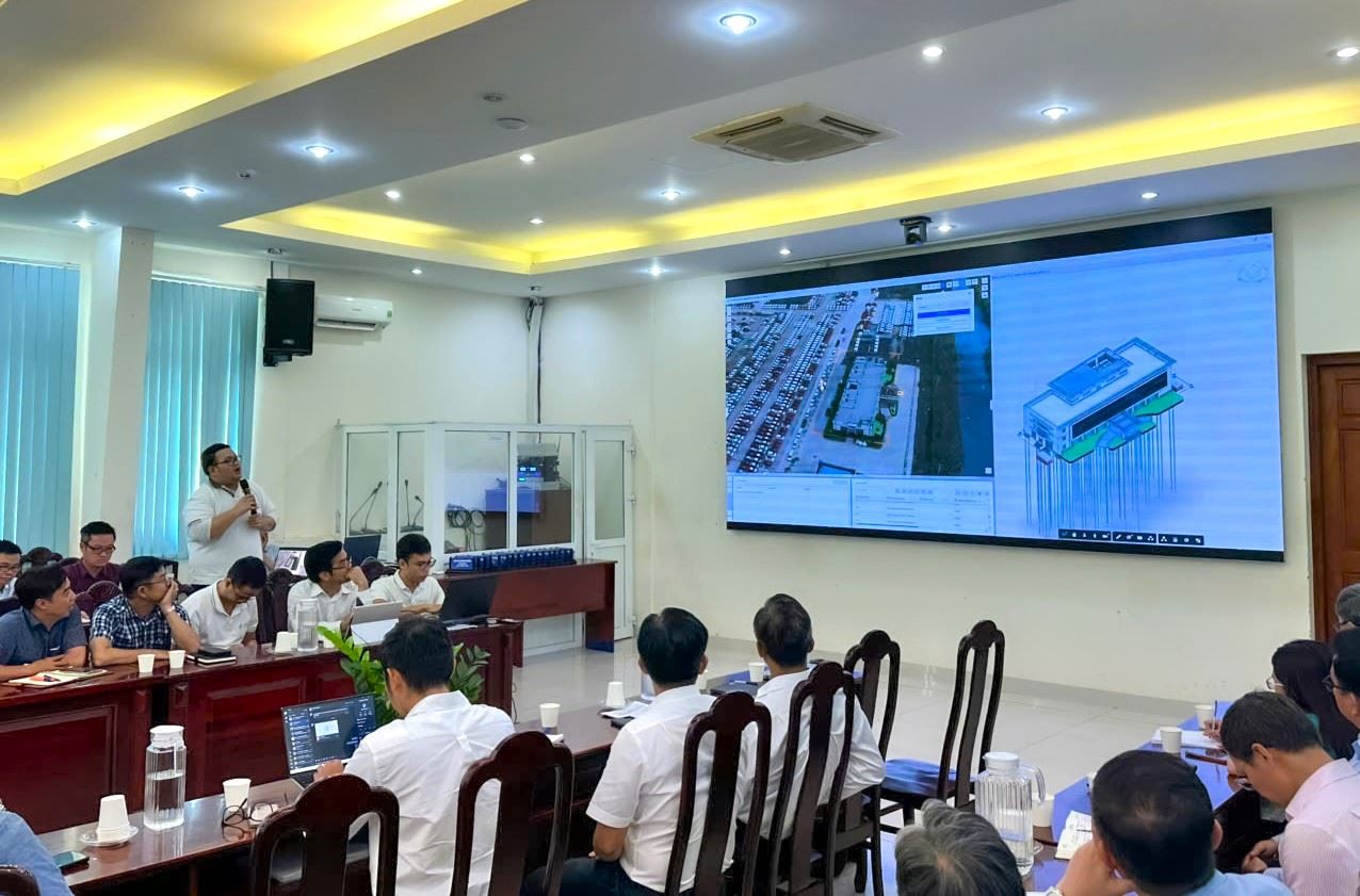
At the conference, Portcoast Company introduced many solutions such as BIM-GIS, scan to BIM, Digital Twin and Smart Urban model. These technologies not only shorten the construction process but also support intuitive and accurate management and operation.
According to a representative of Portcoast Company, the strength of BIM-GIS is the ability to connect data with intuitive 3D images. Thanks to that, engineers and managers can quickly analyze the current status of the infrastructure right on the digital platform, thereby making timely and accurate decisions in maintenance and repair.
Not only bringing technical benefits, BIM-GIS also has strategic value in urban management. When data is digitized and integrated, the government can exploit it for planning and transportation development, towards building a smart city - where data becomes an important "digital asset".


