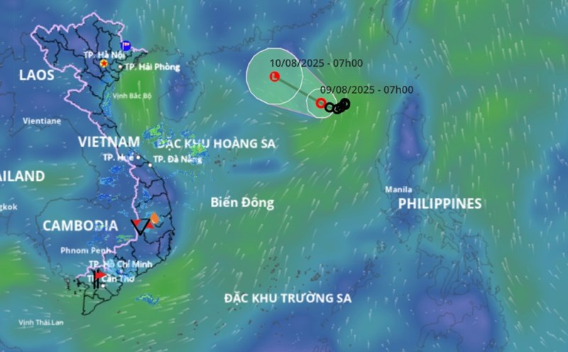
According to the National Center for Hydro-Meteorological Forecasting, last night and night (8.8), the Central Highlands and the Southeast continue to have scattered showers and thunderstorms, with some places having heavy rain. Rainfall from 7pm to 11pm on August 8 was recorded at monitoring stations over 30mm such as: Ia Yeng 1 station (Gia Lai) 70.2mm, La Nga station (Dong Nai) 35.2mm,...
In the Central and Southern Plateau areas on the afternoon and evening of August 9, there will be scattered showers and thunderstorms, locally heavy rain with rainfall of 15 - 30mm, locally over 70mm.
During thunderstorms, there is a possibility of tornadoes, lightning, hail and strong gusts of wind. The warning level of natural disaster risk due to tornadoes, lightning, and hail is level 1. Localized heavy rains are likely to cause flash floods on small rivers and streams, landslides on steep slopes and flooding in low-lying areas.
In the Northern region, Thanh Hoa to Hue provinces and the South Central Coast in the evening and night of August 9, showers and thunderstorms are forecast in some places.
Regarding the rainfall trend in August, nationwide, total rainfall is generally at the same level as the average of many years, especially in the South Central Coast region, the total rainfall is 10 - 25% higher than the average of many years in the same period.
The Northern region and the provinces from Thanh Hoa to Hue are likely to experience some widespread heavy rains. In the Central and Southern Plateau in August, it is forecasted that there will be many days of showers and thunderstorms, mainly in the late afternoon. In particular, some days may have moderate to heavy rain.
On a national scale, there is a continued possibility of dangerous weather phenomena such as thunderstorms, tornadoes, lightning, hail and strong gusts of wind.