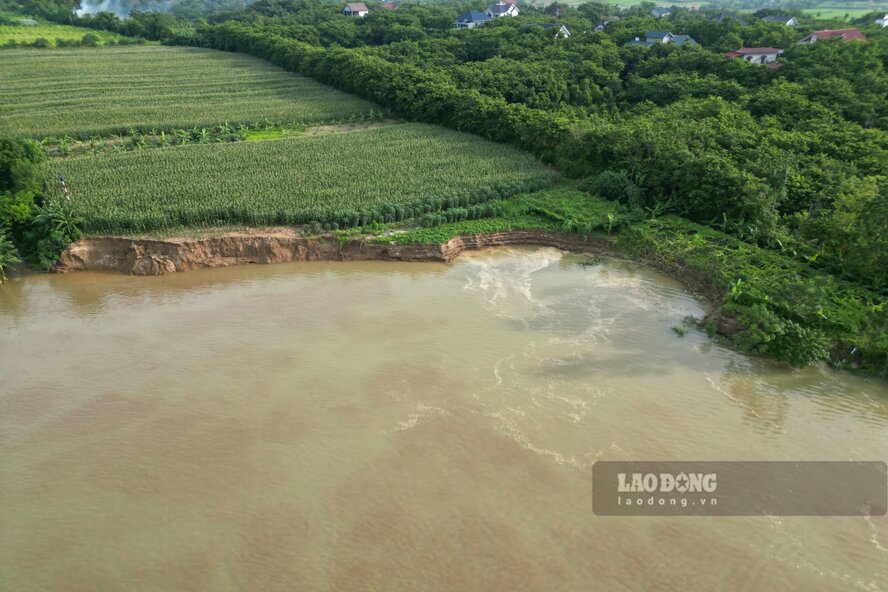
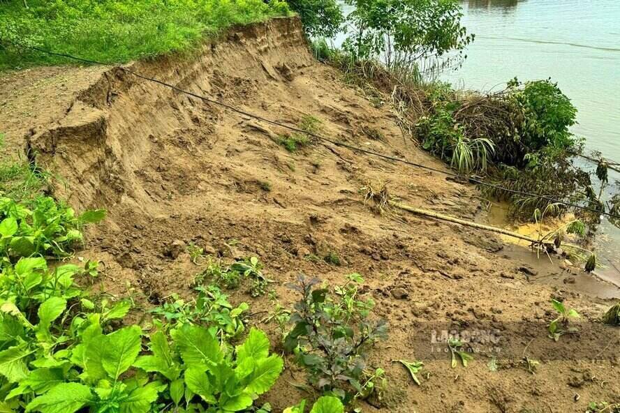
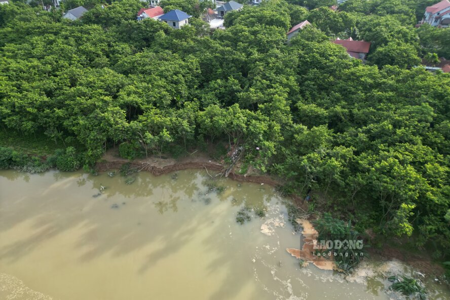
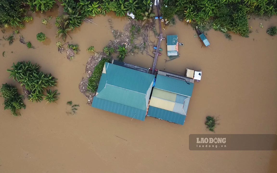
High water levels caused landslides on the banks of the Red River, Da River, and Lo River

Tô Công |

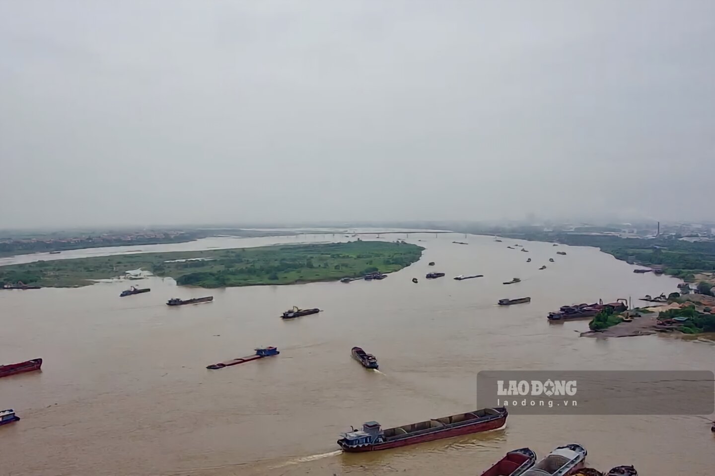
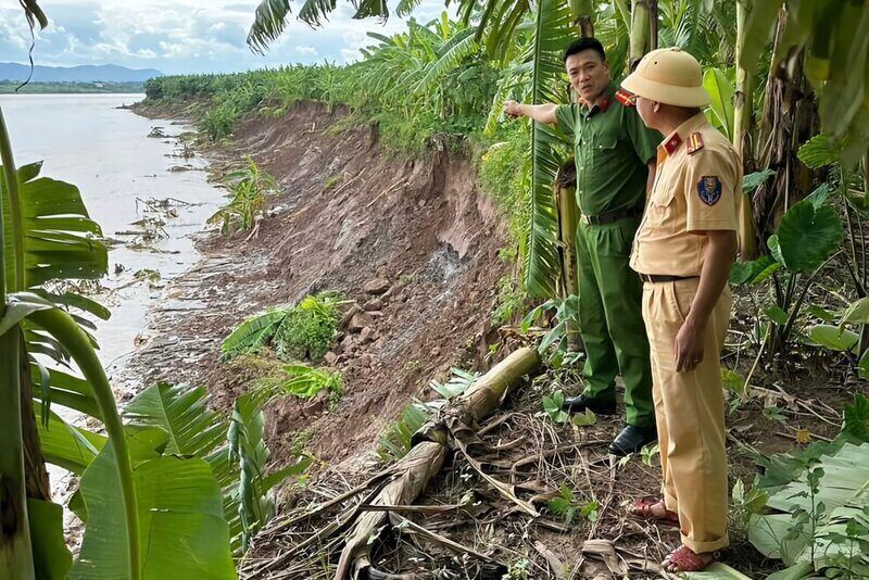
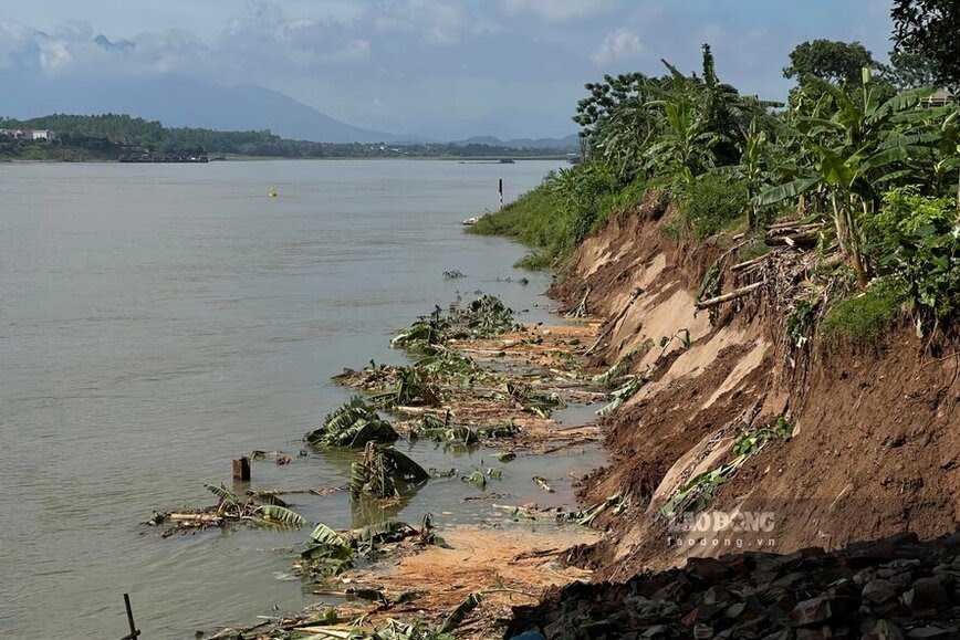
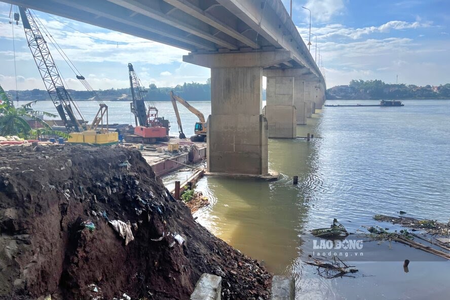
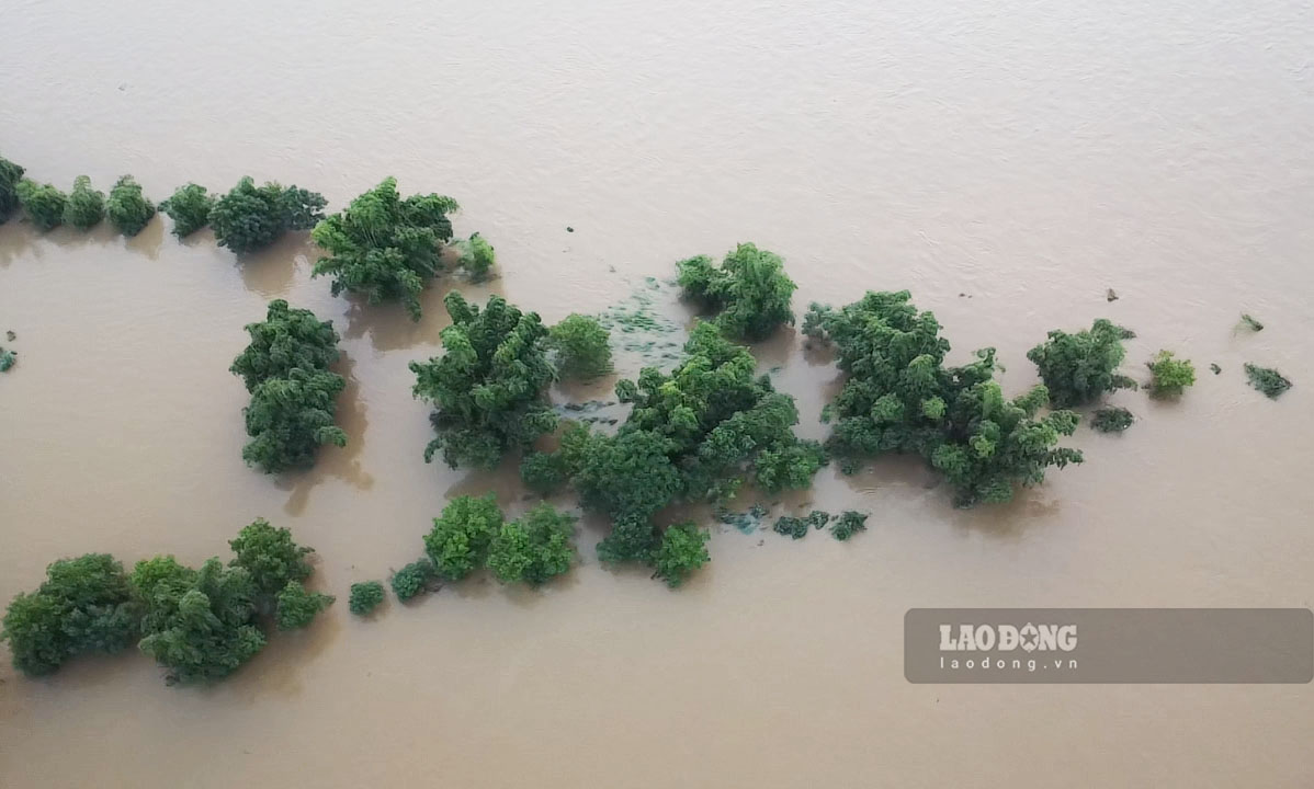
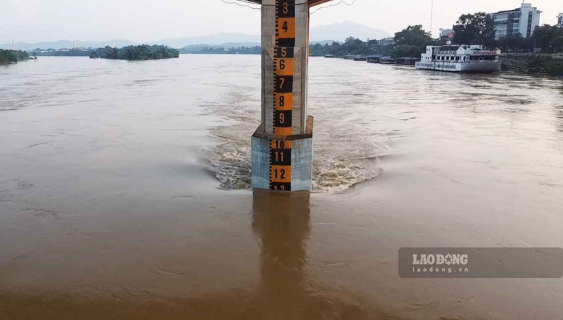
Phu Tho - In recent days, the water levels in the Red River, Da River, and Lo River have all risen and flowed rapidly, and river bank erosion has begun to appear.

Over the past few weeks, the North has often had heavy rains, combined with hydroelectric reservoirs continuously releasing floods, causing water levels in rivers to rise and flow rapidly.
In Phu Tho, at the confluence of three large rivers, the Red River (Thao River), Da River and Lo River, in the past 2 months, many riverbank landslides have appeared, causing property damage. for the people. Photo of the river junction area in Viet Tri City.
Regarding the Red River, according to information from Phu Tho Provincial Police on August 15, through the inspection process, it was shown that there have recently been 2 areas where river bank landslides occurred in Ban Nguyen commune, Lam Thao district (length of about 250m, about 10m wide, about 80m from people's houses) and Xuan Ang commune, Ha Hoa district (about 1km long, about 3m wide, affecting the residential land area of ​​14 households in zones 4 and 5 of Xuan commune Ang).
Regarding the Red River, according to information from Phu Tho Provincial Police on August 15, the inspection process showed that there have recently been 2 areas where river bank landslides occurred in Ban Nguyen commune, Lam Thao district (about 250m long). , about 10m wide, about 80m from people's houses) and Xuan Ang commune, Ha Hoa district (about 1km long, about 3m wide, affecting the residential land area of ​​14 households in zones 4 and 5 of Xuan Ang commune ).
Regarding the Da River, as Lao Dong has informed since the end of June, the river bank belongs to areas 13 and 14, Dan Quyen commune, Tam Nong district, the section adjacent to the foot of Trung Ha bridge (connecting Tam Nong district, Phu Tho province and Ba Vi district). , Hanoi city) landslides occurred.
According to the reporter, the left dyke bank of the Da River collapsed just over 50m from the residential area, 400m from the base of the Hong Da dyke, close to the foundation pier of the Trung Ha bridge that is currently being repaired. Many areas of people's land and crops flow into the fast-flowing river. Currently, an anti-landslide embankment here is being urgently built.
With Lo River, in Tri Quan commune, Phu Ninh district, floods caused landslides close to Ms. Tran Thi Lien's house (in area 10, Tri District commune), causing land and many trees along the river to be swept away by the water. In Tien Du commune (Phu Ninh district), according to the report of the Commune People's Committee, in area 1 there was also a landslide and damage to crops and plants of about 5 households.
Mr. Tran Xuan Truong - a resident of Area 1, Tien Du Commune - said that his family has cultivated the area of ​​land along the river since 2017. In the dry season, the land expands 30 to 40 meters outside the river bed. The landslide area is above the surface, over 20m long...
“The land along this river is mainly sandy soil, so every year when there is a lot of rain, landslides occur. About 200m from this landslide location, there is a sewer flowing from the village. When it rains heavily, the water will roll into the soil at the foot of the dike, causing landslides" - Mr. Truong shared.
According to Mr. Le Xuan Ket - Chairman of Tien Du Commune People's Committee, the section of Lo River flowing through the commune is 5.6km long. Recently, a landslide appeared on the riverbank in area 1, causing damage to property, trees and crops of some households.
“The area of ​​land that has been eroded is exploited and cultivated by the people themselves, the government does not allocate or lease it. The cause of the landslide was prolonged rain, combined with the hydroelectric plant upstream releasing floodwaters, causing the water level of the Lo River to rise and flow rapidly," Mr. Ket informed.
According to the forecast of the hydro-meteorological agency, the weather in the coming days will continue to have many complicated developments, especially continuous and prolonged heavy rain, with a potential risk of landslides on river banks. Authorities warn that people living along the river should actively monitor weather forecasts and comply with regulations on moving out of potentially unsafe areas, especially Landslides, flash floods, pipe floods, and deep floods. Photo of Lo River in Tuyen Quang city.
Tô Công
TIN LIÊN QUAN

Bờ biển tại Thanh Hóa bị xâm thực và sạt lở tan hoang

QUÁCH DU |

Thanh Hóa - Hiện nay, khu vực bờ biển của huyện Hoằng Hóa xuất hiện nhiều điểm bị xâm thực, sạt lở nghiêm trọng. Thậm chí có đoạn bị nứt gãy, đổ sập.

Thời tiết hôm nay 13.8: Bắc Bộ tiếp tục có mưa lớn kéo dài

AN AN |

Thời tiết hôm nay 13.8, mưa lớn diện rộng tiếp diễn tại Bắc Bộ, nguy cơ cao xảy ra lũ quét, sạt lở đất.

Nước sông Lô lên cao hiếm thấy sau gần 20 năm có thủy điện

Việt Bắc |

Sau gần 20 năm có thủy điện Tuyên Quang điều tiết lũ, những ngày qua người dân mới lại chứng kiến nước sông Lô lên cao hiếm thấy.

So sánh hình ảnh TP Yên Bái hiện tại và thời điểm bão lũ lịch sử

Trần Bùi - Vũ Bảo |

Trận đại hồng thủy đã đi qua TP Yên Bái gần 10 ngày, hiện nước đã rút, đường đã khô, cuộc sống người dân đã dần ổn định trở lại.

Giá vàng hôm nay 20.9: Vàng nhẫn tăng sốc

Khương Duy |

Giá vàng hôm nay 20.9 tăng mạnh ở thị trường trong nước và thế giới. Giá vàng nhẫn tròn trơn 9999 sáng nay sắp bằng giá vàng miếng SJC.

Giám đốc công ty làm máy nhắn tin cho Hezbollah bị điều tra

Anh Vũ |

Công ty Gold Apollo, có trụ sở tại Đài Loan (Trung Quốc), đang bị điều tra liên quan đến vụ nổ hàng nghìn máy nhắn tin của lực lượng Hezbollah.

Ngắm mùa lúa chín ở Hà Giang vẹn nguyên sau bão lũ

Đan Thanh |

Không chịu ảnh hưởng nhiều sau bão số 3, ruộng bậc thang ở các huyện Vị Xuyên, Hoàng Su Phì đang vào mùa lúa chín đẹp, thu hút khách trở lại Hà Giang.

Điện Biên xuất hiện thêm cung trượt đe dọa nhiều hộ dân

NHÓM PV |

Nhiều vết nứt tạo thành cung trượt lớn đang đe dọa nguy cơ mất an toàn đối với nhiều hộ dân tại TP Điện Biên Phủ, tỉnh Điện Biên.