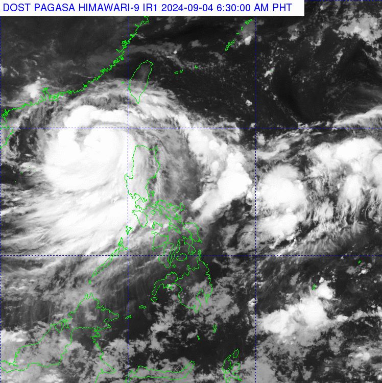
The storm forecast bulletin of the Philippine Atmospheric, Geophysical and Astronomical Services Administration (PAGASA) said that at 4:00 a.m. on September 4, the center of storm Yagi (local name Enteng) was at about 18.9 degrees north latitude; 118.0 degrees east longitude, 265 km northwest of Laoag City, Ilocos Norte, in the eastern sea area of the northern East Sea.
The strongest wind near the storm center is level 11 (103-117km/h), gusting to level 13, and the central pressure is 980 hPa. The storm moves west-northwest, traveling about 10km per hour. Storm-force winds spread out to 280km from the storm center.
Typhoon Yagi has moved outside the Philippine forecast area (PAR) but is still bringing heavy rains to many parts of the country.
PAGASA forecasts heavy to intense rains (100-200mm) on September 4 in Pangasinan, Zambales, Bataan, Occidental Mindoro. Moderate to heavy rains (50-100mm) in northern Palawan.
September 5: Heavy to intense rain (100-200mm) in Pangasinan, Zambales, Bataan, Occidental Mindoro. Moderate to heavy rain (50-100mm) in northern Palawan.
September 6: Moderate to heavy rain (50-100mm) in Ilocos Norte and Ilocos Sur.
Additionally, the strengthening southwest monsoon will bring moderate to very heavy rainfall in other parts of Luzon (especially along the western parts) over the next three days.
Meanwhile, the Vietnam National Center for Hydro-Meteorological Forecasting has forecast the development of storm No. 3 in the next 24 to 72 hours.
It is expected that by 4:00 a.m. on September 5, the center of storm No. 3 will be at about 19.2 degrees north latitude, 115.8 degrees east longitude, about 560 km east of Hainan Island (China). The strongest wind near the center of the storm is level 13, gusting to level 16, moving west.
At 4:00 a.m. on September 6, the center of storm No. 3 was at about 19.5 degrees north latitude, 112.8 degrees east longitude, about 230 km east of Hainan Island (China). The strongest wind near the center of the storm was level 14, gusting to level 17, moving west.
At 4:00 a.m. on September 7, the center of storm No. 3 was at about 20.3 degrees north latitude, 108.9 degrees east longitude, in the Gulf of Tonkin. The strongest wind near the center of the storm was level 13, gusting to level 16, moving west-northwest.
From the next 72 to 120 hours, the storm moved mainly in the west-northwest direction, traveling 15km per hour, and its intensity continued to decrease.
The eastern sea area of the northern East Sea has strong winds of level 8-10, the area near the storm's eye has winds of level 11-13, gusting to level 16; the sea is very rough.
From September 5-6, storm No. 3 may reach very strong storm level in the northern sea area of the North East Sea, with strong winds reaching level 14, gusting to level 17 near the storm's center.
In the next 24 hours, the eastern sea of the northern East Sea will have waves 2-4m high, and 4-6m near the storm center. From September 5-6, they may gradually increase to 7-9m. The sea will be very rough.
Ships operating in the above mentioned dangerous areas are likely to be affected by strong winds and large waves.