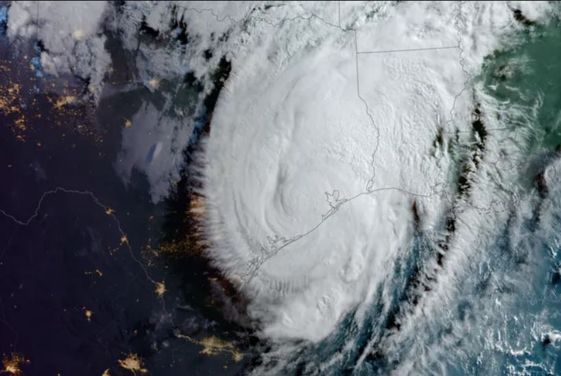
Storm Beryl became the earliest super storm to form in early July, and was also the strongest July super storm recorded in the Atlantic Ocean, with winds of 265 km/h.
Storm forecasts show that this year's Atlantic hurricane season is busier than usual, while the storm-prone Pacific region is quieter.
On July 3, for the first time since the satellite era began in 1966, the entire northern Pacific had no named storms between June 1 and July 3. - Phil Klotzbach, writer Senior research scientist at Colorado State University (USA) said.
According to Mr. Klotzbach, the same phenomenon — crazy warm water temperatures across the North Atlantic — is affecting hurricane activity in both oceans.
Scientists compare hurricane season activity through an index called cumulative eddy energy. This index calculates the total energy of a hurricane season according to the frequency of storms and the maximum wind speed of each storm over its lifetime.
This year, for the first time in recorded history, the Atlantic Ocean generated more cumulative cyclonic energy through July 9 than the entire Pacific Ocean.
In the westernmost Pacific Ocean, this is "one of the slowest starts of the tropical storm season" - said Landon Aydlett, a meteorologist with the US National Weather Service (NWS) in Guam.
The western North Pacific had only one storm in May, and this was the second time since 1950 that the region had no storm from June 1 to July 15. The previous time was 1975.
In the eastern part of the North Pacific, storm Aletta formed on July 4, 320 km west of Mexico, the latest start of the hurricane season on record in this storm area, breaking the previous record set established in 1969.
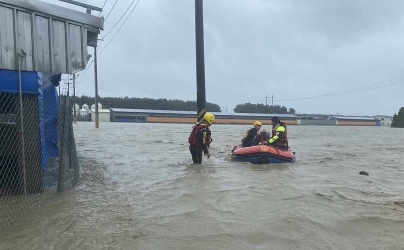
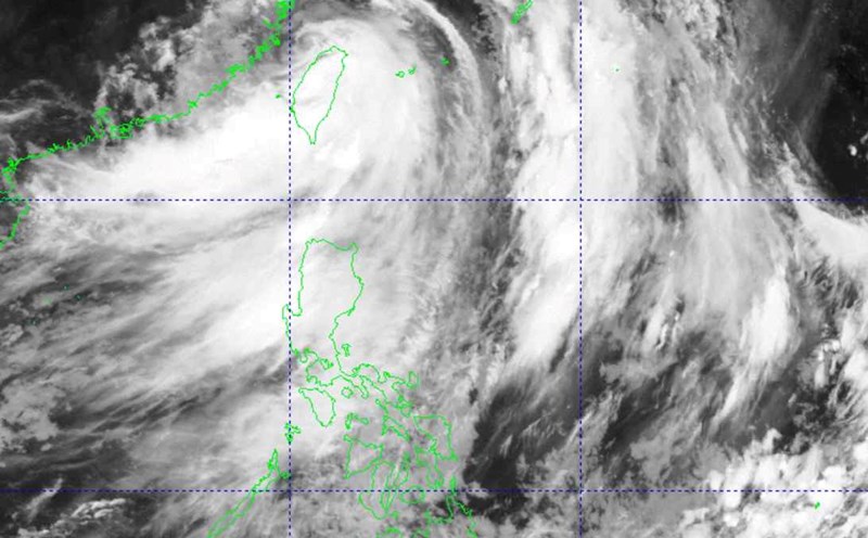
But the storms have accelerated this week. Storm number 3 of the 2024 Pacific storm season - super typhoon Gaemi - made landfall for the second time in China on the evening of July 25 after sweeping the Philippines and Taiwan (China).

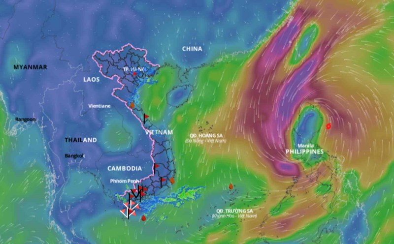
Previously, storm No. 2 Prapiroon hit level 13, causing heavy rain and strong winds in many provinces of Vietnam.
There are several factors at play in the Pacific this summer, Klotzbach said, including a lack of a strong monsoon trough in the western part of the North Pacific and too much wind shear in the eastern part of the North Pacific. .
Meanwhile, water temperatures in the tropical Atlantic increased dramatically from March to June 2023 and have remained at or near record warm levels since then. Thanks to global wind patterns, what happens in one location can directly affect what happens in another.
The Atlantic and Pacific Oceans are influenced by three weather periods known as El Nino - Southern Oscillation (ENSO). These include El Nino, La Nina and the neutral phase.
El Nino typically creates conditions for more storms in the Pacific and fewer storms in the Atlantic.
Warmer temperatures in the Atlantic also favor sinking motion in the eastern Pacific and upper-level easterly winds in both oceans.
In the Atlantic, this wind pattern reduces westerly wind shear, creating more favorable conditions for storm formation . In the eastern part of the North Pacific, easterly winds increase wind shear, making storms stronger.
Scientists believe that the reason the waters in the Atlantic Ocean are unusually warm is mainly due to weaker-than-normal subtropical high pressure leading to weaker trade winds.