On June 15, the Ho Chi Minh City Command coordinated with experts to organize the use of ground-penetrating radar scanning equipment to survey locations suspected to be mass graves of martyrs at Le Thi Rieng Park.
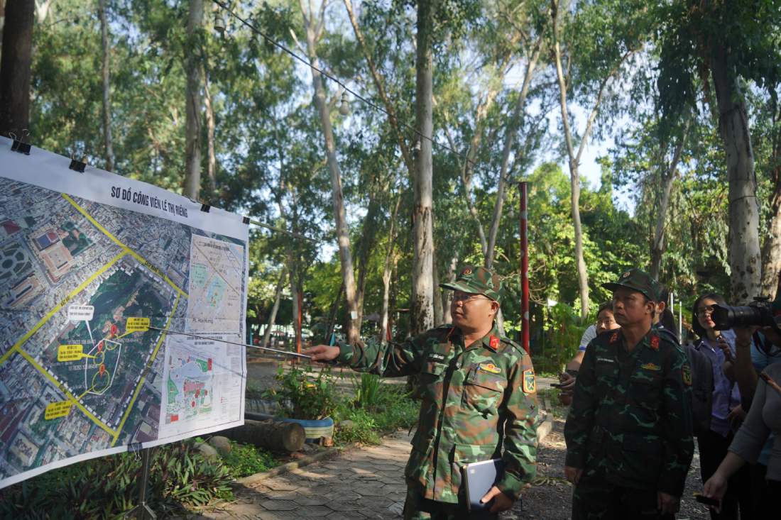
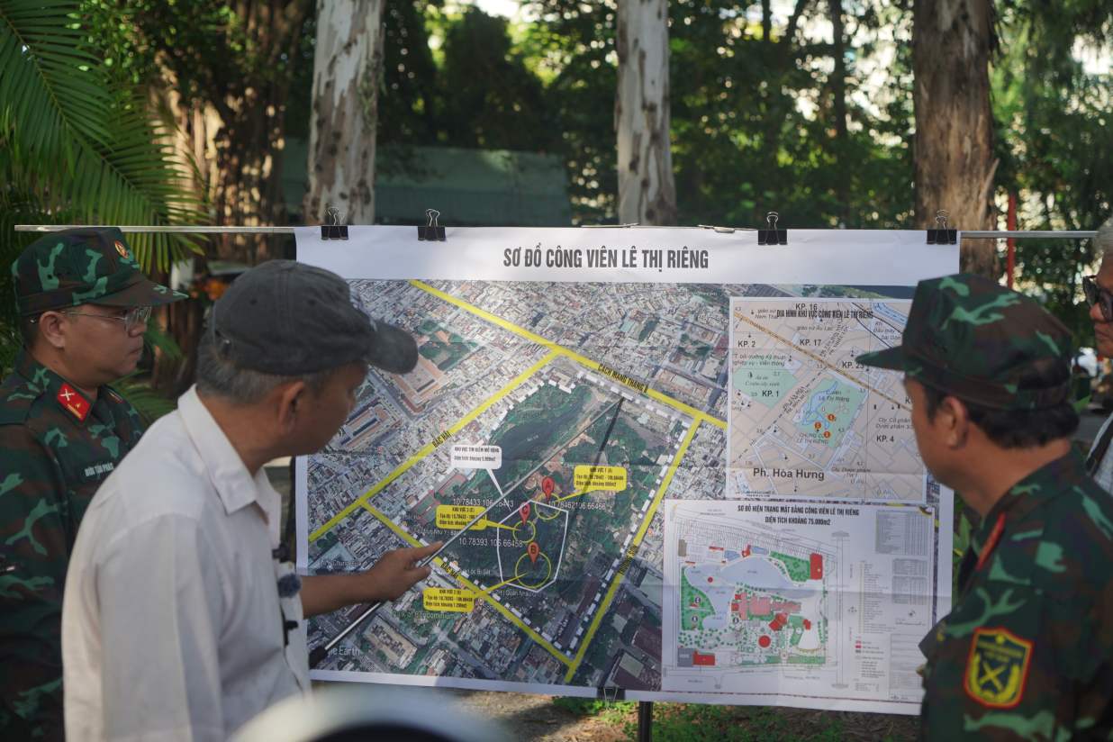
The survey activity aims to verify and consolidate data to prepare for the exhumation of martyrs' remains, which is expected to be deployed at the end of June or early July. The basis of this search comes from many records and images provided by architect Nguyen Xuan Thang combined with the accounts of historical witnesses. Information sources all point out that the former Chi Hoa - Cho Quan cemetery area (now Le Thi Rieng Park) may have 3 mass graves with about 900 soldiers who sacrificed in the 1968 campaign.
The working session was directly directed by Colonel Nguyen Dinh Chuan, Deputy Political Commissar of the Ho Chi Minh City Command. At the working session, Colonel Nguyen Dinh Chuan said that this phase focused on 3 main suspicious areas. These points were carefully selected through comparison of historical documents, witness accounts, military maps and aerial photos.
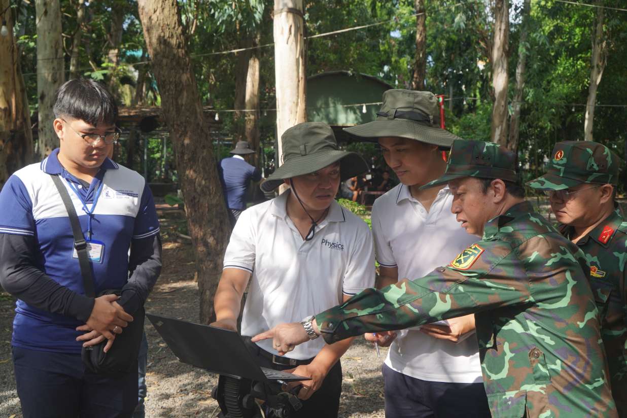
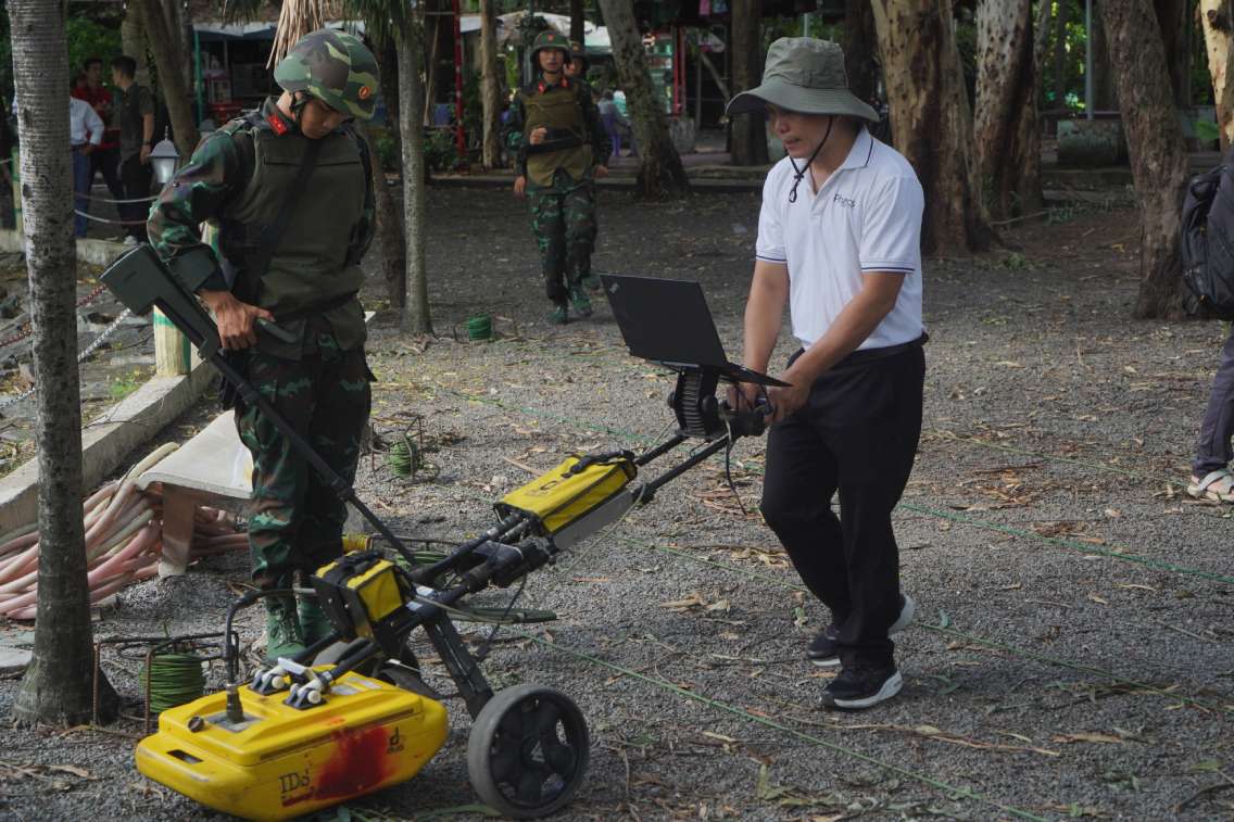
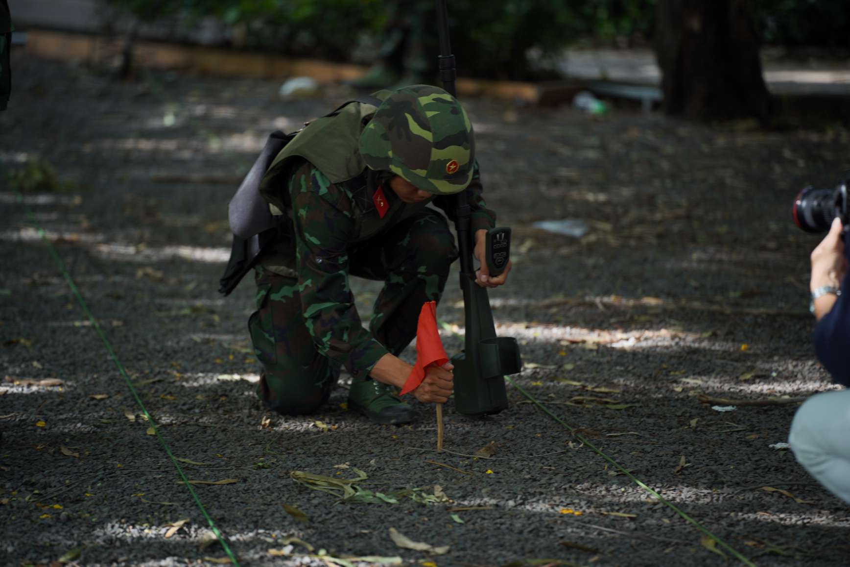
Because the terrain has undergone many fillings and renovations and the time has passed nearly 60 years, the stratigraph in the area has been greatly disturbed, making the search work difficult. To solve this problem, the professional team has coordinated with the University of Science to bring the IDS Duo Detector machine into the exploration process, combining geophysical methods and one-way current resistance measurement techniques. Ground-penetrating radar technology is expected to detect unusual signs beneath the surface to zone suspicious locations such as ditches or burial ditches.
Land-penetrating radar is currently widely used in many countries in the fields of archeology and geology. The application of this technology will help narrow the search range, significantly reducing time and costs compared to manual excavation methods on a large scale.
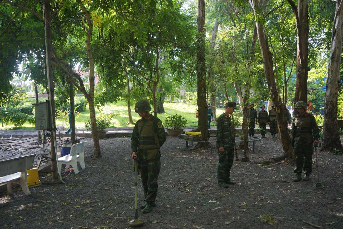
In addition, the surveying process is also supported by a series of other advanced technologies such as electromagnetic sensors, shallow seismic surveys, unmanned aerial vehicles and artificial intelligence to synthesize and analyze complex terrain data, helping the search work achieve the highest efficiency.


