According to the latest weather forecast from the Philippine Atmospheric, Geophysical and Astronomical Services Administration, the low pressure is moving out of the Philippine mainland.
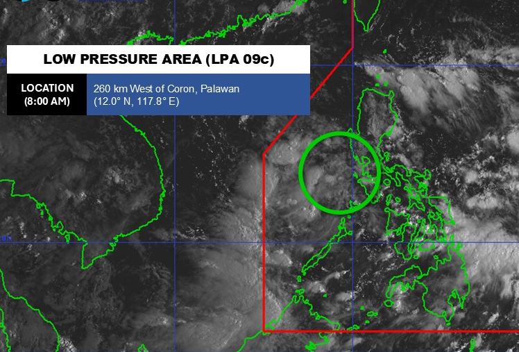
As of 8:00 a.m. on September 15, the center of the low pressure was at about 12.0 degrees North latitude - 117.8 degrees East longitude, about 260 km west of Conron, Palawan, inside the East Sea.
The low pressure is forecast to be unlikely to develop into a tropical depression in the next 24 hours.
However, due to the influence of the depression, Rizal, Aurora and Quezon regions will have heavy rain. Scattered rain and thunderstorms have occurred in the Manila urban area, Ilocos, Cordillera, Cagayan Valley, Central Luzon, Calabarzon, Mimaropa, Western Visayas, Negros and Camarines Norte islands.
According to the National Center for Hydro-Meteorological Forecasting, on September 15, the tropical convergence zone with an axis through the Central East Sea will connect with the low pressure area. At 7:00 a.m., the center of the convergence zone was located at about 11.5-12.5 degrees North latitude; 118.0-119,0 degrees East longitude.
The eastern sea area of the Central and South East Sea (including the eastern sea area of Truong Sa) will have showers and thunderstorms.
It is forecasted that during the day and night of September 15, coastal waters from Quang Ninh to Ninh Binh, waters from Khanh Hoa to Ca Mau, Ca Mau to An Giang, the Gulf of Thailand, the Central and South East Sea (including the Truong Sa special zone) will have scattered showers and thunderstorms. During thunderstorms, there is a possibility of tornadoes, strong gusts of wind of level 6-7, waves over 2.0m high.
All ships operating in the above areas are at risk of being affected by tornadoes and strong gusts of wind.
People and tourists planning to visit these coastal areas should pay attention to weather forecasts. Follow local instructions to avoid storms and big waves at sea that affect the journey.


