According to the new low pressure forecast from the US National Hurricane Center (NHC), the depression is active in southern Mexico, near the offshore area of Tehuantepec Bay.
The low pressure will cause scattered showers and thunderstorms, which are likely to develop into a tropical depression from mid- to late week when moving west-northwest at a speed of 15-25 km/h.
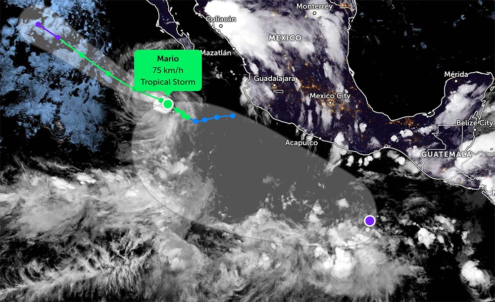
The depression is forecast to move along with Mario. The low pressure is likely to strengthen into a tropical depression or tropical storm in the next 7 days.
Currently, Mario has winds near the center of the storm reaching about 70-75 km/h, sometimes stronger up to about 95 km/h.
Mario is currently moving slowly west-northwest along the southwest coast of Mexico. This trend is forecast to continue in the next few days.
In the next 24-30 hours, the storm will remain in a favorable environment, so there is a possibility of strengthening slightly.
However, from the evening of September 15, when entering the colder sea and the wind will increase, the storm will quickly weaken. Mario is forecast to weaken into a depression in the next 2-3 days.
Visitors should note that the southwestern coastal area of Mexico, especially near Socorro Island and Michoacan State, should be on guard against heavy rain and strong winds in the next few days.
Tourists should not participate in activities at sea, limit travel to areas with storm warnings. Closely monitor weather forecasts and consider adjusting travel schedules to ensure safety.
In addition, a low pressure has entered the East Sea and caused widespread thunderstorms. The low pressure is currently west of Luzon Island, Philippines.
Maximum winds are recorded at about 25-35 km/h. Global forecast models agree that the depression will continue moving into the South China Sea with little chance of strengthening.


