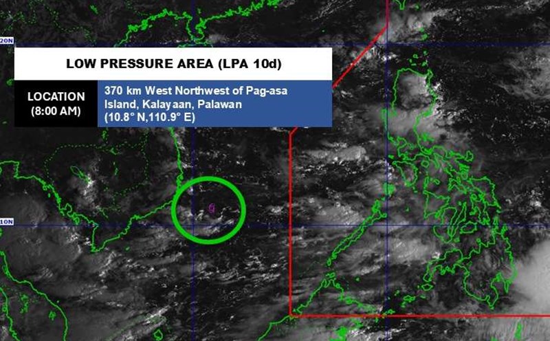
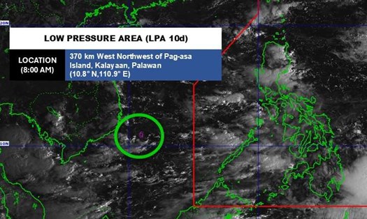
According to the weather forecast from the Philippine Atmospheric, Geophysical and Astronomical Services Administration (PAGASA), a new low pressure has formed near the East Sea, outside the Philippine Area of Responsibility.
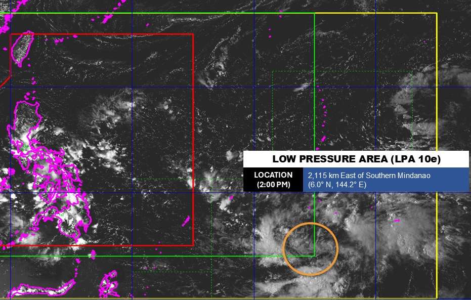
As of 2:00 p.m. on October 13 (local time), the center of the low pressure was at about 6.0 degrees North latitude - 144.2 degrees East longitude, about 2,115 km east of the southern part of Mindanao.
PAGASA forecasts that the low pressure is likely to develop into a tropical depression in the next 24 hours.
Because it is still quite far away, the low pressure has not greatly affected the weather in the Philippines.
PAGASA forecasts that during the week of October 13-16, the low pressure will move through the Northern Luzon area, then towards the East Sea, entering the Vietnamese sea. The low pressure is forecast to have a high probability of strengthening into a storm.
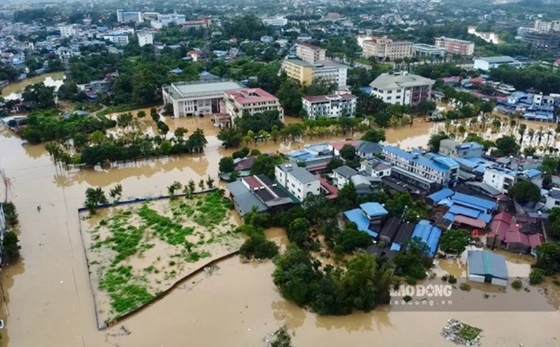
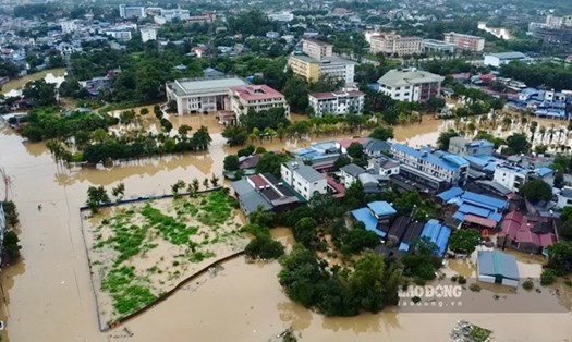
According to the National Center for Hydro-Meteorological Forecasting, in the East Sea, the Gulf of Tonkin will have scattered showers and thunderstorms. During thunderstorms, there is a possibility of tornadoes and strong gusts of wind of level 6-7. A view of over 10km away, reduced to 4-10km in rain. East wind level 3-4 Waves are 0.5 - 1.5m high.
The sea area from Quang Tri to Ca Mau will have scattered showers and thunderstorms. Strong gusts of wind level 6-7. A view of over 10km away, reduced to 4-10km in rain. Light wind. Waves are 0.5 - 1.5m high.
People and tourists planning to visit the above sea areas should pay attention to weather forecasts. Tuan follows local instructions to avoid dangerous storms.