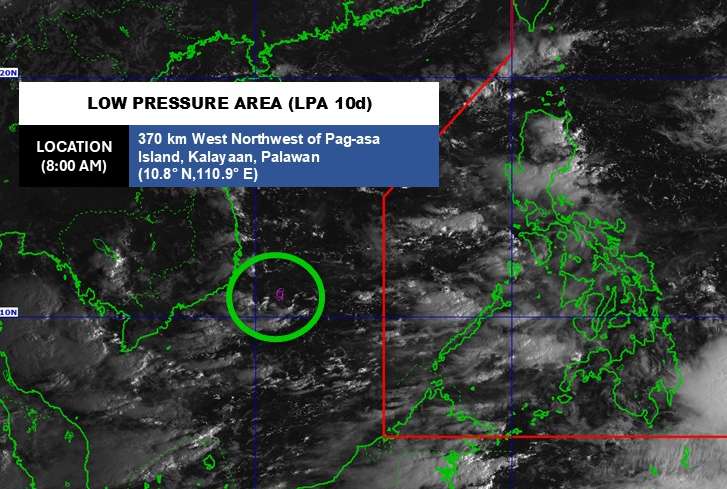
According to the National Center for Hydro-Meteorological Forecasting, on the morning of October 10, the low pressure trough with an axis at about 12-14 degrees North latitude connected with a low pressure area at 7:00 a.m. located at about 11.5-12.50 degrees North latitude - 112.5-112.50 degrees East longitude, near the mainland of Lam Dong and Khanh Hoa provinces.
The low pressure is forecast to be unlikely to develop into a tropical depression in the next 24 hours.
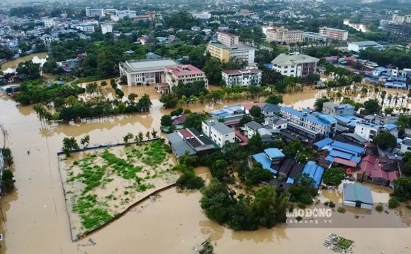
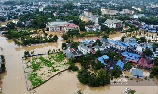
Due to the influence of the low pressure, according to the National Center for Hydro-Meteorological Forecasting, last night and this morning (October 10), in the area from Quang Tri to Da Nang, Dak Lak, Lam Dong, Khanh Hoa and the South, there were scattered showers and thunderstorms, locally heavy rain.
Rainfall from 7pm on October 9 to 8am on October 10 was over 60mm in some places such as: Viet Trung station (Quang Tri) 60mm, Hoa Hai station (Da Nang city) 98.4mm, Vinh Xuong station (An Giang) 61.4mm...
The Central and South East Sea area (including Truong Sa special zone), the sea area from Quang Tri to Ca Mau, Ca Mau to An Giang and the Gulf of Thailand are having showers and thunderstorms.
It is forecasted that during the day and night of October 10, the North East Sea (including Hoang Sa special zone), the Central and South East Sea (including Truong Sa special zone), the sea area from Quang Tri to Ca Mau, Ca Mau to An Giang and the Gulf of Thailand will have showers and thunderstorms. During thunderstorms, there is a possibility of tornadoes, strong gusts of wind of level 6-7 and waves over 2.0m high.
The area from Quang Tri to Lam Dong and the South will have scattered showers and thunderstorms, locally heavy rain with rainfall from 10-30mm, locally over 80mm. Warning of the risk of rain with an intensity greater than 60mm/3 hours.
During thunderstorms, there is a possibility of tornadoes, lightning, hail and strong gusts of wind. Localized heavy rains are likely to cause flash floods on small rivers and streams, landslides on steep slopes and flooding in low-lying areas.
All ships operating in the above areas are at risk of being affected by tornadoes and strong gusts of wind.
People and tourists in these areas should bring umbrellas and raincoats when going out to prevent sudden changes in weather. When going to sea, you should follow local instructions to avoid dangerous storms and big waves.