According to the latest storm information from the Philippine Atmospheric, Geophysical and Astronomical Services Administration (PAGASA), strong tropical storm Fung-wong is rapidly intensifying as it moves northwest over the West Pacific Ocean, off the east coast of the Visayas.
The storm is forecast to enter the Philippine Area of Responsibility (PAR) tonight or early tomorrow morning (8.11) and be locally named UWAN.
According to PAGASA, the center of Typhoon Fung-wong at 10:00 a.m. on November 7 (local time) was located at 11.6 degrees North latitude; 137.5 degrees East longitude, about 1,315 km east of Eastern Visayas.
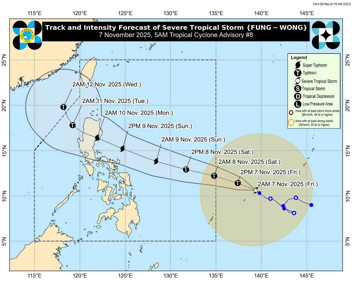
The storm has the strongest wind speed of 100 km/h, gusts of up to 125 km/h, central pressure of 980 hPa, moving west - northwest at a speed of 20 km/h.
It is forecasted that in the next 24 to 36 hours, Fung-wong will quickly strengthen into a major storm, then reach super typhoon level on the evening of November 8 or the morning of November 9 when entering the East Sea.
On its path, the storm could make landfall in the southern part of Isabela province or northern Aurora in the Philippines on the evening of November 9 or early morning of November 10. The system will then sweep across the mountainous terrain of Northern Luzon and then enter the West Philippine Sea on November 10 in a state of weakness.
People and tourists need to closely monitor updated news and prepare to respond to the worst situation.


