According to the National Center for Hydro-Meteorological Forecasting, early this morning, November 7, the tropical depression (weakened from storm No. 13.) weakened into a low pressure area in the Ha Lao area.
At 4:00 a.m., the low pressure area was located at about 14.6 degrees North latitude - 106.8 degrees East longitude. The strongest wind in the center of the low pressure area is below level 6 (under 39km/h). It is forecasted that in the next 12 hours, the low pressure area will continue to move mainly in the West Northwest direction, weakening and gradually dissipating.
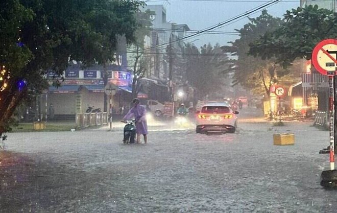
Due to the impact of storm No. 13, last night and this morning, the area from South Quang Tri to Lam Dong had heavy to very heavy rain. Rainfall from 7pm on November 6 to 7am on November 7 was over 150mm in some places such as: La To Hydropower Dam Station (Quang Tri) 176.8mm, Dinh Bach Ma Station (Hue City) 214.8mm, Ba Na Station (Da Nang City) 178.6mm, Ia Glai Reservoir Station (Gia Lai) 158.0mm, Son Hoi Station (Dak Lak) 208.2mm...
From the morning of November 7 to the end of November 8, the area from Thanh Hoa to North Quang Tri will have moderate rain, heavy rain, locally very heavy rain with common rainfall of 50-100mm, locally over 200mm. Warning of the risk of heavy rain (>100mm/3 hours).
In addition, in the evening and night of November 7, in the Southern region, there will be scattered showers and thunderstorms with rainfall of 10-30mm, locally heavy rain over 70mm. Warning of the risk of heavy rain (>60mm/3 hours).
During thunderstorms, there is a possibility of tornadoes, lightning, hail and strong gusts of wind. Localized heavy rains are likely to cause flash floods on small rivers and streams, landslides on steep slopes and flooding in low-lying areas.
From the night of November 8, heavy rain in the area from Thanh Hoa to North Quang Tri tends to decrease. Warning level of natural disaster risk due to heavy rain, tornadoes, lightning, hail: level 1. Heavy rain can cause flooding in low-lying areas, urban areas, industrial parks, flash floods on small rivers and streams, and landslides on steep slopes.
On the morning of November 7, floods on rivers in Hue city, Vu Gia river (Da Nang city), Tra Khuc river (Quang Ngai), upstream Ba river (Gia Lai) are receding, downstream Thu Bon river (Da Nang city), downstream Kon river (Gia Lai), downstream Ba river (Dak Lak) are rising.
It is forecasted that in the next 6 hours, floods in the downstream of the Ba River at Phu Lam station will rise above level 2, then fall. In the next 6-24 hours, floods in the downstream of the Ba River at Phu Lam station will continue to fall and remain below BD1.
In the next 24 hours, the upstream flood of Ba River (Gia Lai) at Ayunpa station will decrease and fluctuate at level 2-BD3; Huong River at Kim Long station, Vu Gia River at Ai Nghia station will continue to decrease and stay above level 1; Thu Bon River at Cau Lau station will drop below level 2, downstream of Kon River at Thanh Hoa station will fluctuate below level 2; Tra Khuc River at Tra Khuc station will drop below level 1.
Flooding risk in low-lying areas along rivers, urban areas, and residential areas in provinces/cities from Hue city to Dak Lak.There is a high risk of flash floods on rivers and streams and landslides on steep slopes of provinces/cities in Hue city to Dak Lak.
People and tourists planning to visit these areas should pay attention to weather forecasts. Avoid going out during heavy rain, do not go to areas at risk of flash floods and landslides. Tuan followed the local instructions to avoid dangerous floods throughout the journey.


