According to the National Center for Hydro-Meteorological Forecasting, on the evening of November 6, storm No. 13 Kalmaegi made landfall in Vietnam.
At 1:00 a.m. this morning, November 7, the center of the storm was at about 14.3 degrees North latitude - 107.8 degrees East longitude, on the mainland from Quang Ngai to Dak Lak, deep into the mainland and gradually weakening. The storm is moving west-northwest at a speed of about 30 km/h. The strongest wind near the storm center is level 8, gusting to level 10.
Natural disaster risk level: level 4 for the sea area from Quang Ngai to Dak Lak (including Ly Son special zone); mainland east of Quang Ngai to Gia Lai, North Dak Lak; Level 3 for the west of the Central East Sea, sea area from South Quang Tri to Da Nang (including Cu Lao Cham island) and Khanh Hoa; mainland from South Quang Tri to Da Nang, South Dak Lak province and North Khanh Hoa province.
At 7:00 a.m. this morning, the storm will continue moving west-northwest at a speed of 30km/h, the center of the storm will be in the Southern Laos area and gradually weaken into a tropical depression.
The strongest wind will reach level 6, gusting to level 8. Natural disaster risk level: Level 3 for the sea area from South Quang Tri to Da Nang (Cu Lao Cham island), Ly Son and Khanh Hoa special zones; mainland from South Quang Tri to Da Nang, south of Dak Lak province and north of Khanh Hoa province.
By 7:00 p.m. today, the tropical depression will move to the eastern part of Thailand and weaken into a low pressure area.
Due to the influence of storm No. 13, the sea area west of the Central East Sea will have strong winds of level 6-8, gusts of level 10, waves 3.0-5.0m high; rough seas. The coastal areas from South Da Nang to Dak Lak (including Ly Son special area, Cu Lao Cham island) will have strong winds of level 8-9, waves 3.0-5.0m high; the area near the storm's eye will have strong winds of level 10-12, gusts of level 14, waves 5.0-4.0m high; the sea will be very rough.
The sea area from South Quang Tri to North Da Nang and Khanh Hoa will have strong winds of level 6-7, gusts of level 8-9, waves 2.0-4.0m high; rough seas.
Coastal areas from South Quang Tri to Dak Lak will have storm surge of 0.5-1.0m high. The highest sea level is in Thuan An (1.0m), Son Tra (1.2m), Hoi An (1.3m), Dung Quat (1.5m), Quy Nhon (1.2m), Tuy Hoa (1.1m). Warning of flooding, waves of overflooding of dykes, coastal erosion, affecting low-lying areas and aquaculture.
The area from South Da Nang to Dak Lak has strong winds of level 6-9, the area near the storm's eye has strong winds of level 10-12 (focused on the East of Quang Ngai-Gia Lai provinces, North of Dak Lak), gusting to level 14. The area from South Quang Tri to the North of Da Nang and the North of Khanh Hoa province will have strong winds of level 6-7, gusting to level 8-9. The strongest wind will be from the evening to the night of November 6.
The area west of Quang Ngai to Gia Lai has strong winds of level 6-7, the area near the storm's eye has strong winds of level 8-9, gusting to level 11.
From the evening of November 6-7, the area from Da Nang to Dak Lak will have very heavy rain with common rainfall of 150-300mm, locally over 450mm; the area from South Quang Tri to Hue, Khanh Hoa and Lam Dong will have heavy rain with common rainfall of 100-250mm, locally very heavy rain over 400mm. From November 8, heavy rain in the above areas tends to decrease.
From November 7-8, the area from Thanh Hoa to North Quang Tri will have moderate rain, heavy rain with common rainfall of 50-150mm, locally very heavy rain over 200mm. Warning of the risk of heavy rain (>200mm/3 hours).
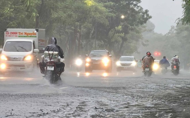
People and tourists in these areas should pay attention to the path of the storm. Avoid going out when not necessary and follow local instructions so that storms do not cause danger.
Weather forecast for today, November 7, nationwide:
Hanoi
Lowest temperature: 20-22 degrees Celsius Highest temperature: 23-25 degrees Celsius Cloudy, sometimes with rain, showers and thunderstorms.
North to northwest wind level 2-3.Cold at night and morning.
Northwest
Lowest temperature: 18-21 degrees Celsius, some places below 17 degrees Celsius Highest temperature: 23-26 degrees Celsius, some places above 27 degrees Celsius Cloudy, some places have rain at night; scattered showers and thunderstorms during the day.
Light wind.Cold at night and morning, some places are cold.
Northeast
Lowest temperature: 19-22 degrees Celsius, mountainous areas below 18 degrees Celsius Highest temperature: 23-26 degrees Celsius Cloudy, some places have rain at night; scattered showers and thunderstorms during the day; in the plains, there is rain, moderate rain and thunderstorms, locally heavy rain.
North to northwest wind level 2-3.Cold at night and morning, some mountainous areas are cold.
Thanh Hoa to Hue
Lowest temperature: 19-22 degrees Celsius Highest temperature: North 22-25 degrees Celsius, South 25-28 degrees Celsius Cloudy, North has scattered rain and thunderstorms at night, moderate rain, heavy rain during the day, locally very heavy rain; South has heavy to very heavy rain.
North to northwest wind level 3; in the South, the wind will gradually increase to level 6-7, gusting to level 8-9.Cold at night and morning.During thunderstorms, there is a possibility of tornadoes, lightning and strong gusts of wind.
South Central Coast
Lowest temperature: 22-25 degrees Celsius Highest temperature: 26-29 degrees Celsius, some places above 29 degrees Celsius Cloudy, heavy to very heavy rain.
The wind gradually increased to level 6-7, then increased to level 8-9, near the storm center level 10-13, gusting to level 15-16.During thunderstorms, there is a possibility of tornadoes, lightning and strong gusts of wind.
Central Highlands
Lowest temperature: 18-21 degrees Celsius Highest temperature: 24-27 degrees Celsius Cloudy, with heavy to very heavy rain.
Northwest wind level 3-4, especially in the North from the evening the wind will gradually increase to level 6-7, near the storm center level 8-9, gusting to level 11.During thunderstorms, there is a possibility of tornadoes, lightning and strong gusts of wind.
Southern region
Lowest temperature: 23-26 degrees Celsius Highest temperature: 28-31 degrees Celsius, some places above 31 degrees Celsius Cloudy, scattered showers and thunderstorms in some places; in the afternoon and evening, there will be scattered showers and thunderstorms, locally heavy rain in some places.
Southwest wind level 3-4.During thunderstorms, there is a possibility of tornadoes, lightning and strong gusts of wind.
Ho Chi Minh City
Lowest temperature: 23-25 degrees Celsius Highest temperature: 28-30 degrees Celsius Cloudy, scattered showers and thunderstorms in some places; In the afternoon and evening, there will be scattered showers and thunderstorms, locally heavy rain in some places.
Southwest wind level 3-4.During thunderstorms, there is a possibility of tornadoes, lightning and strong gusts of wind.


