Hurricane Penha has weakened slightly after making landfall for the first time in Bayabas, Surigao del Sur province at 11:50 pm on February 5. The maximum sustained wind at the time of the storm's landfall was about 65 km/h, gusts up to 90 km/h; the strong wind area extended to 330 km from the storm's center.
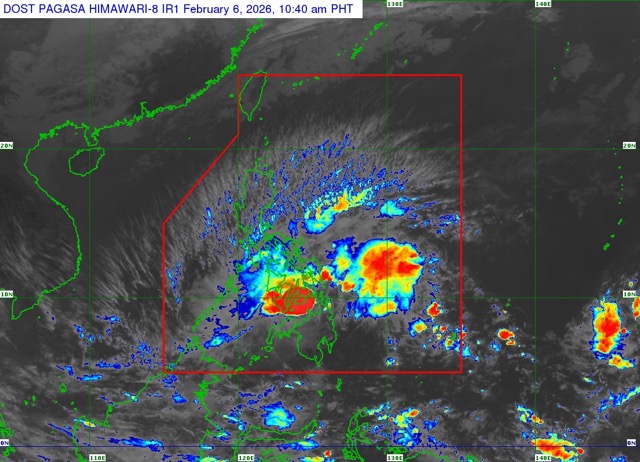
According to the latest storm news from the Philippine Atmospheric, Geophysical and Astronomical Services Administration (PAGASA), at 10:00 AM on February 6th (local time), Typhoon Penha officially weakened into a tropical depression and is approaching Bohol Island.
The tropical depression is moving in a west-northwest direction at a speed of about 10 km/h. The strongest wind in the area near the center of the tropical depression is about 55km/h, gusting up to 70km/h.
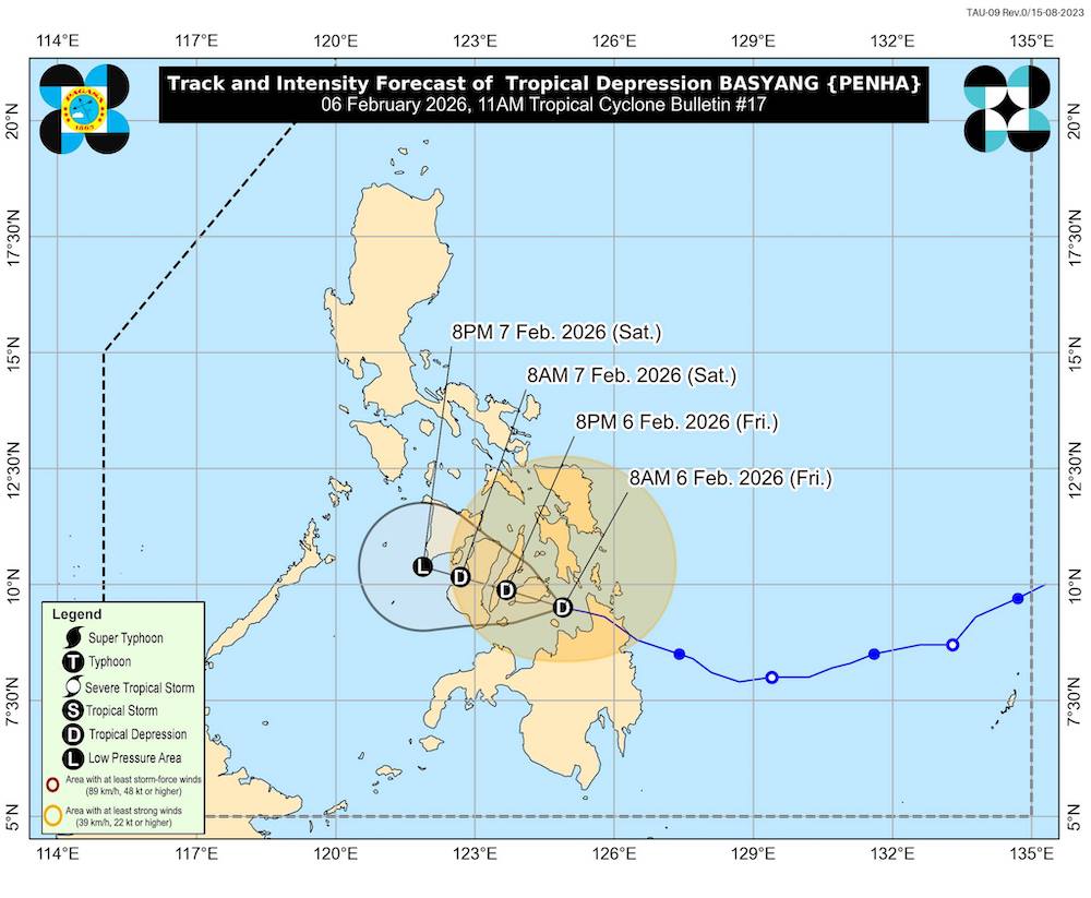
It is forecast that by February 8th, it may only become a low pressure area when entering the East Sea.
However, during the storm weakening phase, this low pressure still causes prolonged heavy rain due to the influence of cold air overflowing, increasing the risk of flooding and landslides in affected areas.
Due to the impact of the storm, many sea areas in the Philippines around Surigao, Siargao, Dinagat, Samar, Bohol and Mindanao recorded waves of 4-5.5 m high, the sea is very rough. Even other sea areas such as Palawan, Visayas, Bicol also have waves of 2-4 m high, causing great risks for ships and marine tourism activities.
Tourists planning to visit the Philippines near the Lunar New Year should regularly update weather forecasts and storm information from PAGASA, and proactively adjust their schedules. Limit travel by high-speed boats, ferries, and island tours during rough seas; prioritize indoor activities when prolonged heavy rain.
Penha is storm number 2 affecting the Philippines in 2026. The weather in Southeast Asia at the beginning of the year is potentially volatile, tourists need to put safety first when traveling during the Tet peak season.
According to the National Center for Hydro-Meteorological Forecasting, on the night of February 6, the northeastern sea area of the Northern East Sea had strong Northeast winds of level 6, gusts of level 7-8, rough seas, waves from 2.0 to 3.0 m high.
The sea area in the Southeast of the Central East Sea and the sea area in the Northeast of the South East Sea will gradually strengthen to level 5, sometimes level 6, gusting to level 7-8, rough seas, waves from 1.5 to 2.5 m high, wind and wave directions change.
In addition, the Southeast area between the East Sea and the Southeast of the East Sea will experience scattered showers and thunderstorms, and there is a possibility of tornadoes and strong gusts of wind during thunderstorms.
Day and night 07.02, the Northern East Sea area, including the sea area of the Hoang Sa archipelago, Northeast wind gradually strengthens to level 6-7, gusts level 8-9, strong rough seas, sea waves from 4.0 to 6.0 m high. In the Gulf of Tonkin, wind turns Northeast direction strong level 5, sometimes level 6; from night gradually strengthens to level 6, sometimes level 7, gusts level 8-9, strong rough seas, waves from 2.0 to 3.0 m high. Meanwhile, the sea area from South Quang Tri to Dak Lak has Northeast wind gradually strengthening to level 6, gusts level 7, rough seas, waves from 2.0 to 4.0 m high.


