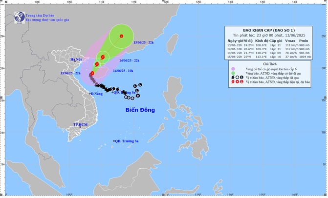
According to the latest storm forecast from the National Center for Hydro-Meteorological Forecasting, at 10:00 p.m. on June 13, the center of storm No. 1 Wutip was about 19.2 degrees North latitude; 108.6 degrees East longitude, on the west coast of Hainan Island (China), about 135km southeast of Bai Lu Island.
Maximum wind speed: Level 11 (103-117km/h), gust level 14.
It is forecasted that in the next few hours, the storm will continue to move north, at a speed of about 5 km/h.
Due to the influence of storm No. 1, Bach Long Vi island district has strong winds of level 7, gusting to level 8-9. Con Co island district (Quang Tri) has strong winds of level 7, gusting to level 8. Bai Chay, Cua Ong (Quang Ninh) strong winds of level 6.
It is forecasted that in the next 24 to 72 hours, the storm will continue to move in the North-Northeast direction, directly affecting the weather in the Gulf of Tonkin and coastal areas in the North of our country.
Typhoon No. 1 is forecast to move deep into mainland China and gradually weaken into a tropical depression, then a low pressure.
At sea, the Gulf of Tonkin, including island districts such as Co To and Bach Long Vi, has strong winds of level 7-9; near the storm center, winds of level 10-11, gusting to level 14. The waves are generally 2.0-4.0m high, with some places in the East experiencing 5.0-4.0m, causing rough seas.
In the northwest area of the North East Sea and the offshore waters from Quang Tri to Hue, strong winds of level 6-7.
Waves are 2.0-4.0m high, with some places experiencing 3.0-5.0m, and the sea is rough. Ship operating in these dangerous areas are at high risk of thunderstorms, whirlwinds, strong winds and large waves.
On land, coastal areas from Quang Ninh to Hai Phong will have strong winds of level 6-7, gusting to level 8-9; coastal areas from Thai Binh to Nam Dinh will have winds of level 5, some places level 6, gusting to level 7-8.
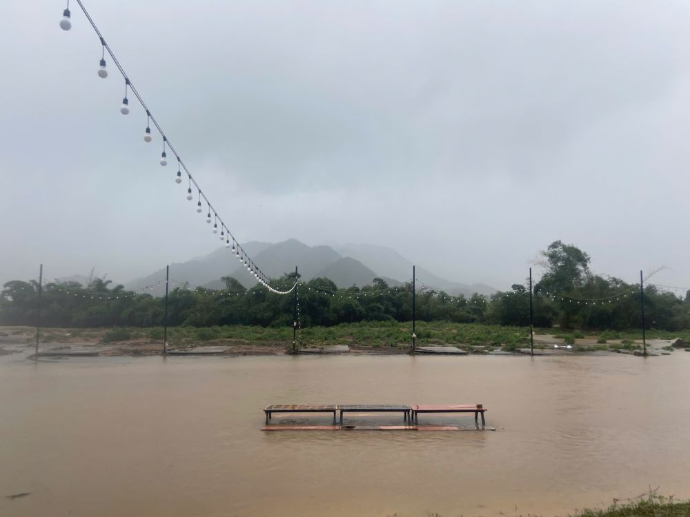
On the night of June 13 and early morning of June 14, the area from Ha Tinh to Hue will have moderate rain, heavy rain, locally very heavy rain with common rainfall from 20-50mm, some places over 100mm.
By early morning of June 14, heavy rain in the above areas is forecast to decrease.
People and tourists need to be on guard against the high risk of flash floods, landslides in mountainous areas, and flooding in low-lying areas and urban areas.