According to emergency storm information from the National Center for Hydro-Meteorological Forecasting, on the afternoon of June 13, storm No. 1 Wutip was located in the eastern sea of the Gulf of Tonkin, about 215km south-southeast of Bach Long Vi Island.
At 7:00 p.m., the center of the storm was at about 18.9 degrees North latitude; 108.3 degrees East longitude. In the next 3 hours, the storm will move north-northeast at a speed of about 10km/h.
Due to the influence of storm No. 1, Bach Long Vi island district recorded strong winds of level 7, gusting to level 8-9; Con Co island district (Quang Tri) had strong winds of level 7, gusting to level 8. In Bai Chay and Cua Ong areas (Quang Ninh), strong winds of level 6.
It is forecasted that at 4:00 a.m. on June 14, the storm will continue to move in the North Northeast direction at a speed of 10-15 km/h. The center of the storm is located in the eastern sea of the Northern Gulf of Tonkin. Natural disaster risk level: level 3, affecting the Gulf of Tonkin, offshore waters from Quang Tri to Hue and the Northwest of the North East Sea.
At 4:00 p.m. on June 14, the center of the storm was located near the coast of China, in the coastal area of Guangxi - Guangdong (China), at about 21.5 degrees North latitude - 109.7 degrees East longitude. Strong wind level 11, gust level 13. Maintain the level 3 natural disaster risk for the above areas.
The coastal area of Quang Ninh - Hai Phong is forecast to have strong winds of level 6-7, gusting to level 8-9; the coastal area of Thai Binh - Nam Dinh has strong winds of level 5, some places have level 6, gusting to level 7-8.
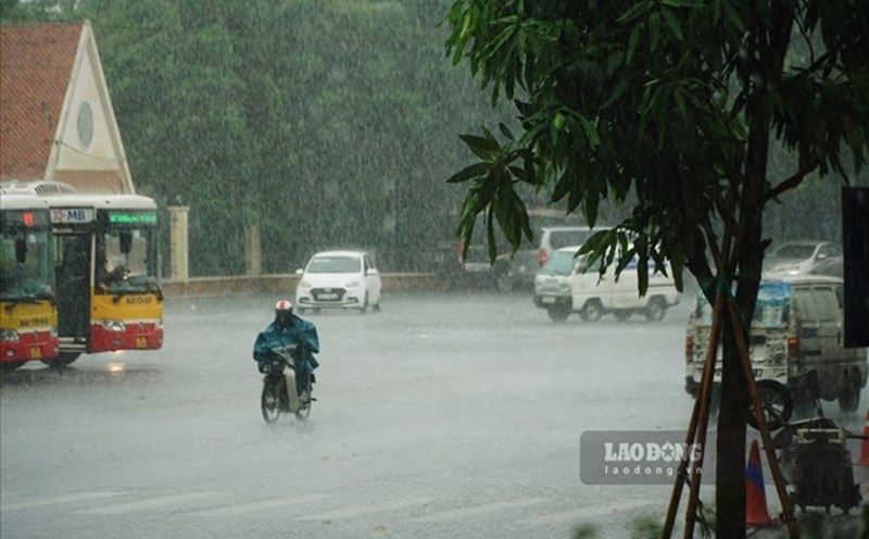
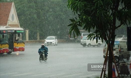
It is forecasted that on the night of June 13 and June 14, the North, North and Central Central regions will have scattered showers and thunderstorms, locally heavy to very heavy rain.
In the Northeast, there will be scattered showers and thunderstorms, with some places having heavy rain.
From Ha Tinh to Hue, there will be moderate rain, heavy rain, some places will have very heavy rain; sunny days, some places will have hot weather.
The Central Highlands and the South will have scattered showers and thunderstorms in some places, with scattered showers and thunderstorms in the afternoon and evening, and some places will have heavy rain.

Weather forecast for tonight and tomorrow, December 14:
Hanoi
The lowest temperature is from 25-27 degrees Celsius, the highest is from 32-34 degrees Celsius.
Cloudy weather, scattered showers and thunderstorms. North to northwest wind level 3. During thunderstorms, there is a possibility of tornadoes, lightning and strong gusts of wind.
Northwest
The lowest temperature is generally 24-27 degrees Celsius, some places below 23 degrees Celsius; the highest is from 31-34 degrees Celsius, some places above 34 degrees Celsius.
Cloudy weather, showers and thunderstorms in some places. Light wind, thunderstorms are likely to cause tornadoes, lightning and strong gusts of wind.
Northeast
The lowest temperature is 24-27 degrees Celsius, in mountainous areas it is below 23 degrees Celsius; the highest is from 31-34 degrees Celsius.
Cloudy weather, scattered showers and thunderstorms, locally heavy rain. North to northwest wind level 3; coastal areas level 5, some places level 6, gust level 7-8; especially in the Quang Ninh - Hai Phong area, strong winds level 6-7, gust level 8-9. During thunderstorms, beware of tornadoes, lightning and strong gusts of wind.
Provinces from Thanh Hoa to Hue
The lowest temperature is from 23-26 degrees Celsius, the highest is from 31-34 degrees Celsius, some places are over 35 degrees Celsius.
At night, it is cloudy, with scattered showers and thunderstorms, locally heavy to very heavy rain, in the South there is moderate rain, heavy rain, some places have very heavy rain; during the day, it is cloudy, sunny, some places are hot.
West to southwest wind level 2-3, coastal areas level 3-4. During thunderstorms, there is a possibility of tornadoes, lightning and strong gusts of wind.
Provinces from Da Nang to Binh Thuan
The lowest temperature is from 24-27 degrees Celsius, the highest is from 32-35 degrees Celsius, some places are over 35 degrees Celsius.
Cloudy night, scattered showers and thunderstorms; in the North, scattered showers and thunderstorms, locally heavy rain. During the day, it will be cloudy, sunny, and hot in some places.
Southwest wind level 3. During thunderstorms, beware of tornadoes, lightning and strong gusts of wind.
Central Highlands
The lowest temperature is 20-23 degrees Celsius, the highest is 28-31 degrees Celsius, some places are over 31 degrees Celsius.
Cloudy, with showers and thunderstorms in some places; in the afternoon and evening, there will be scattered showers and thunderstorms.
Southwest wind level 2-3. During thunderstorms, there is a possibility of tornadoes, lightning and strong gusts of wind.
Southern region
The lowest temperature is 24-27 degrees Celsius, the highest is 30-33 degrees Celsius, some places are over 33 degrees Celsius.
Cloudy weather, scattered showers and thunderstorms; scattered showers and thunderstorms in the afternoon and evening. Southwest wind level 2-3. During thunderstorms, beware of tornadoes, lightning and strong gusts of wind.