According to the new storm forecast from the National Center for Hydro-Meteorological Forecasting, at 1:00 p.m. on June 13, the center of storm No. 1 Wutip was at about 18.7 degrees North latitude; 108.4 degrees East longitude, about 235 km from Bach Long Vi Island.
In the next 3 hours, storm No. 1 Wutip will move north, at a speed of about 10-15km/h.
It is forecasted that by 10:00 a.m. on June 14, storm No. 1 Wutip will move in the North-Northwest direction, then turn North-Northeast at a speed of 10-15km/h.
The center of the storm will be on the Lusian Peninsula (China), at 21.1 degrees North latitude - 109.7 degrees East longitude.
Maintain intensity level 11, gust level 14. The danger zone is the area north of latitude 16.0N and from 106.5E to 111.5E.
The natural disaster risk level is level 3, affecting the northwest of the North East Sea, the offshore waters from Quang Tri to Da Nang and the Gulf of Tonkin.
By 10:00 on June 15, storm No. 1 is forecast to continue moving in the North Northeast direction, at a speed of about 15km/h and gradually weaken into a tropical depression. The center of the low pressure is located in the southwest of Guangdong province (China), at 23.4 degrees North latitude - 112.0 degrees East longitude.
The wind speed has decreased to level 7, gusting to level 9. The danger zone extends to the north of latitude 18.5 and from 106.5 to 113.0 degrees East longitude. The natural disaster risk level remains at level 3.
The Gulf of Tonkin, which includes Co To and Bach Long Vi island districts, has strong winds of level 7-8, near the storm's eye level 9-11, gusting to level 14. Waves are 2.0-4.0m high, with some places in the East experiencing 3.0-5.0m, and the sea is rough.
The Northwest of the North East Sea and the offshore waters from Quang Tri to Da Nang will have strong winds of level 6-8, near the storm center level 9-11, gusting to level 14. Waves are 3.0-5.0m high, with some areas near the center of the storm experiencing 4.0-4.0m. The sea is rough. Ship operating in these dangerous areas are at high risk of being affected by thunderstorms, whirlwinds, strong winds and large waves.
The impact of high tides combined with storm surge can cause high sea levels in some areas. In Hon Dau, it can reach 3.9m, in Hon Ngu, it can be about 2.8m. Local flooding risk in low-lying coastal areas and river mouths in the area from Hai Phong to Nghe An from 5:00 p.m. to 7:00 p.m. on June 13 and 14.
From noon and afternoon on June 13, the coastal area of Quang Ninh - Hai Phong will have strong winds of level 6, gusting to level 7-8. The coastal area of Thai Binh - Nam Dinh has strong winds of level 4-5, gusting to level 6-7.
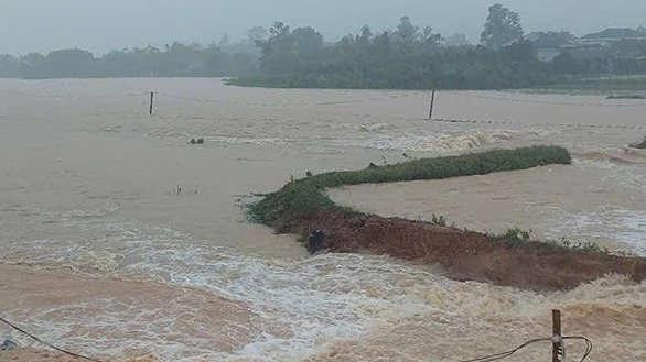
On June 13, the provinces from Quang Binh to Thua Thien Hue will have heavy to very heavy rain with common rainfall of 50-100mm, some places over 200mm.
The South Nghe An and Ha Tinh areas, from Da Nang to Quang Nam and Kon Tum, will have moderate rain, heavy rain, locally very heavy rain with thunderstorms. The common rainfall is 20-40mm, in some places over 100mm.
People in coastal areas from Quang Tri to Quang Ninh, especially in island districts such as Co To and Bach Long Vi, need to closely monitor storm forecast information, proactively reinforce their homes and boats and have evacuation plans if necessary.
Tourists planning to visit the North Central and Northern regions should temporarily postpone or adjust their travel schedule to avoid traveling at sea at this time.
Do not gather in coastal areas and river mouths from the afternoon of June 13 to 14 due to the risk of rising sea level and large waves causing local flooding.
It is necessary to pay attention to ensuring the safety of life and property, following the instructions of local authorities and functional forces.