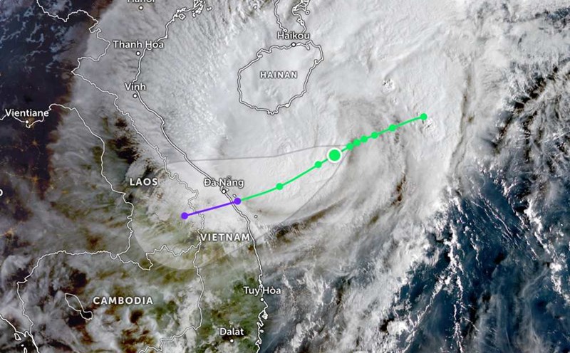
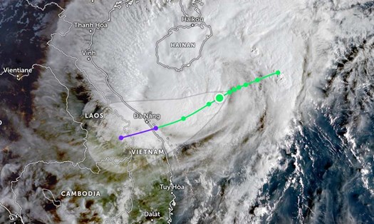
According to the National Center for Hydro-Meteorological Forecasting, at 2:00 p.m. on October 22, the center of storm Fengshen was at about 17.1 degrees North latitude; 110.0 degrees East longitude, about 210km East Northeast of Da Nang City.
The strongest wind near the storm center is level 10 (89-102km/h), gusting to level 12. It is forecasted that in the next 3 hours, the storm will move westward, at a speed of about 10km/h.
At 1:00 a.m. on October 23, the storm moved in a West-Southwest direction at a speed of about 10km/h. The center of the storm is located at about 16.60 degrees North latitude - 109.2 degrees East longitude, about 100km East Northeast of Da Nang City and gradually weakens.
The strongest wind near the storm center is Hamlet 8, gusting to level 10.
Natural disaster risk level: level 3 for the western sea area of the North East Sea (including Hoang Sa special zone), the sea area from Quang Tri to Quang Ngai (including Con Co special zone, Cu Lao Cham island and Ly Son special zone); coastal mainland of the provinces from Quang Tri to Da Nang city.
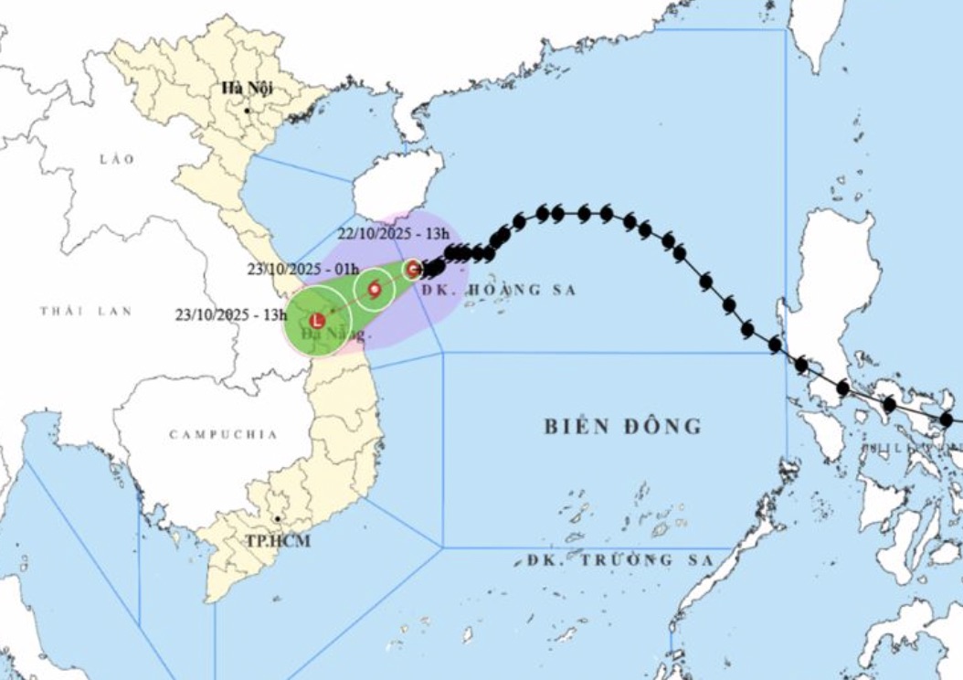
At 1:00 p.m. on October 23, the storm moved in a West-Southwest direction at a speed of about 15km/h. The strongest wind near the storm center reached 15.80 degrees North latitude -107.70 degrees East longitude in the Hue - Da Nang area and gradually weakened into a low pressure area. The strongest wind is less than level 6.
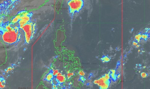
Due to the influence of storm Fengshen, the western sea area of the North East Sea (including Hoang Sa special zone) has strong winds of level 7-8; the area near the storm's center has strong winds of level 9-10, gusting to level 12. Waves 3.0-5.0m high, near the center of the storm 5.0-7.0m high, very rough seas.
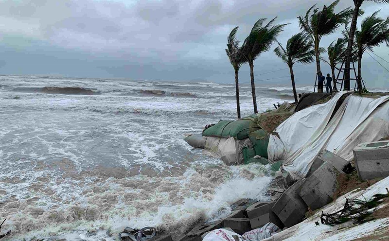
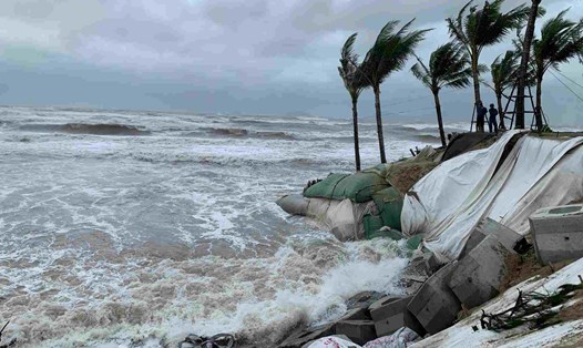
The sea area from Quang Tri to Quang Ngai (including Con Co special area, Cu Lao Cham island and Ly Son special area) will have strong winds of level 6-7, near the storm's eye level 8-9, gusts of level 11, waves 3.0-5.0m high, rough seas. The coastal areas of the provinces from Quang Tri to Da Nang City will have storm surge of 0.4-0.8m high.
Coastal areas and river mouths from Quang Tri to Da Nang City need to be on guard against large waves combined with high tides and storm surges causing flooding in low-lying areas, waves overflowing coastal roads along rivers, and coastal erosion.
All ships, boats, and aquaculture areas in the above-mentioned dangerous areas are likely to be affected by thunderstorms, whirlwinds, strong winds, large waves, and high tides.
Due to the influence of storm No. 12 combined with strong cold air, from the evening of October 22, on the mainland along the coast of the provinces from Quang Tri to Da Nang City, the wind will gradually increase to level 6, sometimes level 7, gusting to level 8-9.
From the night of October 22 to October 24, in the area from Ha Tinh to Quang Ngai, there will be heavy rain and thunderstorms with common rainfall of 100-250mm, locally very heavy rain over 350mm; in the area from South Quang Tri to Da Nang City, there will be heavy to very heavy rain with common rainfall of 400-600mm, locally over 800mm (high intensity rain concentrated from the night of October 22 to the end of October 23).
Warning of the risk of heavy rain (>200mm/3 hours) in coastal communes/wards from South Quang Tri to Da Nang City. Forecast of natural disaster risk level due to heavy rain in the area from South Quang Tri to Da Nang City: level 2.
Heavy rain in the Central region is likely to last until the end of October 2025. There is a high risk of flash floods and landslides in mountainous areas, flooding in low-lying areas and urban areas.
Localities need to pay attention to safe operation of hydroelectric and irrigation reservoirs before, during and after the storm, and prepare response plans for flood scenarios on rivers from Quang Tri to Quang Ngai that are likely to reach alert level 3 and exceed alert level 3. Forecast of natural disaster risk level due to floods: level 3.
People and tourists should be on guard against the risk of thunderstorms, whirlwinds and strong gusts of wind in the area affected by the storm's circulation, both before and during the storm's landfall. Regularly check flight schedules and follow local instructions to avoid dangerous storms.