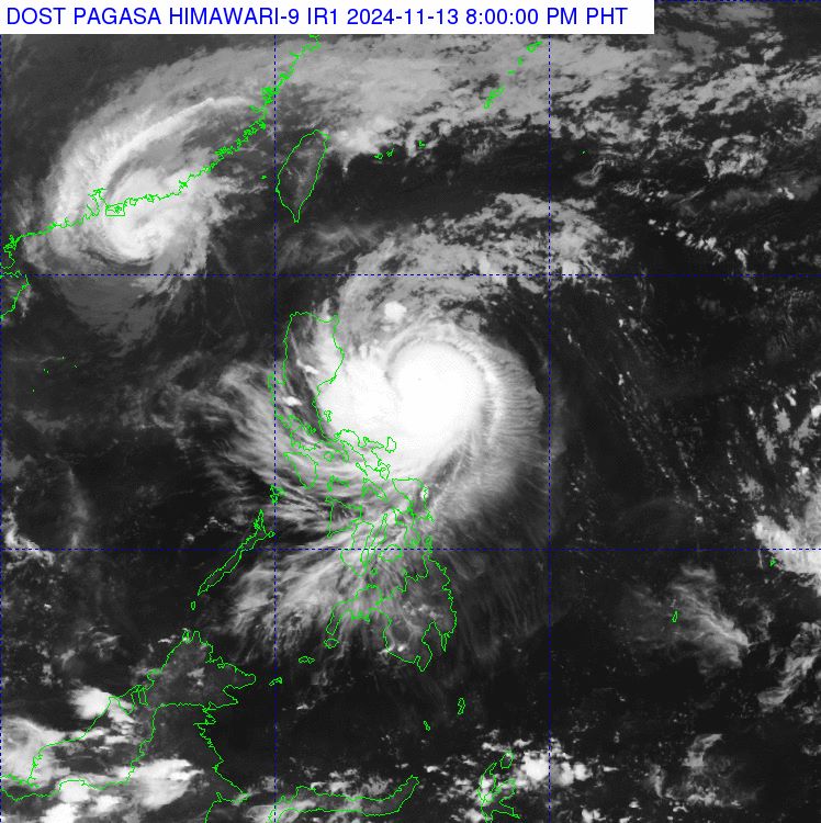
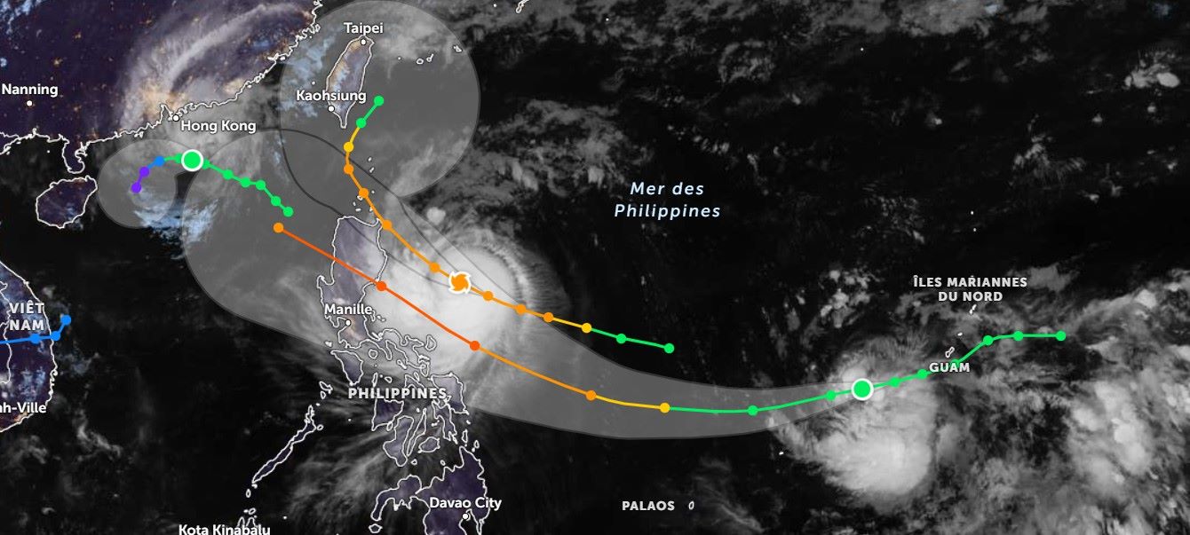
According to the latest storm information from the Philippine Atmospheric, Geophysical and Astronomical Services Administration (PAGASA), at 3:00 p.m. on November 13 (local time), the center of storm Usagi (local name: Ofel) was determined to be about 505 km northeast of Infanta, Quezon; about 500 km east of Baler, Aurora.
The current location of the storm center is estimated at approximately 15.6 degrees North latitude; 126.3 degrees East longitude.

The storm is currently packing strong winds with maximum speeds of up to 120 km/h and possible gusts of up to 150 km/h, moving northwest at 25 km/h.
In light of the above situation, PAGASA forecasts that some areas affected by Typhoon Ofel, including the Cagayan region, will experience bad weather with the possibility of flash floods or landslides due to heavy rains.
The remaining areas of Cagayan Valley, Cordillera, Ilocos Norte and Aurora administrative regions of the country will experience rains with gusty winds, with the risk of flash floods and landslides.
Bicol, Quezon and Northern Samar will have partly cloudy skies with scattered rains and possible thunderstorms; while Metro Manila and the rest of the country will have partly cloudy weather with scattered showers or thunderstorms.
Regarding wind and weather conditions at sea, the eastern areas of North and Central Luzon will have strong to stormy winds with northeast to northwest direction, rough seas with waves from 2.5 to 4.5 meters high; the northern and western areas of Luzon will have moderate to strong winds with northeast to northwest direction, rough seas with waves from 2.5 to 4.0 meters high.
Meanwhile, the rest of the country will have light to moderate winds from the southeast to south, calm seas, and waves ranging from 0.6 to 3.0 meters high.
Residents living in coastal areas or tourists planning to travel to the coastal areas of the Philippines should take note as the current situation is advised to be cautious of the weather developments.
Meanwhile, as of now, there are two other tropical storms also active outside the Philippine Area of Responsibility (PAR), namely Tropical Storm Toraji (local name in the Philippines: Nika; or storm number 8 in Vietnam) and Tropical Storm Man-Yi.

As for Typhoon Toraji, it is currently located about 660 km west of Itbayat, Batanes, Philippines, with maximum sustained winds of 75 km/h and gusts of up to 90 km/h, moving northwest at 15 km/h.
As for Typhoon Man-Yi, it is currently located about 1,900 km east of the Eastern Visayas of the Philippines, with maximum sustained winds of 65 km/h and gusts of up to 80 km/h, moving west at 15 km/h.
In this situation, tourists planning to travel to areas forecasted to be affected by the above storms should pay attention to regular weather updates and be flexible in their schedules to ensure a complete travel experience. Limit recreational activities at sea to ensure safety.


