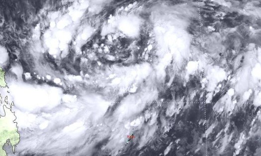
According to the Philippine Atmospheric, Geophysical and Astronomical Services Administration (PAGASA), as of 11 p.m. on October 21 (local time), the center of the tropical depression was at 13.2 degrees North latitude, 129.0 degrees East longitude, 480 km east of Catarman, Northern Samar (Philippines).
The low pressure is moving west at a speed of 25 km/h. The strongest wind near the center of the low pressure remains at 55 km/h, gusting up to 70 km/h.
By 8am on October 22 (local time), the low pressure will strengthen into Tropical Storm Kristine, 435km east of Virac, Catanduanes, Philippines. The storm will head straight towards the Philippines in a west-northwest direction, becoming the 11th storm to hit the Philippines this year.
PAGASA experts say it is not impossible that storm number 11 Kristine will strengthen into a super typhoon. Because super typhoons usually form at the end of the year.
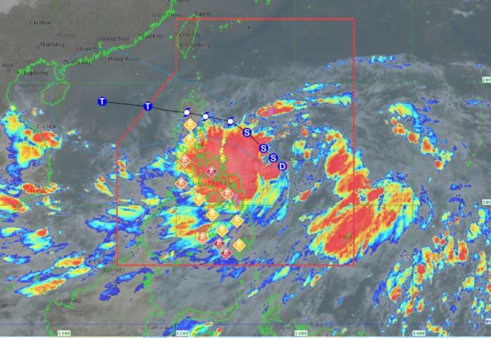
According to the National Center for Hydro-Meteorological Forecasting, in the next 12 hours, storm Kristine will move mainly in the West - Northwest direction.
At 4:00 p.m. on October 22, the center of the storm was located at approximately 14.8 degrees North latitude; 127.1 degrees East longitude, in the sea east of the Philippines. The strongest wind near the center of the storm was level 8 (62-75 km/h), gusting to level 11. Waves were 3-4 meters high.
It is forecasted that around October 25, the storm is likely to move into the East Sea. From around the afternoon and night of October 24, the eastern sea area of the North East Sea (east of the 118.5 degree East longitude) will have winds gradually increasing to level 8, near the storm center will be level 9-10, gusting to level 12; very rough seas, waves 3-5m high, thunderstorms with dangerous whirlwinds.
PAGASA forecasts that from around the evening of October 22, Tropical Storm Kristine will intensify, reaching the level of a severe storm. If conditions are favorable, Kristine could reach typhoon level in the afternoon or evening of October 24.
After moving to the mainland in the northern Philippines, the storm gradually weakened into a typhoon, before leaving the PAR (Philippines area of responsibility) and entering the East Sea on October 25.
With the unpredictable weather, tourists should consider if they have a travel schedule to the Philippines in the coming days, especially in areas where Typhoon Kristine is likely to make landfall. Don't forget to follow the weather forecast, flight delays/cancellations updated daily to have a safe and time-saving trip.


