Mr. Juanito Galang, Head of Weather Forecast Division of the Philippine Atmospheric, Geophysical and Astronomical Services Administration (PAGASA), said that the development of super typhoons usually occurs at the end of the year, so it is not impossible that typhoon No. 11 Kristine will strengthen into a super typhoon.
Speaking at a press conference on October 21, Mr. Galang noted that Kristine's path was similar to that of Super Typhoon Lawin (international name Jelawat), which entered the Philippine forecast area (PAR) from the Pacific Ocean and then moved west-northwest in 2012.
“We do not rule out the possibility of a super typhoon because at the end of the year, typhoons often reach super typhoon level,” Galang explained, emphasizing that “there is still a possibility of Kristine becoming a super typhoon.”
Like Super Typhoon Lawin, Kristine is forecast to mainly affect Northern Luzon, Galang said, but it could still change its path in the next 24 hours.
“We are waiting until tomorrow to see if Kristine will make landfall in Central Luzon,” Galang said.
Kristine's expected impact will be heavy rainfall over much of Luzon and light to moderate rains in Visayas and Mindanao.
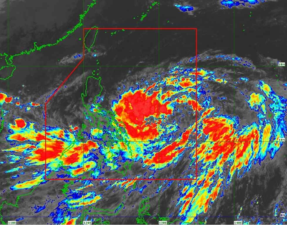
According to the latest storm information from PAGASA, at 11:00 a.m. on October 21, the center of storm Kristine was at approximately 13.2 degrees north latitude, 132.6 degrees east longitude, 870 km east of Eastern Visayas, carrying maximum winds of 55 km/h, gusting up to 70 km/h, moving west-southwest at a speed of 30 km/h.
Although it is still quite far from the Philippine mainland, PAGASA has raised Tropical Cyclone Wind Signal No. 1 in 15 areas nationwide.
Storm Kristine is forecast to move westward through tomorrow morning (October 22) before turning west-northwest to northwest from tomorrow afternoon through the forecast period.
On October 23, at 8:00 a.m., Typhoon Kristine was about 520 km east of Baler, Aurora. By 8:00 p.m. the same day, the typhoon moved closer to Baler, Aurora, about 375 km away.
The tropical storm is forecast to make landfall in Northern Luzon on Friday afternoon (October 25).
Storm No. 11 may strengthen to severe storm level tomorrow afternoon or evening (October 22) and to typhoon level on Thursday afternoon or evening (October 24) before making landfall in the northeastern part of Cagayan.
By 8:00 a.m. on October 26, the storm turned toward the East Sea, about 170 km west-northwest of Laoag City, Ilocos Norte.
As Typhoon No. 11 remains over the Philippine Sea, the possibility of further strengthening is high, given the favorable environmental conditions (high sea surface temperatures and low wind shear) for development.
Changes in the forecast track are also not ruled out, depending on the movement of mid-latitude weather systems in the coming days.
Kristine is the 11th typhoon to hit the Philippines this year.


