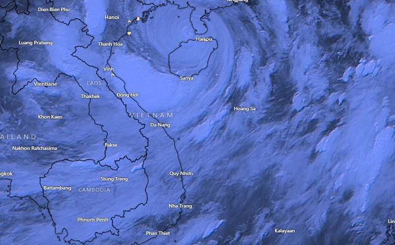
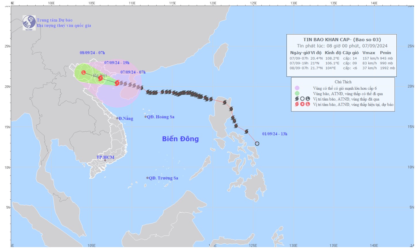
The National Center for Hydro-Meteorological Forecasting's quick news on storm No. 3 Yagi said that at 8:00 a.m. on September 7, the storm's center was at about 20.4 degrees North latitude; 108.0 degrees East longitude, about 132km from the coast of Quang Ninh - Hai Phong.
Storm No. 3 is currently active in the Gulf of Tonkin, with the strongest wind at Level 14 (150-166km/h), gusting to Level 17.
In areas affected by storm No. 3 in the North Central Coast and the Gulf of Tonkin, the strongest winds will be from morning to evening today, September 7.
On Bach Long Vi Island, the wind is strong at level 12 and can gust up to level 14. Co To Island recorded strong winds at level 7, gusting to level 11.
Mong Cai (Quang Ninh) is experiencing strong winds of level 6, gusting to level 9, while Cua Ong (Quang Ninh) has strong winds of level 8, gusting to level 9.
It is forecasted that in the next 24 to 48 hours, storm No. 3 is expected to continue moving in the West-Northwest direction at a speed of 15-20 km/h and will make landfall in the Northeast.
By 7 p.m. on September 7, the storm center is expected to be located at approximately 21.0 degrees North latitude, 106.1 degrees East longitude, on the mainland of the Northeast. At this time, the storm intensity may reach level 9-10, with gusts of level 12.
The severely affected areas will include the northern Gulf of Tonkin, coastal waters and mainland of Quang Ninh, Hai Phong and Thai Binh provinces. These areas will be at level 4 disaster risk. Meanwhile, the southern Gulf of Tonkin and the provinces of Nam Dinh, Ninh Binh and Thanh Hoa will be at level 3 disaster risk.
By 7:00 a.m. on September 8, the storm is expected to continue moving west-northwest, moving further inland and gradually weakening.
The forecast location at this time will be approximately 21.7 degrees North latitude, 104.0 degrees East longitude, on the mainland of the Northwestern provinces of the North. The storm intensity at this time may decrease to below level 6.
The danger zone will shift to the north of latitude 19.5 degrees north and the west of longitude 110 degrees east, with the disaster risk level reduced to level 3.
Regarding the impact of the storm, at sea, the Gulf of Tonkin area, including Bach Long Vi and Co To island districts, will be affected by strong winds of level 9-11, and near the storm center it may reach level 12-14, gusting to level 17. The sea will be very rough.
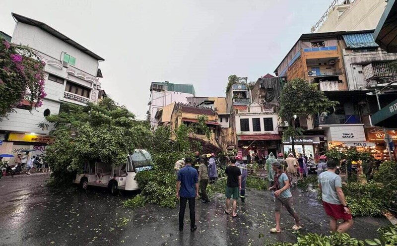
On land, strong winds from level 6-7 in coastal areas from Quang Ninh to Thanh Hoa will increase to level 8-9, and near the storm center can reach level 10-12, gusting to level 14.
The inland area of the Northeast will have strong winds of level 6-8, gusting to level 9-11, with the strongest winds occurring from morning to evening on September 7.
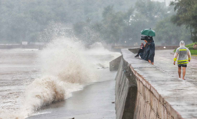
Waves in the Gulf of Tonkin could reach 3.0-5.0 m high, and near the storm center could reach 6.0-8.0 m. Meanwhile, coastal waves from Quang Ninh to Thanh Hoa could reach 2.0-4.0 m.
Storm surge will be from 0.5 m in Thanh Hoa to 2.0 m in Quang Ninh in the afternoon and night of September 7. Coastal areas of Quang Ninh - Hai Phong need to be on guard against water receding by about 0.5 m in the morning and afternoon of September 7. Boat mooring areas, aquaculture areas, and sea dikes and embankments in the danger zone are all likely to be affected by strong winds, large waves, and storm surge/ebb.
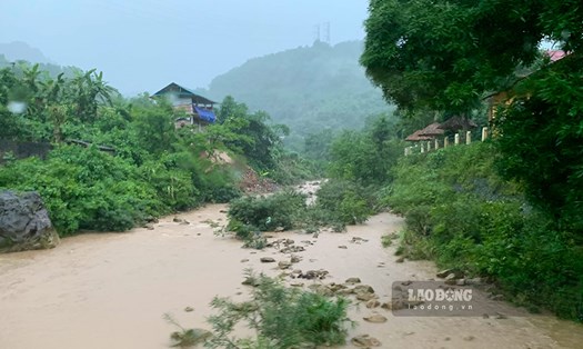
Low-lying coastal and estuary areas need to be on guard against the risk of flooding due to rising water and large waves.
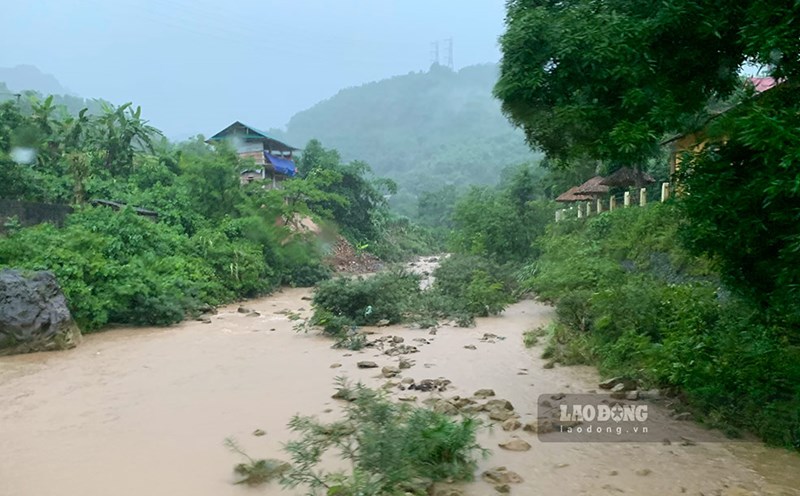
From September 7 to the morning of September 9, the North and Thanh Hoa are forecast to experience widespread heavy rain with total rainfall ranging from 100-350 mm, with some places over 500 mm.
The heaviest rain will be concentrated in the Northeast during the day and night of September 7, and in the Northwest from the evening of September 7 to the night of September 8. Heavy rain is likely to cause flooding in low-lying areas, flash floods on small rivers and streams, and landslides on steep slopes.
Due to the influence of the wide storm circulation, the Northwest region and from Nghe An to Thua Thien Hue need to be on guard against the risk of thunderstorms, tornadoes and strong gusts of wind.
In response to the forecast of Typhoon No. 3 Yagi, many localities have advised residents and tourists to proactively respond and implement storm prevention measures. Residents and tourists are advised to absolutely not go out during the typhoon's landfall to ensure safety.