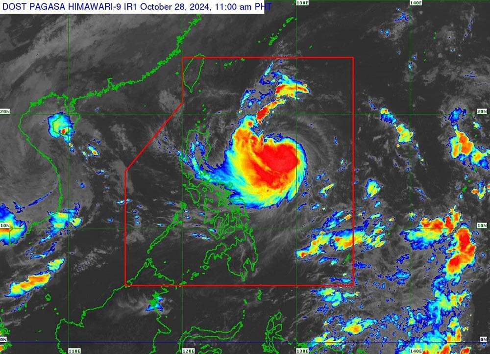
Typhoon Kong-rey (local name in the Philippines: Leon) has developed into a strong tropical storm as it moves across the Philippine Sea today (October 28).
The Philippine Atmospheric, Geophysical and Astronomical Services Administration (PAGASA) said that during its passage through the Philippine Sea, the storm is expected to rapidly intensify and could reach typhoon strength within 24 hours.
There is an increasing chance that Kong-rey will reach super typhoon strength as it approaches Batanes province, the northernmost part of the Philippines. The possibility of the storm making landfall or approaching the area cannot be ruled out.

As of 10:00 a.m. on October 28, typhoon Kong-rey was located about 735 km east of Casiguran city, Aurora province in Central Luzon (Philippines), with maximum winds of 95 km/h and gusts of up to 115 km/h.
The storm has picked up speed slightly, moving west at 20 km/h.
The weather agency has raised alert level 1 for some areas in Luzon but also warned that it could raise it to alert level 3 or 4 during the passage of Kong-rey, especially in the northernmost part of Luzon.
PAGASA has issued Alert No. 1 for more areas in Luzon, warning of strong winds of 39 to 61 km/h over the next 36 hours.
PAGASA forecasts that strong tropical storm Kong-rey will move west-northwest from today until tomorrow morning (October 29), before turning northwest.
The storm is expected to make landfall on Taiwan's east coast late Thursday (October 31) or early Friday morning (November 1).
After crossing Taiwan, the storm will turn northeast toward the East China Sea and exit the Philippine Area of Responsibility (PAR) in the morning or afternoon of November 1.
The storm may move further west within the forecast range. Therefore, the possibility of landfall or approaching the Batanes region cannot be ruled out.
There is an “increasing possibility” that Leon could attain super typhoon status during its closest approach to Batanes, PAGASA said.

Typhoon Kong-rey formed as many areas in the Philippines were still recovering from the aftermath of Typhoon Trami (local name: Kristine).
While Kong-rey may have a minor impact on Metro Manila, tourists planning to visit Northern Luzon this coming weekend are advised to exercise caution, especially when traveling by small boats. Passengers are advised to travel before November 1, as gusty winds and rough seas will pose a hazard to all types of boats during the storm.
Residents and tourists in the above areas are advised to regularly monitor weather forecasts, comply with recommendations from authorities and update announcements from airlines, trains, etc. to be proactive about their schedules and ensure safety.


