According to the latest typhoon and tropical depression forecast from the Philippine Atmospheric, Geophysical and Astronomical Services Administration (PAGASA), a new storm is likely to form near the South China Sea right after Typhoon Yagi.
PAGASA’s latest tropical depression and typhoon bulletin shows that the agency is currently monitoring three low pressure systems, of which one is likely to intensify into a tropical depression in the Philippine forecast area (PAR) next week, from September 9 to 10.
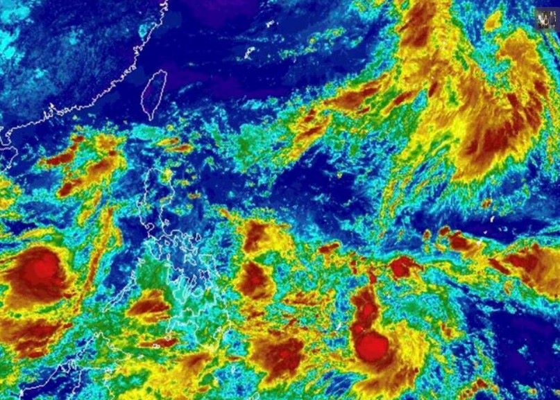
A low pressure system with the potential to strengthen into a tropical depression is forecast to form east of the Philippines.
PAGASA noted that there is a high possibility of a tropical storm entering the Philippine forecast area within the next two weeks.
Meanwhile, the remaining two depressions are not expected to strengthen into storms near the South China Sea. One depression is expected to strengthen north of the Philippine forecast area, but its impact is very low, while the other depression will form northeast, outside the Philippine forecast area.
These systems generally have little impact on the Philippines but still need to be closely monitored.
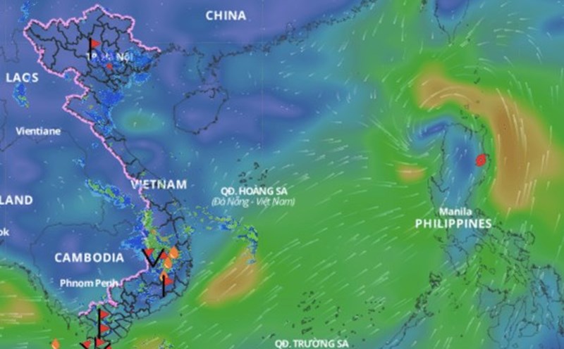
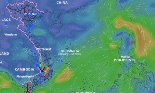
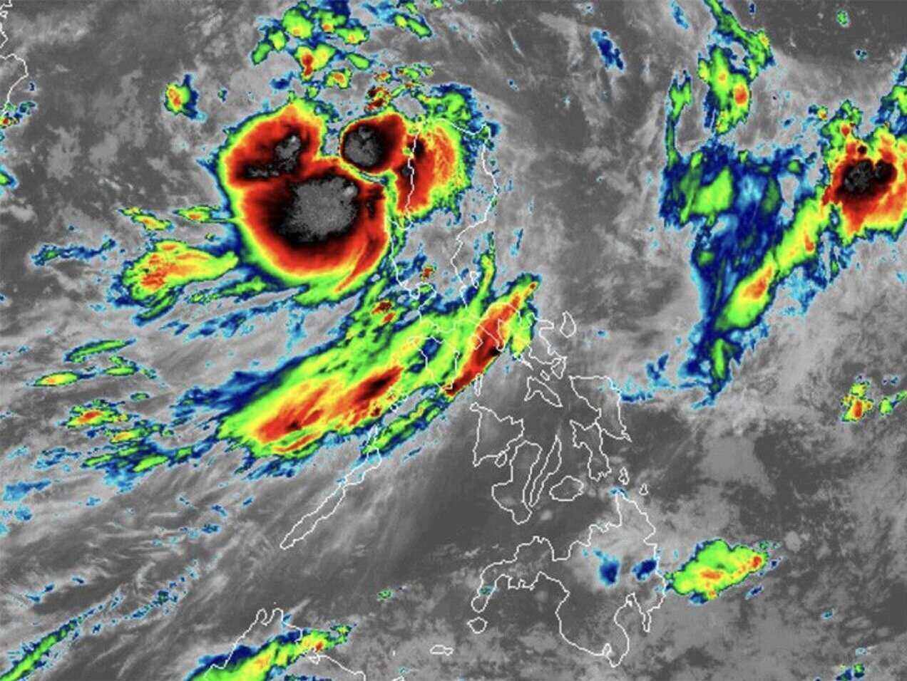
PAGASA is also currently monitoring Typhoon Yagi, a tropical storm moving toward the South China Sea.
According to the news update at 8:00 a.m. on September 3, Typhoon Yagi is in the coastal waters of Laoag city, Ilocos Norte, Philippines.
The storm continues to move west-northwest over the East Sea at a speed of 20 km/h, with maximum sustained winds of 75 km/h near the storm's center and gusts of up to 115 km/h.
Typhoon Yagi is forecast to continue moving west-northwest in the next 24 hours and may leave the PAR area on the morning of September 4.
According to forecasts, Typhoon Yagi will turn westward as it moves over the East Sea and maintain this direction until it reaches Hainan, China on September 7.
In particular, at 5:00 a.m. on September 8, Typhoon Yagi was predicted to be 1,510 km west of Northern Luzon, which is in the sea near Quang Ninh, Vietnam.
PAGASA also said Typhoon Yagi will strengthen into a severe tropical storm in the afternoon or evening of September 3 and is likely to reach typhoon strength on September 6.
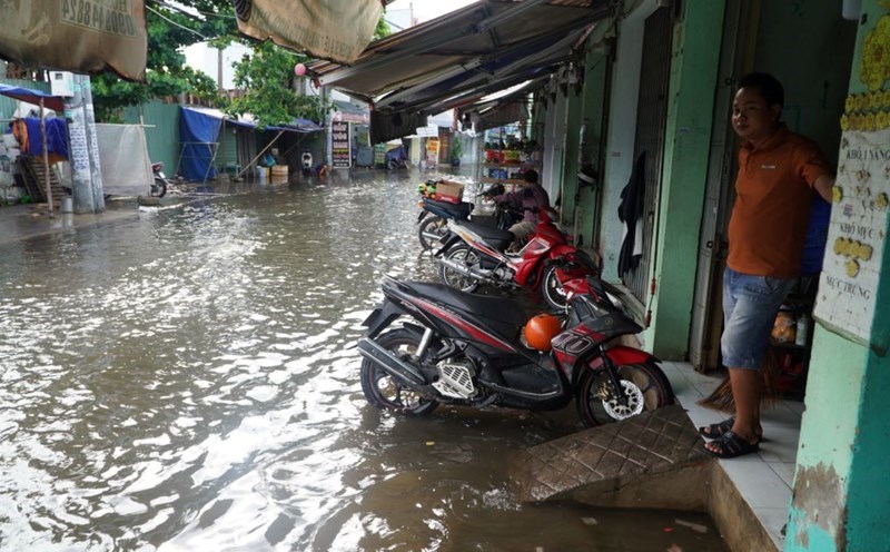
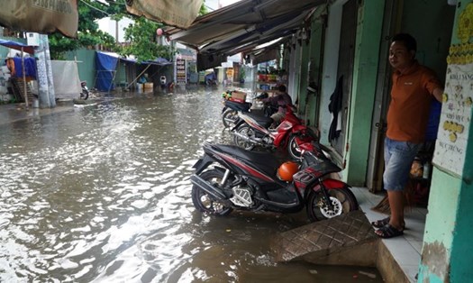
When it officially strengthened into a storm near the East Sea on the night of September 1, Typhoon Yagi caused heavy rain across the Philippines, disrupting the operations of many schools, agencies, and offices.
Given the complex weather conditions and erratic storm developments, visitors should pay close attention to weather reports and warnings from authorities to stay updated with the latest information on storms and tropical depressions.
Travelers planning to travel to the northern and north central coastal areas or to Hainan Island (China) and the islands in the Philippines during this time should consider adjusting their itinerary. If you cannot cancel or postpone your trip, or are in an affected area, prepare contingency plans for your trip and ensure that you know where to go for shelter.
Travelers should avoid areas at high risk of being affected by storms or flooding. In particular, pay attention to warnings and instructions from local authorities.
Make sure you have essential supplies such as medicine, food and water, and stay in touch with family or friends as the storm approaches.
Travelers should be proactive and cautious in planning their trips and ensuring personal safety during the typhoon season.