According to the National Center for Hydro-Meteorological Forecasting, in the past 24 hours (from 2:00 p.m. on November 16 to 2:00 p.m. on November 17), the areas of provinces/cities from Ha Tinh to Lam Dong have had moderate to heavy rain such as Ky Khang 218.2mm (Ha Tinh); La To Hydropower Dam 609.8mm (Quang Tri); Binh Dien 974.6mm (Hue City); Tra River 738.8mm (Da Nang City); Son Long 419.2mm (Quang Ngai); Buong Tang Krong Nang 240.6mm (Gia Lai); Hinh River 750.3mm (Dak Lak); Mang Dai - Suoi Hanh 411.6mm (Khanh Hoa); D'Ran - Duong Dong 146.6mm (Lam Dong)...
Soil moisture models show that some areas in the above provinces are nearly saturated (over 85%) or have reached a saturated state.
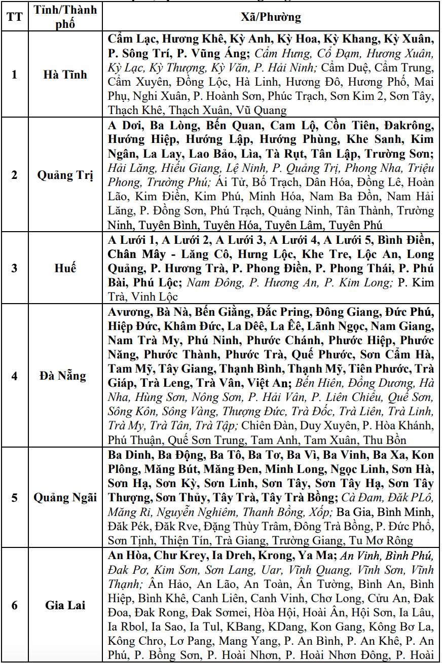
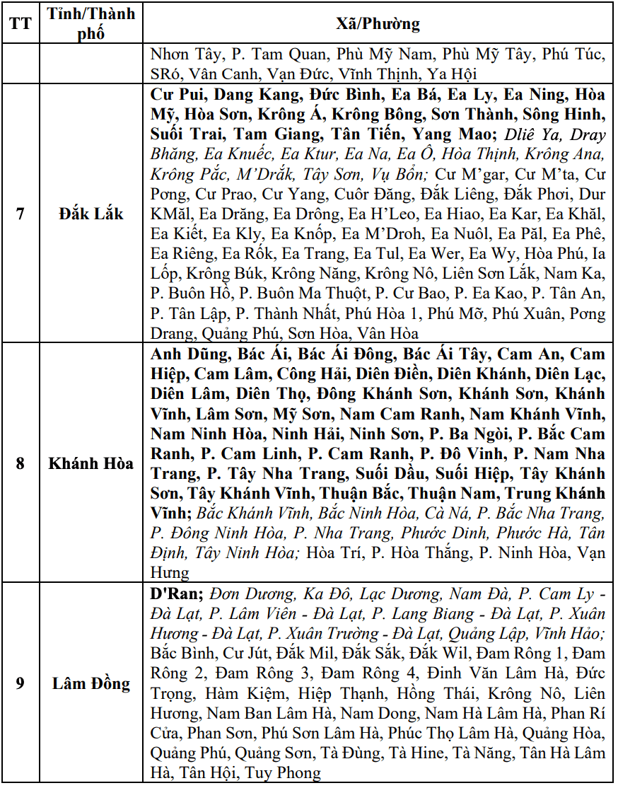
In the next 3 - 6 hours (from 2:30 p.m. on November 17), the above provinces/cities will continue to have rain with common accumulated rainfall in Ha Tinh, Hue City, Da Nang City and Quang Ngai 30 - 70mm, some places over 150mm; Quang Tri, Gia Lai and Dak Lak 10 - 30mm, some places over 70mm; Khanh Hoa and Lam Dong 5 - 10mm, some places over 30mm.
In the next 6 hours (from 2:30 p.m. on November 17), there is a risk of flash floods on small rivers and streams, landslides on steep slopes in many communes/wards.
The warning level of natural disaster risk due to flash floods, landslides, and land subsidence due to heavy rain or water flow is level 1; in Hue City and Khanh Hoa, it is level 2.
Flash floods and landslides can have a very negative impact on the environment, threatening people's lives; causing local traffic congestion, affecting the movement of vehicles; destroying civil and economic works, causing damage to production and socio-economic activities.
The meteorological agency recommends that local authorities pay attention to reviewing bottlenecks and vulnerable locations in the area to take preventive and response measures.


