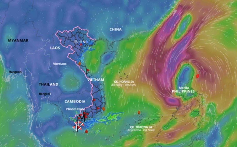
On August 28, monitoring on satellite cloud images, weather radar images and lightning location showed that the thunderstorm area was developing and causing rain with thunderstorms and lightning in the Can Gio area, Nha Be district, Thu Duc city, Ho Chi Minh City. Binh Thanh, District 12 (HCMC). In addition, thunderstorm clouds in Long An and Tien Giang areas are also moving towards Ho Chi Minh City.
In the next 0 - 3 hours, thunderstorm clouds will continue to develop, causing showers, accompanied by thunderstorms and lightning in the above districts, then expanding to other neighboring areas.
Rainfall is commonly from 5-20mm, in some places it is over 20mm. During a thunderstorm, watch out for tornadoes, hail and strong winds of about level 5-7 (8-17m/s).
In the coming days, the low pressure trough with an axis at about 14-16 degrees North latitude, passing through the Central region, will be highly active. The southwest monsoon dominates the region's weather with moderate to strong intensity. At high altitude, the subtropical high pressure with an axis passing through the North is not very active and tends to lift its axis to the North.
During the National Day holidays in 2024, due to the influence of the weather conditions that can cause thunderstorms mentioned above, Ho Chi Minh City will have scattered showers and thunderstorms in many places, with moderate and heavy rain in some places; mainly occurs between noon and late afternoon. The morning is sunny and there is little rain at night.
During August 31 and September 1-2, there is a possibility of moderate rain, heavy rain from around noon to evening. The lowest common temperature is 24-26 degrees Celsius, the highest temperature: 30-33 degrees Celsius.
In the coastal tourist destinations of the South, there are showers and thunderstorms in the afternoon. The waves and winds are not too strong, so it is convenient for sea tourism.