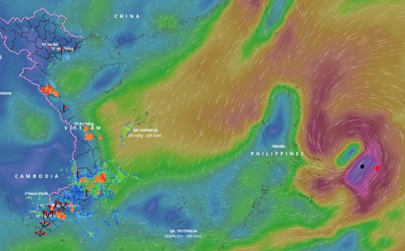
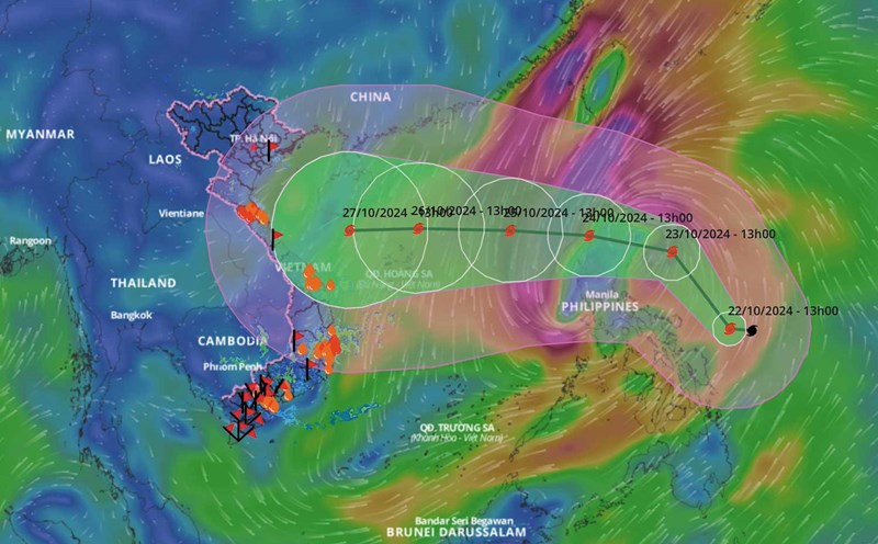
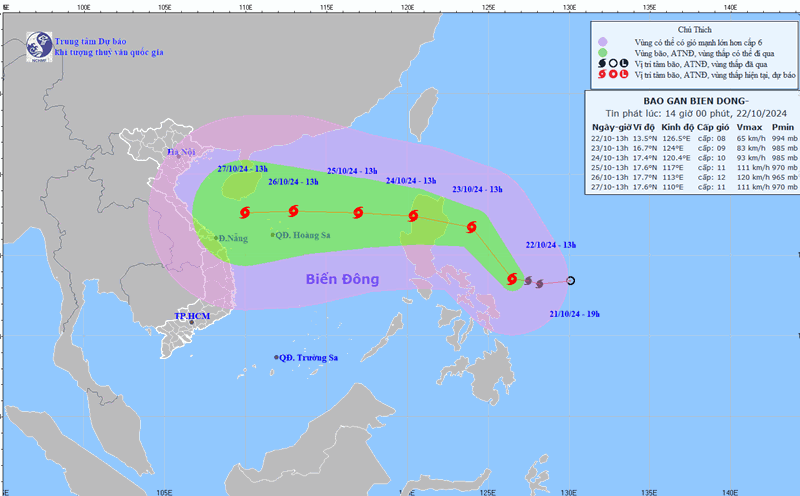
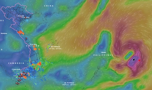
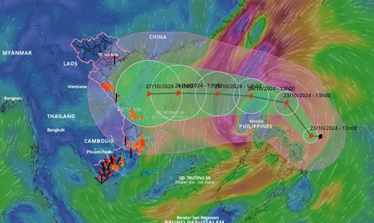
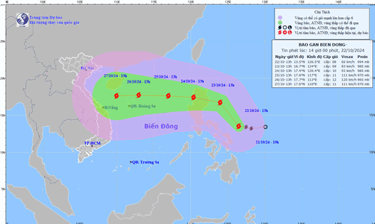
Latest update from the National Center for Hydro-Meteorological Forecasting, at 7:00 p.m. on October 22, storm Tra Mi was centered at about 14.5 degrees north latitude; 126 degrees east longitude, in the sea east of the central Philippines.
The strongest wind near the storm center is level 8 (62-74km/h), gusting to level 10. The storm moves northwest at a speed of about 20km/h.
In the next 24 hours, the storm is forecast to move northwest at a speed of about 15km/h. At 7:00 p.m. on October 23, the center of the storm will be at about 17 degrees north latitude - 123 degrees east longitude; in the sea east of Luzon Island (Philippines).
The strongest wind near the storm center is level 9, gusting to level 11.
It is forecasted that in the next 48 hours, the storm will move westward at a speed of about 15 - 20 km/h, entering the East Sea. At 7:00 p.m. on October 24, the center of the storm will be at about 16.9 degrees north latitude - 119.3 degrees east longitude; in the eastern sea area of the North East Sea.
The strongest wind near the storm center is level 10, gusting to level 12.
It is forecasted that in the next 72 hours, the storm will move west-northwest at a speed of about 15. At 7:00 p.m. on October 25, the center of the storm will be at about 17.3 degrees north latitude - 116.1 degrees east longitude; 450km east-northeast of the Hoang Sa archipelago.
The strongest wind near the storm center is level 11, gusting to level 14.
From the next 72 to 120 hours, the storm will move mainly westward, traveling 15 - 20km per hour, and continue to strengthen.
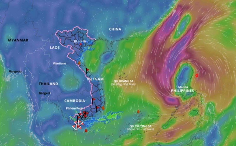
Regarding the impact of the storm at sea, the sea area east of the North East Sea has strong winds of level 6 - 7. From the morning of October 24, strong winds increased to level 8 - 9 (62 - 88 km/h), the area near the storm's eye has level 10 - 11 (89 - 117 km/h), gusts of level 14, waves 4 - 6m high, the area near the storm's eye has 6 - 8m; the sea is very rough.
Ships operating in the above mentioned dangerous areas are likely to be affected by storms, whirlwinds, strong winds and large waves.