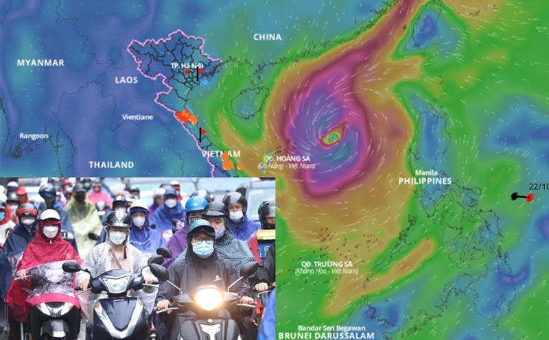
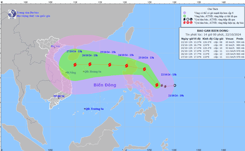
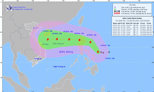
Since storm No. 5, no new tropical cyclone has appeared in the East Sea for more than 20 days. Currently, storm Tra Mi is active in the sea east of the central Philippines, near the East Sea.
According to Mr. Vu Anh Tuan - Deputy Head of Division Weather Forecast, National Center for Hydro-Meteorological Forecasting, this afternoon, October 22, storm Tra Mi has the strongest wind near the storm center at level 8, gusting to level 10.

"Storm Tra Mi is moving northwest. It is forecasted that around October 24, the storm will enter the East Sea and become the 6th storm of 2024" - Mr. Vu Anh Tuan commented on the time the storm entered the East Sea.
According to the representative of the meteorological agency, after entering the East Sea, storm Tra Mi tends to change direction, move westward and increase in intensity. When passing the Hoang Sa archipelago, the storm is forecast to reach level 12, gust level 15 and continue towards the coast of the Central region.
"Further assessment, around October 26 - 28, the Central region may experience widespread heavy rain due to the impact of this storm" - Mr. Tuan said.
Regarding the impact of the storm at sea, the sea area east of the North East Sea has strong winds of level 6 - 7. From the morning of October 24, the strong winds increased to level 8 - 9, the area near the storm's center has level 10 - 11, gusts of level 14, waves 4 - 6m high, the area near the center has 6 - 8m; the sea is very rough. Ships operating in the above-mentioned dangerous areas are likely to be affected by storms, whirlwinds, strong winds, and large waves.