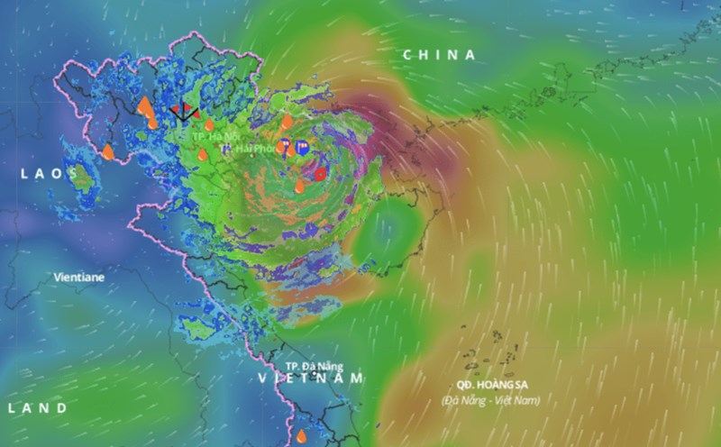
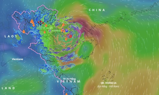
Storm No. 3 is in the sea area of Quang Ninh-Thai Binh
Latest update from the National Center for Hydro-Meteorological Forecasting, due to the influence of storm No. 3's circulation, Bach Long Vi Island has strong winds of level 13, gusts of level 14; Co To Island has strong winds of level 13, gusts of level 16; Tien Yen (Quang Ninh) strong winds of level 9, gusts of level 11; Dam Ha (Quang Ninh) strong winds of level 8, gusts of level 12; Cua Ong (Quang Ninh) strong winds of level 12, gusts of level 14; Dong Xuyen (Hai Phong) strong winds of level 7, gusts of level 8; Ba Lat (Thai Binh) strong winds of level 8, gusts of level 10...
At 10:00 a.m. on September 7 , the center of storm No. 3 was at approximately 20.6 degrees north latitude; 107.6 degrees east longitude, over the Quang Ninh-Thai Binh sea area. The strongest wind near the center of the storm was level 13 (134-149 km/h), gusting to level 16, moving west-northwest at a speed of 15-20 km/h.
It is forecasted that in the next 12 hours , storm No. 3 will move west-northwest at a speed of 15-20km/h, entering the mainland of the Northeast. At 10:00 p.m. on September 7, the center of the storm will be at about 21.2 degrees north latitude - 105.7 degrees east longitude; on the mainland of the Northeast.
The strongest wind near the storm center is level 8, gusting to level 10.
Forecast in the next 24 hours , storm No. 3 will move west-northwest at a speed of 15-20km/h, move deep inland, weaken and gradually dissipate over the mainland of the Northwestern provinces of the North; wind speed below level 6.
Northeast wind can gust to level 11
Regarding the impact of the storm at sea , the sea area of Bac Bo Gulf (including Bach Long Vy and Co To island districts) has strong winds of level 8-10, the area near the storm's eye has winds of level 11-13, gusting to level 16; the sea is very rough.
In the Gulf of Tonkin (including Bach Long Vi and Co To island districts), waves are 3-5m high, and 6-8m high near the storm's eye.
Coastal waters from Quang Ninh to Thanh Hoa have waves 2-4m high, near the storm center 3-5m high.
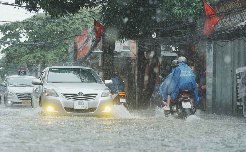
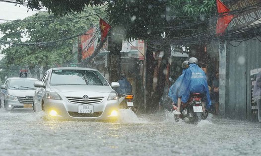
On land , coastal areas from Quang Ninh to Thanh Hoa have strong winds of level 7-9, areas near the storm center have winds of level 10-12, gusting to level 14; areas deep inland in the Northeast have strong winds of level 6-8, gusting to level 9-11. The strongest winds are from noon to evening on September 7.
From the afternoon of September 7 to the morning of September 9, the Northern region and Thanh Hoa experienced widespread heavy rain with total rainfall ranging from 100 - 300mm, with some places experiencing over 450mm. The heaviest rain in the Northeast was concentrated in the afternoon and night of September 7; in the Northwest from the evening of September 7 to the night of September 8.
Heavy rains can cause flooding in low-lying areas; flash floods in small rivers and streams, and landslides on steep slopes.
Due to the influence of the wide storm circulation, in the Northwest region, the area from Nghe An to Thua Thien Hue needs to be on guard against the risk of thunderstorms, tornadoes, and strong gusts of wind.