Heavy rain gradually decreases from July 26
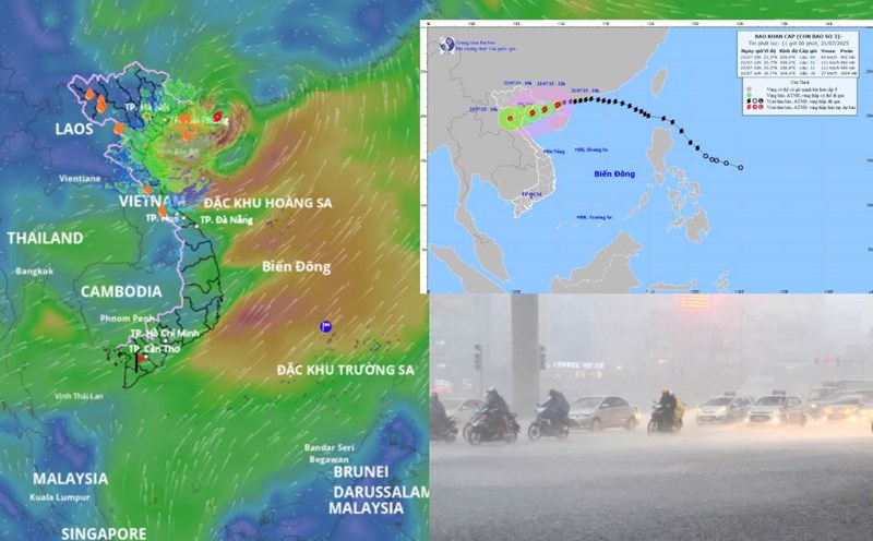
According to the National Center for Hydro-Meteorological Forecasting, last night and this morning (September 24), in the Northwest and Thanh Hoa, the Central Highlands had rain, moderate rain and thunderstorms, locally heavy to very heavy rain. Rainfall from 7pm on July 23 to 7am on July 24 was over 70mm at monitoring stations such as: Y Can station (Yen Bai) 245.8mm; Phuc Khanh station (Phu Tho) 170.4mm; Ba Sao station (Ninh Binh) 86.8mm; Ia Krai 2 Hydropower station (Gia Lai) 72.0mm; Quang Thanh station (Lam Dong) 71.4mm,...
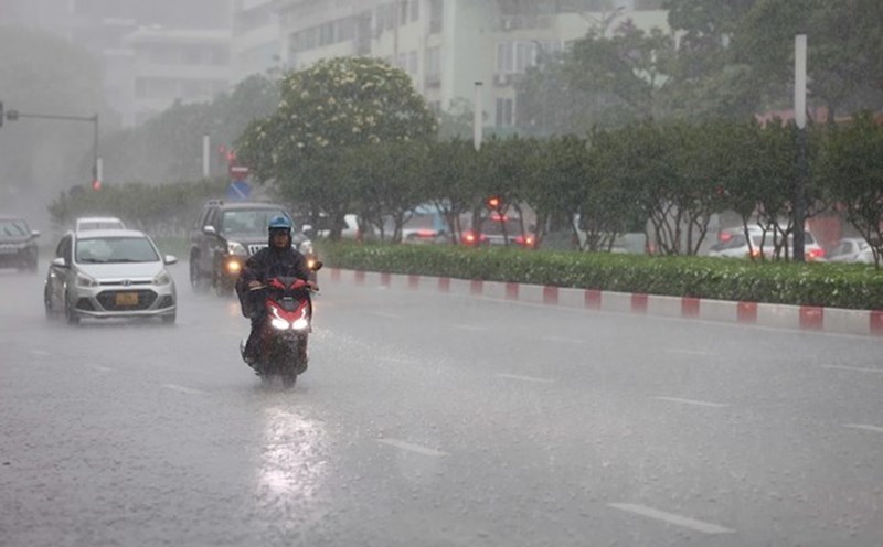
The Northern region, Thanh Hoa and Nghe An from July 24 to the night of July 25 are forecast to have moderate rain, heavy rain and thunderstorms, locally very heavy rain with common rainfall of 60 - 130mm, locally over 250mm. Warning of the risk of heavy rain with rainfall greater than 100mm in 3 hours.
From July 26, heavy rain in the North, Thanh Hoa and Nghe An is likely to gradually decrease.

Commenting on the cause, according to Dr. Truong Ba Kien - Deputy Director of the Center for Meteorological and Climate Research, Institute of Meteorology, Hydrology and Climate Change, the rain in the next 2 days will be due to the small low pressure area in the Gulf of Tonkin bringing southeast winds to the mainland, combined with humid and unstable air after storm No. 3 Wipha.
"The rain in the next 2 days from July 24 to 25 is forecast in some places in the North to be even heavier during the days affected by storm No. 3 Wipha. Because before that, on July 22, storm No. 3 was characterized by moving west-southwest down to Ninh Binh. The thunderstorm caused rain to focus to the south, so the southern provinces such as Thanh Hoa and Nghe An recorded heavier rain. Meanwhile, localities in the northern part of the storm's circulation such as Hanoi and the Northeast region will have less rain" - Mr. Kien analyzed.
In the area from Ha Tinh to Hue and the Southeast region in the afternoon and night of July 24, there will be scattered showers and thunderstorms, locally heavy rain with rainfall of 15 - 30mm, locally over 60mm.
Central Highlands on the day and night of July 24, there is forecast to be showers and thunderstorms, locally heavy rain with rainfall of 15 - 35mm, some places over 70mm.
The meteorological agency warns that thunderstorms may cause tornadoes, lightning, hail and strong gusts of wind. The warning level of natural disaster risk due to heavy rain, tornadoes, lightning, and hail is level 1.
The warning level of natural disaster risk due to floods is level 3
Currently, the flood situation in the lower reaches of the Ca River (Nghe An) and the water level in the lower reaches of the Thao River in Yen Bai are rising. The water level at 7:00 a.m. on July 24 at some stations is as follows: on Ca River at Coconut Station 24.64m, above alert level 3 by 0.14m, 0.33m lower than the historical flood in 1988; at Nam Dan Station 4.8m, 0.6m below alert level 1; on Thao River at Yen Bai Station: 29.45m, 0.55m below alert level 1.
It is forecasted that in the next 6 - 12 hours, the flood downstream of the Ca River at Nam Dan station will continue to rise and will be at alert level 1 to alert level 2. In the next 12 - 36 hours, the flood here will continue to rise and is likely to reach alert level 2 to alert level 3.
From now until July 25, the water level downstream of Thao River in Yen Bai will continue to rise and is likely to be at alert level 1 to alert level 2.
There is a high risk of widespread flooding in the downstream area of Ca River, flooding in low-lying areas along the downstream of Thao River; risk of flash floods on small rivers and streams and landslides on steep slopes in mountainous areas of Nghe An, Yen Bai, Phu Tho provinces.
Real-time warning information for areas at risk of flash floods and landslides is provided online on the website of the Department of Hydrometeorology at: https://luquetsatlo.nchmf.gov.vn and in a separate bulletin warning of flash floods and landslides.
The warning level of natural disaster risk due to floods is level 3.
Floods on rivers cause flooding in low-lying areas along rivers, affecting activities such as waterway transportation, aquaculture, agricultural production, people's livelihood and socio-economic activities.
The meteorological agency noted that the forecast information is calculated at the expected discharge regulation level of upstream reservoirs and will update the bulletins when there are changes in the discharge flow of reservoirs.