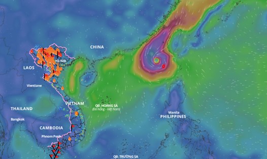
According to data from the National Center for Hydro-Meteorological Forecasting, today (October 1), the Northwest region, Cao Bang, Bac Kan, Lang Son, Ha Giang, Tuyen Quang, Thai Nguyen will have moderate rain, heavy rain and scattered thunderstorms, locally very heavy rain.
Rainfall from 7am to 3pm on October 1st was locally over 120mm in some places such as: Mo Vang (Yen Bai) 170.8mm, Bao Ha (Lao Cai) 122.4mm, Quy Ky (Thai Nguyen) 145.1mm...
In the evening and night of October 1, this cold air mass will continue to affect other places in the North, then affect the North Central region and some places in the Central Central region. Northeast wind inland level 3, coastal areas level 4 - 5.
In the Northwestern region, the Northern Delta, Thanh Hoa and Northern Nghe An in the late afternoon and evening of October 1, there will be scattered showers and thunderstorms, locally heavy rain with rainfall from 10 - 30mm, locally over 70mm.
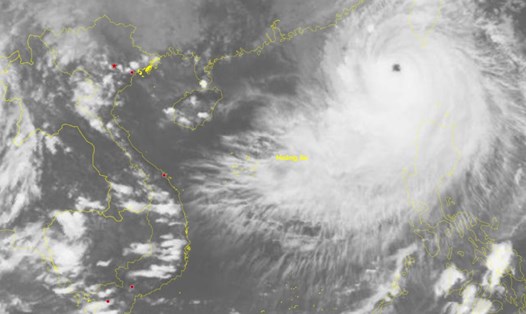
In the bulletin issued at 5:10 p.m. on October 1 from the meteorological agency, through monitoring on satellite images and weather radar images, it shows that convective clouds are developing, causing rain in the areas of Gia Lam, Dong Anh, Chuong My, Thuong Tin, and Quoc Oai districts in Hanoi.
In Hanoi area, in the next 3 hours, the cloud area over Gia Lam area is forecast to cause showers and possible thunderstorms in Hoang Mai, Long Bien areas and will continue to expand to other districts in the center of Hanoi city.
The area from Southern Nghe An to Thua Thien Hue from the evening of October 1 to October 2 is forecast to have moderate rain, heavy rain and thunderstorms, locally very heavy rain with common rainfall from 30 - 70mm, locally over 150mm. Warning of the risk of local heavy rain (greater than 100mm/6 hours). From the night of October 2, heavy rain will gradually decrease.
In the area from Da Nang to Binh Dinh and the Central Highlands, in the afternoon and night of October 2, there are forecasted showers and scattered thunderstorms, locally heavy rain with rainfall from 10 - 30mm, in some places over 100mm.
Thunderstorms are likely to produce tornadoes, lightning, hail, and strong gusts of wind. The warning level for natural disaster risks due to heavy rain, tornadoes, lightning, and hail is level 1.
Localized heavy rains of high intensity can cause flooding in low-lying areas; flash floods on small rivers and streams, and landslides on steep slopes.