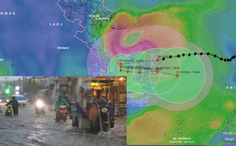
This afternoon (October 27), storm number 6 Tra Mi made landfall in the provinces of Thua Thien Hue, Quang Nam - Da Nang. Normally, heavy rain will continue after the storm makes landfall.

According to Associate Professor, Dr. Mai Van Khiem - Director of the National Center for Hydro-Meteorological Forecasting, Directorate of Hydro-Meteorological Forecasting, today (October 27), heavy rain will focus on the provinces from Quang Binh to Quang Nam with common rainfall of 150 - 200mm, locally over 300mm.
Ha Tinh, Quang Ngai, Binh Dinh and the Northern Central Highlands have heavy rain, locally very heavy rain with total rainfall ranging from 100 - 200mm, in some places over 250mm.
"Storm Tra Mi has made landfall and will cause heavy rain with rainfall within 3 hours possibly exceeding 100mm. The rain will not only be today but is forecast to continue due to the combined impact of cold air and the northern circulation of storm No. 6 (which will then weaken into a tropical depression and low pressure area in the coming days)," said Mr. Khiem.
With such a forecast of heavy and prolonged rain, the Director of the Meteorological Agency warned of a high risk of flooding in low-lying coastal areas and landslides of dykes and seawalls in coastal provinces from Quang Tri to Quang Nam due to the impact of big waves and storm surges.
"The more serious risk is flash floods and landslides in the mountainous areas of the western provinces of the Central Central region, especially the southern areas of Nghe An, Ha Tinh to Quang Nam, Quang Ngai, Kon Tum. The risk of flash floods and landslides is not only today (when storm No. 6 directly impacts), but also in the following days, the risk is still very high, so we need to be extremely cautious" - Associate Professor, Dr. Mai Van Khiem warned.