The latest typhoon bulletin from the Philippine Atmospheric, Geophysical and Astronomical Services Administration (PAGASA) said that Kong-Rey, a tropical storm in the eastern Philippine forecast area (PAR), is expected to enter PAR tonight, October 26, or early tomorrow morning, October 27.
Thus, Typhoon Kong-Rey is following right after Typhoon Tra Mi. The phenomenon of double storms occurs when two storms appear at the same time. Many concerns are raised about this double storm phenomenon.

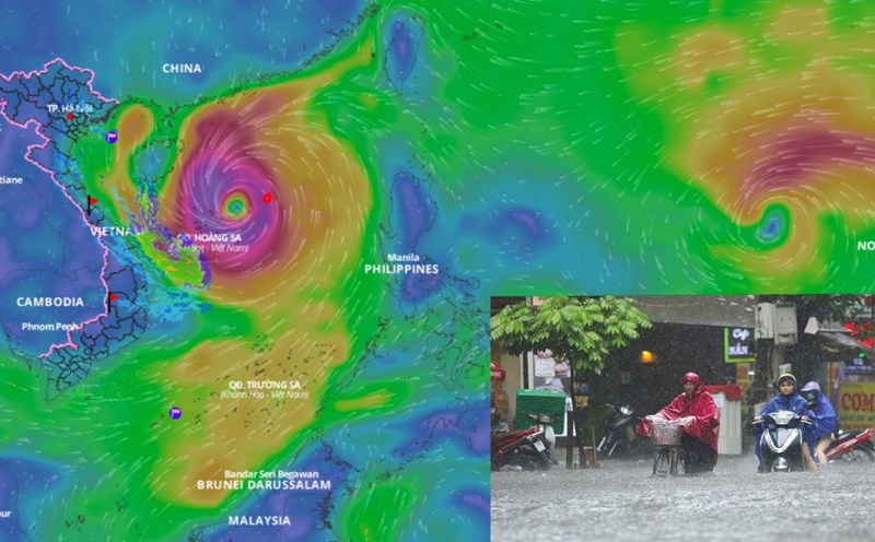
According to Dr. Hoang Phuc Lam - Deputy Director of the National Center for Hydro-Meteorological Forecasting, Directorate of Hydro-Meteorological Forecasting, storm Tra Mi is active in the northeastern sea of Hoang Sa archipelago.
"The distance between the two storms is currently very large, so there is almost no interaction. In the coming days, storm Kong-rey tends to strengthen and move northwest, so the distance will be narrowed, but it is still very large (about 2,200km). There will also be interaction between the two storms in the coming days, but it will be very small," said Mr. Lam.
According to Dr. Hoang Phuc Lam, normally, storms with double storm interactions will cause the storm's orbit to move counterclockwise and pull the storm outward.
"However, with typhoon Kong-Rey, we assess that the impact on typhoon Tra Mi is not too great, so the possibility of pulling typhoon No. 6 out is not much. It is more likely that typhoon No. 6 will weaken and last for quite a while before continuing to weaken in the East Sea," said Mr. Lam.