
According to the National Center for Hydro-Meteorological Forecasting, this morning (July 30), the location of super typhoon Dolphin was at about 16.4 degrees north latitude - 165.8 degrees east longitude. The intensity of the first super typhoon is level 17, gusting above level 17. After super typhoon Sinlaku, super typhoon Mekkhala, super typhoon Bavi, this is the 4th super typhoon in 2026 operating in the Northwest Pacific region.
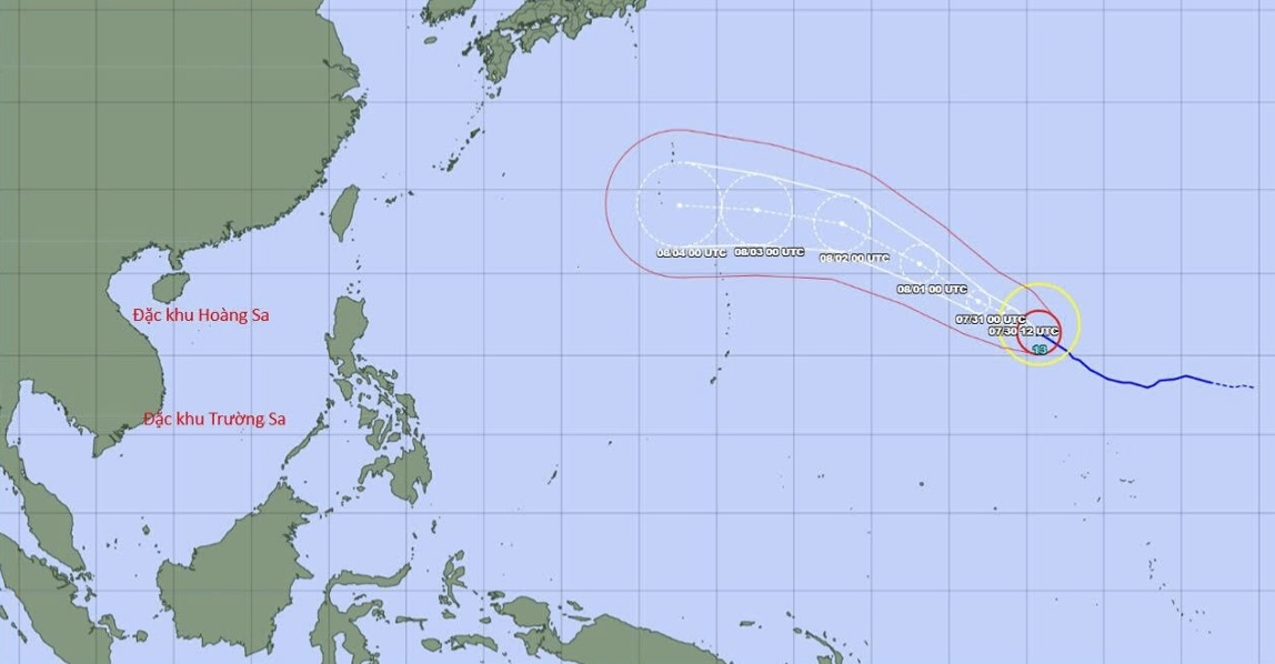
Currently, super typhoon Dolphin is about 5000km east of Luzon Island (Philippines).
Forecast for the next 1-3 days, super typhoon Dolphin will move mainly in the West-Northwest direction at a speed of about 20km/h. After that, the super typhoon will move in the West direction at an average speed of about 20 - 25km/h, turning towards the Fujian - Zhejiang area of China.
According to current forecast data, there are no signs that super typhoon Dolphin will move into the East Sea. However, with super strong intensity, super typhoon Dolphin may also affect the wind field in the East Sea area in the coming days, which tends to increase in intensity.
It is predicted that from now until August 4th (coming Tuesday), super typhoon Dolphin will not have an impact on the East Sea. However, from August 5th when approaching the northern area of Taiwan Island (China), the super typhoon will attract and increase the southwest wind in the southern sea area of the East Sea.
From July 6 - 8, the intensity of the Southwest wind in most areas of the North, Central and South of the East Sea (including Hoang Sa and Truong Sa special zones) may be strong up to level 6 - 7, waves are 2 - 4m high, the sea is very rough.
The National Center for Hydro-Meteorological Forecasting is still closely monitoring the diễn biến of super typhoon Dolphin.


