Bài và ảnh: Tô Công |
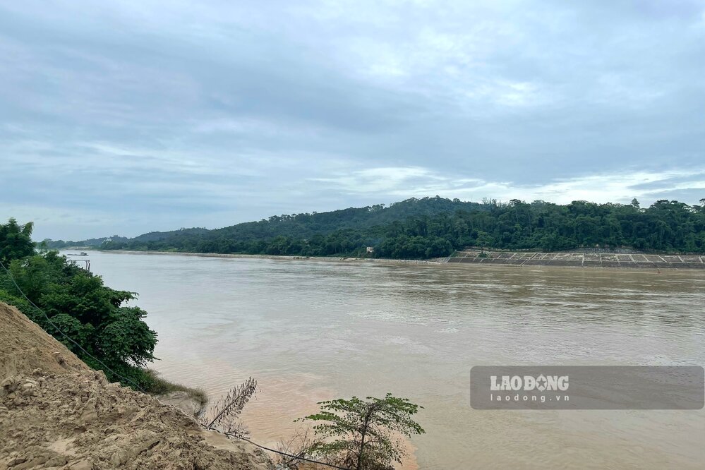
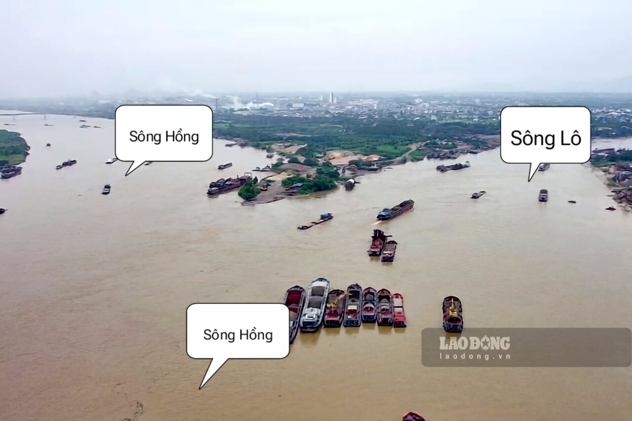
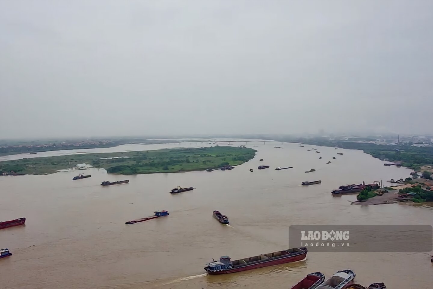
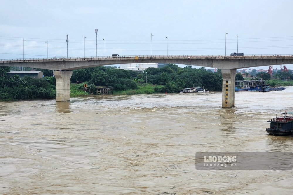
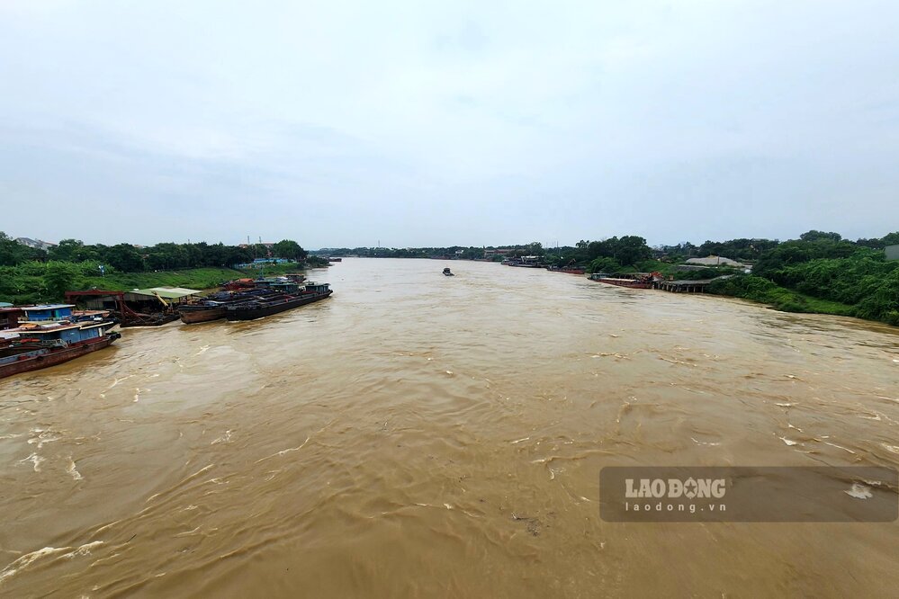
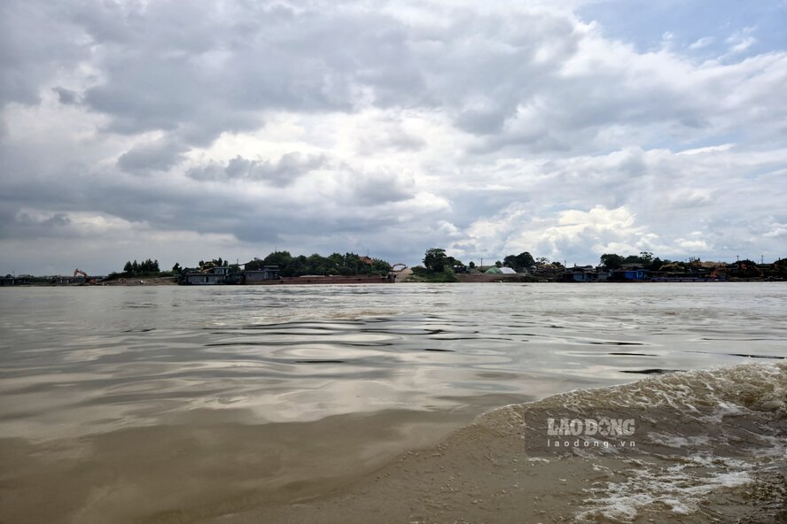
During these rainy and flood days, the water levels of three major rivers, the Red River , Da River , and Lo River , flowing through Phu Tho province , are rising and flowing towards Hanoi .
Tô Công |
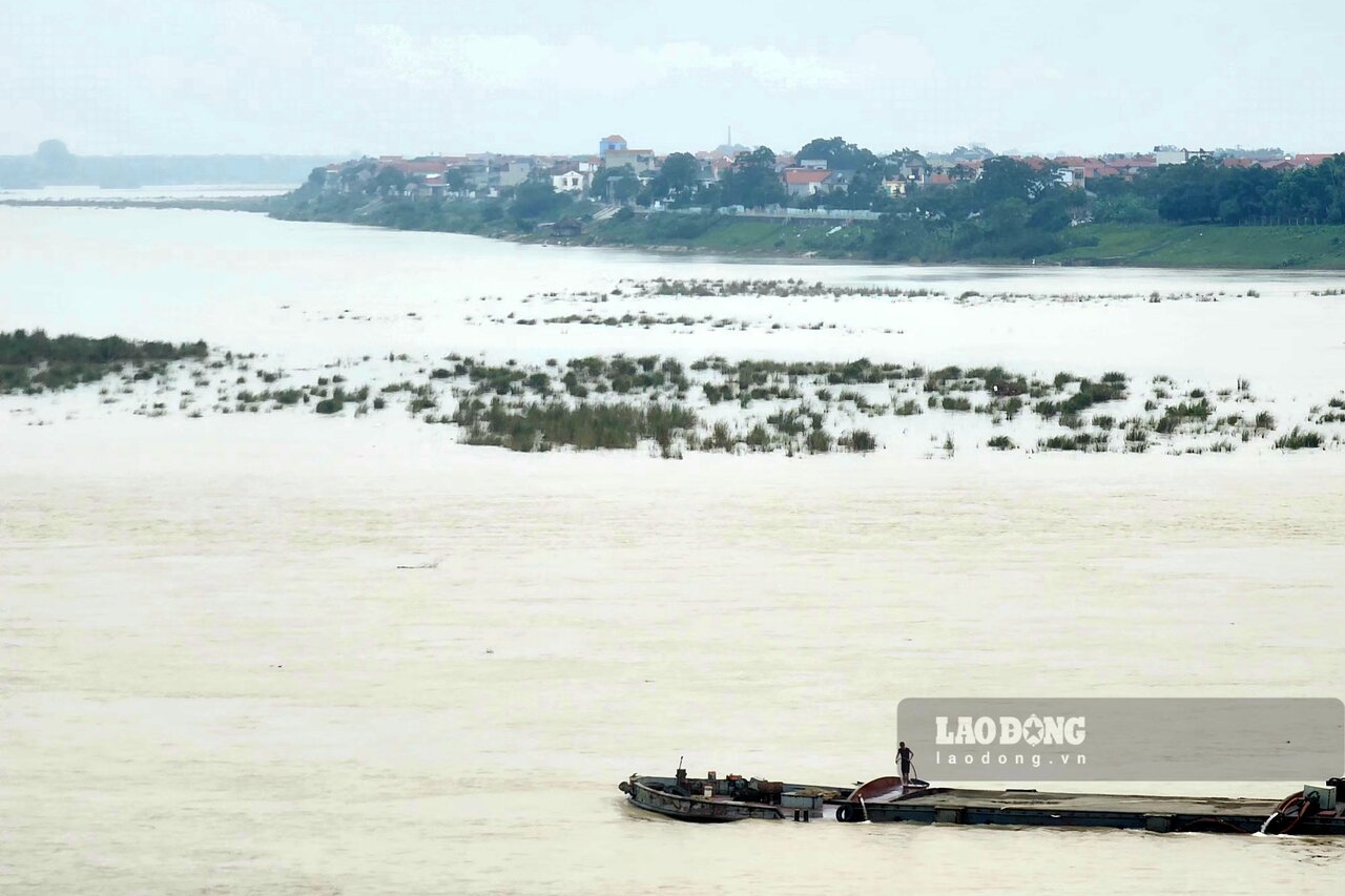
Phú Thọ - Nước sông Hồng dâng cao, các đơn vị kinh doanh bến đò ngang cần tuân thủ tuyệt đối quy định của pháp luật để đảm bảo an toàn cho hành khách sang sông.
Đặng Tình |
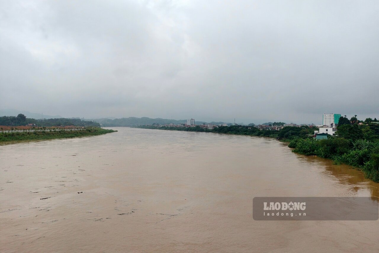
Hòa Bình - Mặc dù Thủy điện Hòa Bình đang trong quá trình xả lũ, nhưng nhiều người dân, trẻ em vẫn vô tư tắm sông Đà dưới dòng nước chảy xiết đầy nguy hiểm.
Nguyễn Tùng |
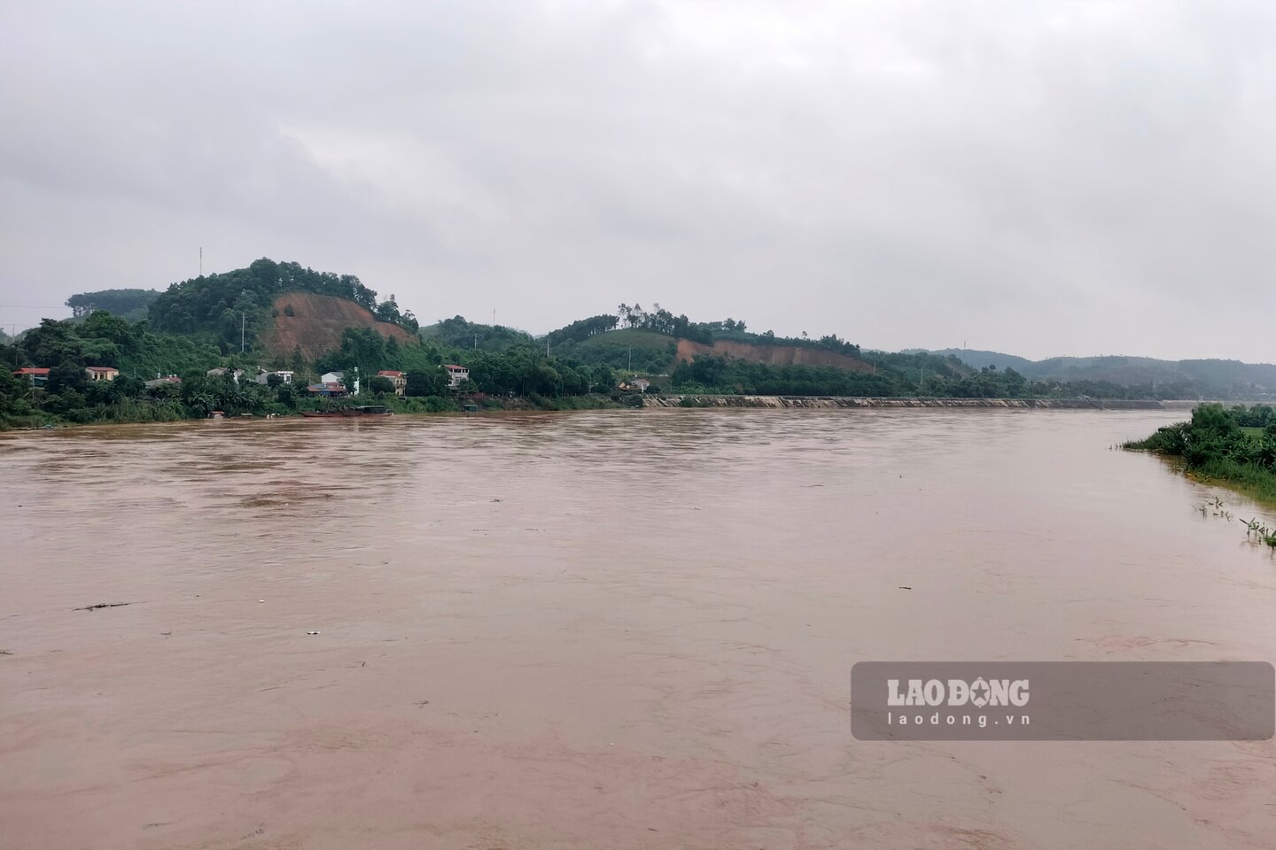
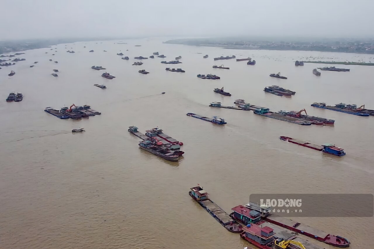
3 vụ khai thác cát trái phép trên sông Lô, đoạn qua địa phận tỉnh Tuyên Quang đã bị phát hiện, bắt giữ chỉ trong 1 ngày.
Nhóm phóng viên |
Dự thảo Luật Công đoàn (sửa đổi) không quy định việc phân phối kinh phí công đoàn khi có nhiều tổ chức đại diện của người lao động.
Thanh Hà - Hữu Chánh (Nguồn: AFP) |
Ít nhất 5 người thiệt mạng và 22 người khác bị thương trong vụ tấn công vào trụ sở của công ty hàng không vũ trụ và quốc phòng Thổ Nhĩ Kỳ TUSAS ngày 23.10.
PHÚC ĐẠT - NGUYỄN PHONG |
HUẾ - Đô thị Huế khi thành thành phố trực thuộc Trung ương là đô thị đặc sắc về sinh thái, cảnh quan, thân thiện môi trường và thông minh.
ĐÌNH TRỌNG |
Ngày 24.10, TAND tỉnh Bình Dương đã mở phiên tòa sơ thẩm vụ án sai phạm để xảy ra cháy karaoke An Phú khiến 32 người chết.
PHÚC ĐẠT |
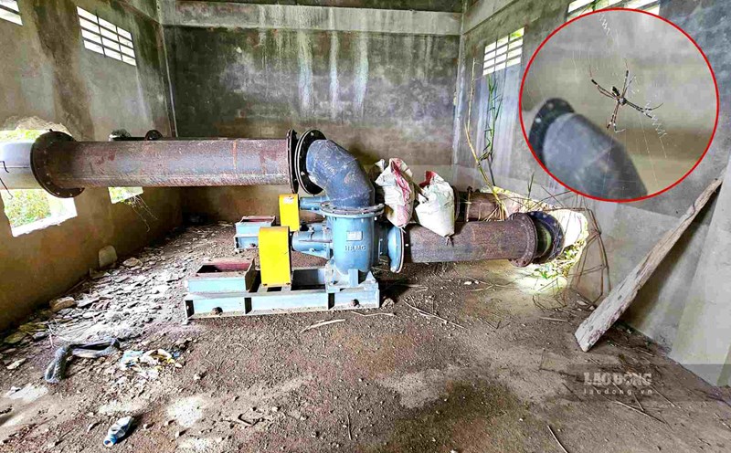
Công trình trạm bơm trị giá 1,5 tỉ đồng ở xã Hương Phong (TP Huế) bị bỏ hoang hơn 4 năm nay, điều đáng nói, khi công trình chưa thể hoạt động, chưa nghiệm thu, chủ đầu tư là UBND xã Hương Phong đã đem tiền đi thanh toán cho đơn vị thi công.

Tô Công |
Phú Thọ - Nước sông Hồng dâng cao, các đơn vị kinh doanh bến đò ngang cần tuân thủ tuyệt đối quy định của pháp luật để đảm bảo an toàn cho hành khách sang sông.

Đặng Tình |
Hòa Bình - Mặc dù Thủy điện Hòa Bình đang trong quá trình xả lũ, nhưng nhiều người dân, trẻ em vẫn vô tư tắm sông Đà dưới dòng nước chảy xiết đầy nguy hiểm.

Nguyễn Tùng |
3 vụ khai thác cát trái phép trên sông Lô, đoạn qua địa phận tỉnh Tuyên Quang đã bị phát hiện, bắt giữ chỉ trong 1 ngày.
Editorial: (+84 24) 38252441 - 35330305
Electronic newspaper: (+84 24) 38303032 - 38303034
Hotline: 096 8383388
Readers: (+84 24) 35335235
Email: toasoan@laodong.com.vn
Print: (+84 24) 39232694 - E-newspaper: (+84 24) 35335237
Address: No. 06, Pham Van Bach street, Cau Giay ward, Ha Noi.
Giấy phép số: 2013/GP-BTTT
Do Bộ TTTT cấp ngày 30.10.2012
Xuất bản số Báo Lao Động đầu tiên vào ngày 14.8.1929