The latest storm news from the US National Hurricane Center on September 19 said that Hurricane Gabrielle is maintaining its intensity at 80 km/h, at least 72 km/h, and its structure has not changed much compared to the time of formation on September 16.
Since its formation in the central Atlantic Ocean, Gabrielle has become chaotic due to the strong winds in the midlands.
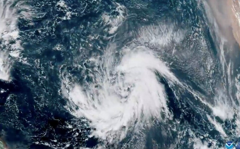
Weather forecasters in the US said that the waters ahead of Typhoon Gabrielle are quite favorable for rapid, even rapid, intensification this weekend. Gabrielle is over a water temperature of around 27 or 28 degrees Celsius, and will encounter warmer water as it moves northwest, towards and eventually across eastern Bermuda.
Thunderstorms could explode over the low torrent of Gabrielle, lifting air, pushing it off the surface and reducing air pressure. That would create an disappearing air space, allowing for stronger winds.
The US National Hurricane Center predicts that Gabrielle will be a Category 1 hurricane on September 21 as the system moves across the Atlantic Ocean.
This is the first storm in the Atlantic since Fernand dissipated on August 28. Only Hurricane Erin has strengthened into a Category 5 hurricane northeast of Puerto Rico this season on August 17.
Since then, the Atlantic hurricane season has been strangely quiet. According to Phil Klotzbach - a hurricane forecaster at Colorado State University, USA - this is the first hurricane season since 1992 without any named storms forming from August 24 to September 16.
As of now, Atlantic hurricane and tropical depression activity is about 48% slower than average.
Typhoon Gabrielle is unlikely to make landfall. But there are still two other notable tropical depressions following Hurricane Gabrielle.
The storm is also forming strongly in the central Pacific, with newly formed Tropical Storm Neoguri forecast to rapidly strengthen.
Meanwhile, the two typhoons in the western Pacific Mitag and Ragasa are forecast to affect the Philippines, southern Taiwan (China), southern China and Hong Kong (China) next week.
Typhoon No. 8 in the East Sea Mitag is expected to make landfall in Guangdong province, China at the end of August 19. The second typhoon Ragasa (called Nando in the Philippines), currently active in the Philippine Sea, could become a super typhoon before threatening the northern Philippines, Taiwan (China) and finally China next week.
Ragasa is expected to become a strong typhoon on September 22 and could become a super typhoon next week. After September 24, Ragasa could make landfall in southern China and threaten Hong Kong (China) with strong winds by the end of next week.
Since June, 18 tropical storms, including eight major storms, have formed in the western Pacific.