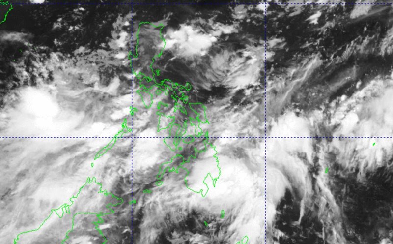
The storm forecast bulletin of the Philippine Atmospheric, Geophysical and Astronomical Services Administration (PAGASA) said that at 6:30 a.m. (local time, 5:50 a.m. Vietnam time) on September 1, the center of the low pressure was at about 11.5 degrees north latitude, 127.3 degrees east longitude, 175 km east-northeast of Guiuan (Eastern Samar), or 205 km east of Borongan City (Eastern Samar, Philippines).
PAGASA issued a red alert for heavy rainfall in the areas of Eastern Samar; Samar; Cebu (including San Francisco, Pilar, Tudela, Poro, Madridejos, Bantayan, Santa Fe, Medellin, Daanbantayan, Bogo, San Remigio, Tabuelan, Borbon, Tabogon, Tuburan, Sogod, Catmon, Asturias, Carmen).
Severe flooding is possible in low-lying areas and landslides in mountainous areas.
PAGASA also issued an orange alert for heavy rain in Biliran, Leyte, Southern Leyte, Cebu (Barili, Carcar, Aloguinsan, Pinamungahan, San Fernando, Naga City, Minglanilla, Talisay City, Toledo City, Balamban, Cebu City, Compostela, Liloan, Consolacion, Mandaue City, Lapu-Lapu City, Cordova, Danao City).
Floods threaten low-lying areas and landslides in mountainous areas.
The latest low pressure area near the East Sea entered the Philippine forecast area (PAR) on the evening of August 30 and is forecast to strengthen into a tropical depression or storm within the next 1-2 days. When it becomes a storm, it will be named Enteng.
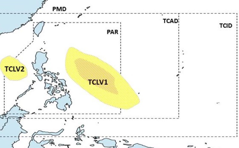
Previously, in the storm forecast for the week of August 30 to September 5, PAGASA said that there were two low pressure areas appearing near the Philippines. The first low pressure area (TCLV1) is located to the east, inside the PAR region of this country. The low pressure is likely to make landfall in the Philippines before turning south towards Japan.
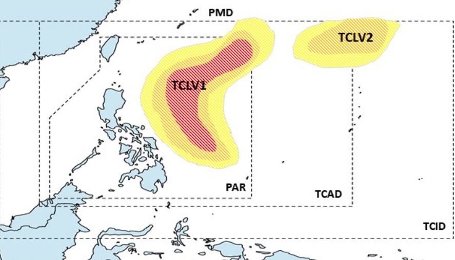
Meanwhile, a second low pressure area (TCLV2) may form northeast of the Philippines' tropical cyclone warning area (TCAD), with little chance of strengthening into a storm.
During the week of September 6-12, PAGASA forecasts two low pressure areas near the country.
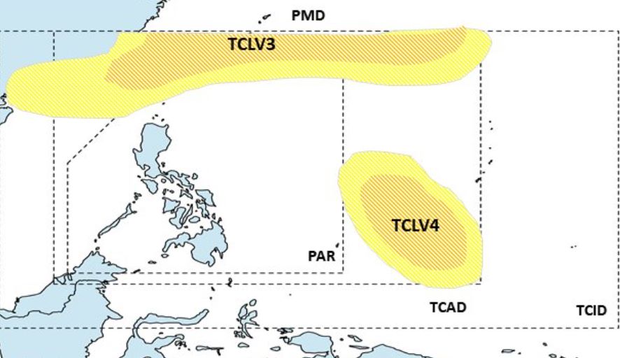
The first low pressure (TCLV3) is north of PAGASA's forecast region (PMD) and the second low pressure (TCLV4) is at the southeastern boundary of TCAD, with the low likely to intensify into a typhoon.