According to Decision No. 1569/QD-TTg dated December 12, 2024 of the Prime Minister approving the Hanoi Capital Planning for the period 2021 - 2030, with a vision to 2050, the Capital city is organized according to the urban cluster model including the central urban area, radial urban axes, and cities in the Capital.
This is considered one of the core orientations for the long-term development of the Capital, promoting and leading the development of the urban transport infrastructure system, reducing urban pressure.
The planning has clearly defined that Hanoi will focus on building 5 economic corridors and belts formed on the basis of economic corridors identified in the national master plan.
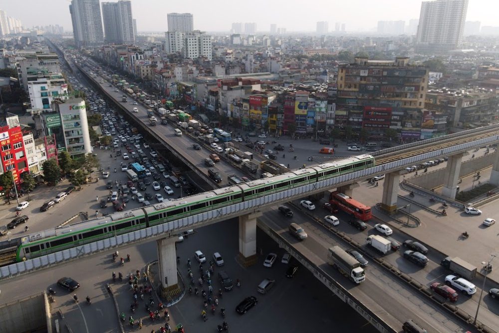
The city also determined to accelerate the process of building, completing and expanding the urban railway network, combined with developing the TOD urban model in areas with railway stations to expand development space, create a convenient and modern living space with synchronous service infrastructure, meeting the needs of the people.
In which, the transportation system has been determined to develop in a green, smart direction, enhancing the role of public transportation, limiting personal vehicles to minimize traffic congestion and environmental pollution. This is also the common trend of all developing cities in the world.
Regarding roads, the city will complete the expressway network; upgrade and renovate existing radial expressways, prioritizing upgrading and expanding the North-South expressway in the East through the city.
Focus on building new, upgrading and renovating national highways within Ring Road 4 to meet urban road standards; completing urban traffic axes; closing ring roads; developing a number of new routes to enhance traffic connections between Hanoi and provinces and cities in the region.
The city will complete the following axes: West Thang Long, West Lake - Ba Vi; North-South axis road and connecting roads in Ung Hoa and Phu Xuyen areas; Ha Dong - Xuan Mai, Ngoc Hoi - Phu Xuyen axis roads; build different-level traffic intersections at intersections of the beltway system and main urban axes.
Hanoi completes the bridge system over the Red River, Da River, Duong River, and Day River and builds new bridges over rivers in sync with the scale of planned routes; studies the option of combining railway bridges and road bridges over rivers.
The city invests in a new inter-provincial bus station system suitable for the process of urban expansion and development, gradually converting functions, relocating bus stations in the Ring Road 3 area; arranging reasonable land funds (including underground spaces) to build parking spots and parking lots suitable for the needs of each area, linked to the system of service works and green parks.
According to Dr. Architect Dao Ngoc Nghiem - Vice President of the Vietnam Urban Development Planning Association, to develop urban transport in Hanoi, it is necessary to allocate clear and specific planning implementation each year and set specific targets.
Hanoi needs to improve its management and operation capacity, focusing on the role of community responsibility in traffic development. The capital's planning needs to take traffic as the "backbone". At the same time, research on underground space planning, construction of modern ring roads, radial roads, and through-center roads.
The city also needs to apply the urban cluster model to create more growth poles, reducing pressure on the central urban area in terms of industry, education, commercial services, culture, sports..., especially in terms of environment and infrastructure.
Satellite cities are linked to the center, but have independent functions, connecting natural elements and preserving traditional culture and traditional craft villages, creating green spaces and ecological spaces.