According to Decision No. 759/QD-TTg dated April 14, 2025 approving the Scheme on arrangement and reorganization of administrative units (DVHC), Kon Tum Province and Quang Ngai Province merged into a province named Quang Ngai.
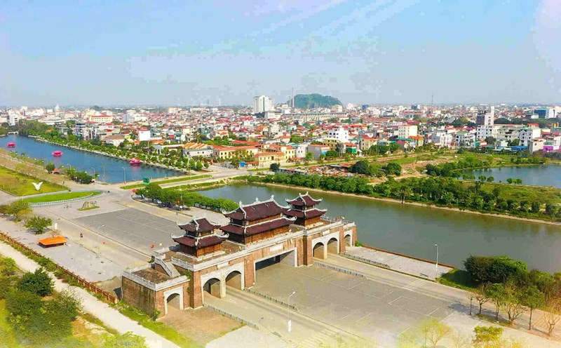
The administrative - political center is located in Quang Ngai City today.
According to the website of the Propaganda Department and the people of Kon Tum province, before 1800, the name Kon Tum has not appeared. In 1893, the French colonialists established the first administrative court in Kon Tum province.
In July 1902, the Kon Tum land was transferred to Vietnam, governed by Binh Dinh Ambassador. In July 704, France issued a Decree to establish Plei Ku Der province.
After 1 year, the French issued a decree to establish the administrative boundary of Plei Ku Der province, including the residence of the Nang-Tang, Ba-na, and Gia-rai people in Binh Dinh province.
In June 1907, France abolished Plei Ku Der, the current part of Kon Tum was merged into Binh Dinh province. The administrative center in Kon Tum was established, under the authority of Binh Dinh Ambassador.
After a long time of separation, the Governor -General of Indochina issued a decree to restore the boundaries of Plei Ku Der in February 1913. The administrative center of Cheo Reo, Buon Ma Thuot was merged, forming a separate autonomous province named Kon Tum.
On July 2, 1923, the Governor -General of Indochina separated the Buon Ma Thuot agent from Kon Tum province and established Dak Lak province. In 5.1932, Pleiku was separated from Kon Tum province to establish Pleiku province. In 1943, An Khe agent (the old part of Binh Dinh) was separated from Kon Tum province to merge into Pleiku province.
On April 15, 1950, according to Decree No. 7/ND -TTg, two provinces of Kon Tum and Gia Lai merged into an administrative resistance unit, named Gia Lai - Kon Tum (Gia - Kon).
In October 10, 1951, the inter -committee of the 5th area of Kon Tum province and 4 districts in the west of Quang Ngai including Ba To, Tra Bong, Minh Long, Son Ha became the Western Front.
After the victory of the anti -French resistance war (1954), Gia - Kon province was divided into Kon Tum and Gia Lai provinces.
At the same time, the Western Front dissolved, 4 mountainous districts returned to Quang Ngai province.
In the period of 1958 - 1975, Kon Tum undergo many journeys to divide, separate and merge administrative units with surrounding provinces including Pleiku and Quang Ngai.
In 1975, after the liberation of the South reunited the country, the People's Committee of the Central Central Region decided to merge Kon Tum and Gia Lai provinces in Gia Lai - Kon Tum province, the provincial capital is located in Pleiku town.
Over 15 years of merger, until August 12, 1991, the 8th National Assembly, the 9th session issued a Resolution to adjust the administrative boundaries, Gia Lai - Kon Tum province was divided into two provinces, including Kon Tum and Gia Lai province.
After the separation and adjustment process, Kon Tum has 10 administrative units including Kon Tum city, Sa Thay district, Ia H'Drai, Kon Ray, Kon Plong, Dak Ha, Dak To, Ngoc Hoi, Tu Mo Rong, Dak Glei.
Kon Tum province has 43 ethnic groups, including long -standing indigenous peoples such as fibers, Ba Na, River - Trieng, Gia Rai, Brau, Ro Mam and Hre.