Information from the Department of Dyke Management and Natural Disaster Prevention and Control said that currently the water level on Thao River (Yen Bai, Phu Tho), Lo River (Tuyen Quang, Vu Quang), Red River (Viet Tri, Son Tay, Hanoi) has dropped below level 1.
Besides, floods on Cau River (Bac Ninh), Thuong River (Bac Giang), Luc Nam River (Bac Giang), Hoang Long River (Ninh Binh) at Ben De, Thai Binh River (Hai Duong) are receding slowly.
Water levels as of 7am today (September 15) on rivers are as follows: Cau River at Dap Cau 6.23m, above BD2 0.93m. Thuong River at Phu Lang Thuong 5.81m, above BD2 0.51m. Luc Nam River at Luc Nam 4.89m, above BD1 0.59m. Hoang Long River at Ben De 3.92m, above BD2 0.42m. Thai Binh River at Pha Lai 4.66m, above BD1 0.66m. Red River in Hanoi 7.16m, below BD1 2.34m.
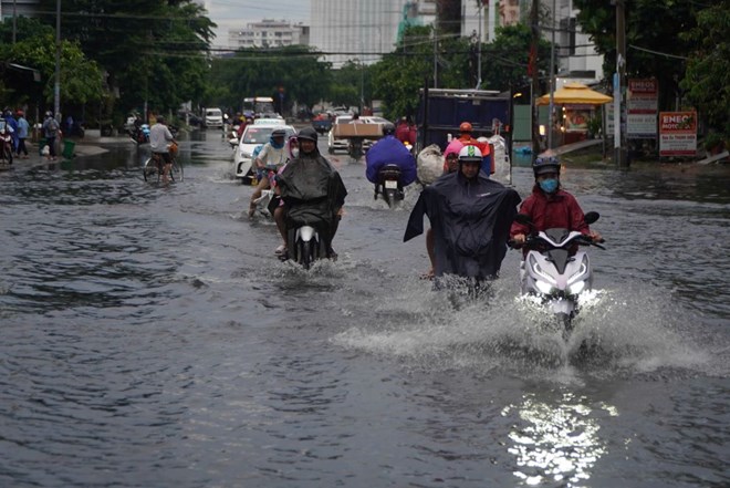
In the next 24 hours, the water level of many downstream stations of the Red River - Thai Binh River system will tend to decrease slowly, generally from BD2 to above BD3. Cau River, Thuong River and Hoang Long River will continue to decrease but still above BD2. Luc Nam River and Thai Binh River will decrease below BD2 and above BD1.
Flood disaster risk warning level: Level 3.
The Department of Dyke Management and Natural Disaster Prevention and Control forecasts that from September 15 to September 17, the Central Highlands and the South will have moderate rain, heavy rain and thunderstorms, some places will have very heavy rain with common rainfall of 40 - 80mm, locally over 120mm (rain concentrated in the afternoon and night).
During the day and night of September 15, the area from Da Nang to Binh Thuan will have rain, moderate rain and scattered thunderstorms, some places will have heavy rain to very heavy rain with rainfall from 20 - 40mm, locally over 90mm. The North will have scattered showers and thunderstorms, locally heavy rain with rainfall from 10 - 30mm, locally over 60mm.
Warning level of natural disaster risk due to heavy rain, tornado, lightning: level 1.
In addition, on the day and night of September 15, the sea area from Ninh Thuan to Ca Mau, the south of the central East Sea area, the southern East Sea area (including the sea area of Truong Sa archipelago) will have strong southwest winds of level 6, level 7, gusting to level 8-9, rough seas.
The sea area from Ca Mau to Kien Giang and the Gulf of Thailand has southwest winds of level 5, level 6, gusting to level 7 - 8, rough seas. The sea area from Quang Tri to Ca Mau, Ca Mau - Kien Giang, the Gulf of Thailand, the sea area south of the North East Sea (including the sea area of Hoang Sa archipelago), the Central and South East Sea (including the sea area of Truong Sa archipelago) has showers and thunderstorms. During thunderstorms, there is a possibility of tornadoes and strong gusts of level 7 - 8.
Disaster risk level due to strong winds at sea: level 2.