As Lao Dong newspaper has reported, in April 2026, the water level of the Thao River (main stream of the Red River) section passing through Lao Cai and Phu Tho provinces reached a record low.
At Yen Bai station (now Lao Cai province), on April 27, the water level dropped to 22.81m - the lowest level in history.
Similarly, at Phu Tho station, the lowest water level in history was also recorded. At 13:00 on April 16, the measured water level was only 10.14m.
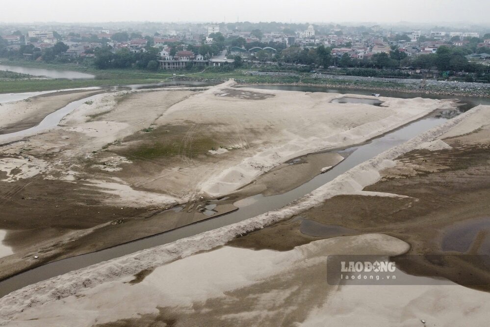
According to records of Lao Dong Newspaper reporters in mid-May, the image of the Red River section passing through Phu Tho province has changed, as the river begins to have small floods at the beginning of the season.
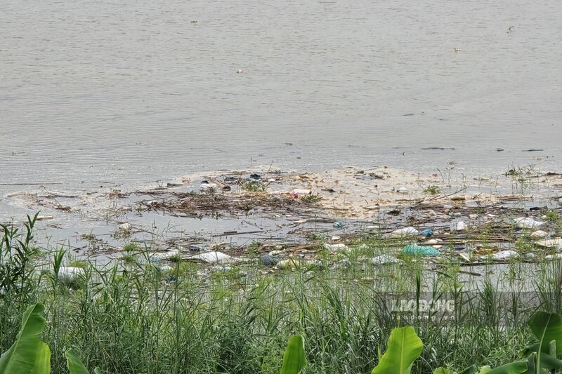
It can be seen that the clear blue water of the river in dry days has now been replaced by cloudy, dark water - the characteristic color of the Red River in the flood season.
Along with that, the flow has begun to become wider, the river water is rising and overflowing the alluvial grounds and dry sand dunes after many months of drying up.
At some riverside pumping stations, in the previous record dry days, to maintain operation, irrigation enterprises had to dred continuously, lower the drainage bed, creating a flow to bring water to the field pumping station.
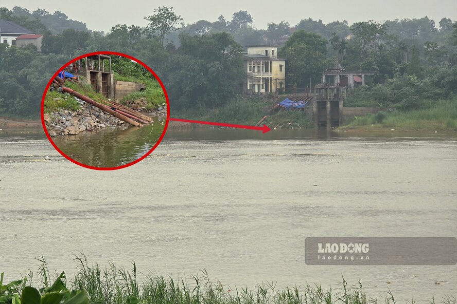
Now, when the river water has started to rise, pumping water for irrigation to serve people's agricultural production on both sides of the river will become easier.
Ms. Phung Thi Phuong Thu - a resident of Lam Thao commune, Phu Tho province - shared: "This year, the Red River water has dried up unprecedentedly, I am only worried that if it dries up too long, the riverbank will erode. The Red River is like that, floods that are too big or too shallow will also cause erosion.
According to the forecast bulletin, medium-term hydrological warning (from May 11 to May 20) of the National Center for Hydro-Meteorological Forecasting, in the past 10 days (from May 1 to May 10), there have been 2 small floods on the Thao River with an amplitude of water rising from 1 - 1.9m.
In the past 10 days, the actual water level measured at Phu Tho station is on average 11.11m, highest 12m, lowest 10.31m.
Forecast for the next 10 days, the water level on the Thao River is likely to have a small fluctuation, followed by a slow change.
Accordingly, the water level at Phu Tho station is forecast to average about 11.50m, highest 12.20m, lowest 11m (the lowest water level in history nearly 1 month ago was 10.14m).


